
Warren Creek Falls (Oregon) facts for kids
Quick facts for kids Warren Creek Falls |
|
|---|---|
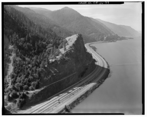
Historic Columbia River Hwy, at Mitchell Point, the reason for Warren Creek Diversion
|
|
| Lua error in Module:Infobox_mapframe at line 185: attempt to index field 'wikibase' (a nil value). | |
| Location | Columbia River Gorge |
| Coordinates | 45°41′08″N 121°42′05″W / 45.685633°N 121.701511°W |
| Type | Cascade |
| Elevation | 220 ft (67 m) |
Warren Creek Falls was once a beautiful waterfall in Oregon, located in Starvation Creek State Park. This park is found in the amazing Columbia River Gorge in Hood River County.
The waterfall was in a special area along the Historic Columbia River Highway. Many other waterfalls are nearby in Starvation Creek State Park. These include Cabin Creek Falls, Lancaster Falls, and Starvation Creek Falls. All of them are within 2 miles (3.2 km) of each other. Warren Creek Falls is often confused with Hole-in-the-Wall Falls, which is just a short distance downstream.
The area where Warren Creek Falls used to be is now surrounded by forests. It's part of the Columbia Plateau, near Viento Ridge. Sometimes, when there's a lot of water, it overflows from the tunnel that diverted the creek. When this happens, water flows down the old path of Warren Creek, creating a temporary waterfall where the original one used to be.
How Warren Creek Falls Changed
Warren Creek Falls was first formed by huge floods that happened about 13,000 years ago. These floods are known as the Missoula Floods. They shaped much of the landscape in this area.
In 1938, something big changed for Warren Creek. The creek's water was moved through a special tunnel. This was done to stop the newly built Historic Columbia River Highway from getting washed out by floods. When the creek was diverted, the original waterfall stopped flowing. Instead, a new waterfall called Hole-in-the-Wall Falls was created downstream.
