Watch Hill Castle facts for kids
Quick facts for kids Watch Hill Castle |
|
|---|---|

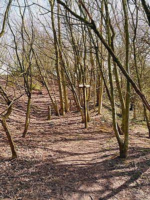
The motte in 2009
|
|
| General information | |
| Architectural style | Motte-and-bailey castle |
| Town or city | Bowdon, Greater Manchester |
| Country | England |
| Coordinates | 53°22′13″N 2°22′53″W / 53.3704°N 2.3813°W |
| Completed | Probably 12th century |
| Client | Hamon de Massey |
| Technical details | |
| Size | 0.37 ha (0.91 acres) |
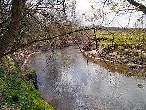
Watch Hill Castle is an old castle ruin in Greater Manchester, England. It's also known by other names like Yarwood Castle or Castle Hill. This castle is a special type called a motte-and-bailey castle. It sits near the River Bollin and is a protected historical site, meaning it's very important to preserve.
Contents
History of Watch Hill Castle
Historians believe Watch Hill Castle was built sometime between the Norman Conquest (around 1066) and the 1200s. This type of castle, a motte-and-bailey, was usually made of wood. They were quick to build but often didn't last very long.
Archaeologists haven't found many old records about the castle. This might be because it was only used for a short time. A coin from the time of King Henry II (who ruled from 1154 to 1189) was found here. This suggests the castle might have been built during his reign.
The castle probably belonged to a powerful person named Hamo de Mascy. He was involved in a big rebellion against King Henry II in 1173. By the 1200s, the castle was no longer in use.
Exploring the Castle: Later Discoveries
In the 1800s, a person named W. T. Pownall found an old penny from King Henry II's time at the castle site. This was an exciting clue about its age.
Later, in 1976, a group of archaeologists dug up parts of the castle. They wanted to find out exactly when it was built and confirm it was a motte-and-bailey castle. Even though they didn't find clear dates, they discovered old fireplaces and holes on top of the castle mound.
In 1978, Watch Hill Castle was officially named a scheduled monument. This means it's a very important archaeological site that needs to be protected. It's the only scheduled monument in the area of Trafford.
In 1997, volunteers and students carefully measured the castle's earthworks (the old mounds and ditches). In 2005, another group used special equipment to map out where the castle's outer wall used to be.
What Watch Hill Castle Looked Like
Watch Hill Castle had two main parts. First, there was a large, artificial mound called a motte. This mound is about 6 meters (20 feet) tall. It's 40 meters (130 feet) wide at the bottom and 17 meters (56 feet) wide at the top.
Around the motte, there was a ditch about 5 meters (16 feet) wide and 3 meters (10 feet) deep. The second part of the castle was a triangular area called a bailey. This area was about 2,400 square meters (half an acre) and sat to the east of the motte.
The bailey was surrounded by an earthen wall. In some places, this wall is still about 0.3 meters (1 foot) high. On top of this wall, there would have been a wooden fence called a palisade. The north side of the bailey was naturally protected by a steep slope. The River Bollin protected the south side.
Protecting the Castle for the Future
In the 1980s, experts noticed that the castle mound was covered in trees. Also, a walking path was causing the mound to wear away.
The castle is very close to the River Bollin. This creates a challenge for keeping it safe. As the climate changes, the river is more likely to flood. These floods could wash away parts of the old castle remains. Protecting Watch Hill Castle means keeping an eye on the river and the land around it.
See also
 | Calvin Brent |
 | Walter T. Bailey |
 | Martha Cassell Thompson |
 | Alberta Jeannette Cassell |


