Waterville, Dublin facts for kids
Waterville (Irish: An Coireán) is a housing area near Dublin city. It is located in Fingal, Ireland. This neighbourhood was built in two main periods: from 2002 to 2008, and then again from 2013 to 2016. It sits on the edge of the Abbotstown estate, close to Blanchardstown village. Waterville is part of the area known as Deanestown, which is in the civil parish of Castleknock.
A Look Back: Waterville's History
The land where Waterville now stands was bought from the Eastern Health Board by a company called Granbrind Ltd. Before that, the land had many different owners over hundreds of years. It was once owned by the Barons of Castleknock, then by the Baronets of Abbotstown, and later by the Barons HolmPatrick. These lands were a very important part of the barony of Castleknock.
Waterville is on the southern edge of the Abbotstown estate. The Tyrell family owned this estate until about 1400. After them, Thomas Sergent and his wife Joan Tyrell lived there. By the 1600s, the lands belonged to Sir John Dungan. He owned a small house, some cottages, and an old church in Abbotstown. Later, the Clements family, who were ancestors of the Earls of Leitrim, owned the Abbotstown lands.
One family who lived on the lands that became Waterville was the Falkiner family. They were given the special title of "Baronets of Abbotstown" in 1812. The Falkiners later married into the Hamilton family. The Hamiltons owned land nearby in Sheephill. In 1832, the Hamiltons joined both estates together. They built a new main house called Abbotstown House for their family.
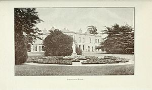
Ion Trant Hamilton was given the title of Baron HolmPatrick by Queen Victoria. Abbotstown House was the home of the barons until 1947. At that time, James Hans Hamilton, the 3rd Baron HolmPatrick, lost some of his land. This happened because of a special order that allowed the James Connolly Memorial Hospital to be built. Later, Lord HolmPatrick sold the rest of his lands at Abbotstown and Sheephill to the Marine Institute of Ireland. This institute was located at Abbotstown House until 2005. Then, the house was bought to become part of the National Sports Campus. In the late 1990s, half of the land owned by the health board was sold. This money helped to rebuild the hospital buildings.
Where is Waterville and How Did it Get its Name?
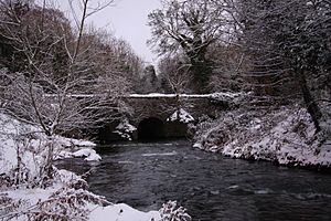
The area of Waterville has about 1500 homes. It was named Waterville because it is very close to the River Tolka. Waterville is on the north side of the Tolka River and covers about 50 acres of land.
To the south, Waterville is next to the Navan Road (N3). To the west, it borders the Snugborough Road (R843). To the north, it is next to the playing fields of the National Sports Campus. To the east, it is near Connolly Hospital in Abbotstown. Waterville is about 9 kilometres from the centre of Dublin city. It is also about 2.5 kilometres from Castleknock railway station. Each part of Waterville is privately owned and managed. Each section is named after a famous Irish coastal area or island.
Many of the homes in Waterville were built around a central green space. The whole area was planned to fit in with the existing trees and parklands.
Waterville also has a large 25-acre park called Waterville Park. In the park, there is a lake with swans and ducks. The lake even has an island in it, and there is another lake above it. The park also has a playground for children.
Waterville also has a shop and a creche (a childcare facility).
Getting Around: Access and Public Transport
Waterville is located right next to the N3 road and the M50. This makes it easy to get to, as it's only nine kilometres from the city centre. It is also connected to the M3 motorway by a link road.
You can get to Waterville using public buses. The bus routes that serve the area include: 38, 38a, 38b, 39, 39a, 70, 76a, 220, 238, and 239. The closest train station is Castleknock railway station.


