Waukeenah, Florida facts for kids
Quick facts for kids
Waukeenah, Florida
|
|
|---|---|
| Country | |
| State | |
| County | Jefferson |
| Area | |
| • Total | 3.22 sq mi (8.35 km2) |
| • Land | 3.16 sq mi (8.18 km2) |
| • Water | 0.07 sq mi (0.17 km2) |
| Elevation | 194 ft (59 m) |
| Population
(2020)
|
|
| • Total | 259 |
| • Density | 82.01/sq mi (31.67/km2) |
| Time zone | UTC-5 (Eastern (EST)) |
| • Summer (DST) | UTC-4 (EDT) |
| ZIP code |
32344
|
| Area code(s) | 850 |
| FIPS code | 12-75425 |
| GNIS feature ID | 294191 |
Waukeenah is a small community in Jefferson County, Florida, United States. It is called a census-designated place (CDP) because the U.S. Census Bureau collects information about it.
In 2020, about 259 people lived in Waukeenah. This was a small decrease from 272 people in 2010. Waukeenah is also part of the larger Tallahassee area, which includes several cities and towns.
Long ago, there was a school here called Waukeenah Academy. Samuel Pasco was the principal of this school. It closed around the time of the American Civil War. The Florida Archives have old pictures of the teachers and students from this academy.
Contents
Where is Waukeenah?
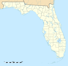
Waukeenah is located at 30°24′40″N 83°57′11″W / 30.4111°N 83.9531°W. You can find it near where US 27/State Road 20 and County Road 259 meet.
It is about 11 miles (18 km) southwest of Monticello, which is the main town for Jefferson County. Waukeenah is also about 20 miles (32 km) east of Tallahassee, the capital city of Florida.
In the past, Waukeenah was a place where travelers could rest. They used an old road called the Old St. Augustine road. This road went all the way from St. Augustine to Pensacola, Florida.
What's in a Name?
The name Waukeenah has an interesting history. A plantation owned by John G. Gamble was named Joaquina. This name honored a Spanish lady who lived in Pensacola.
Later, a post office was set up at this plantation. In 1841, it moved to where the Tallahassee and St. Augustine Roads crossed. It was first called Marion Cross Road (or Marion Post Office). Then, in 1850, the settlement was again named Joaquina. But this time, the spelling was changed to sound more English, becoming Waukeenah.
About the Land and Water
The U.S. Census Bureau measures the size of places like Waukeenah. The total area of Waukeenah is about 3.22 square miles (8.4 square kilometers). Most of this area is land, about 3.16 square miles (8.2 square kilometers). A small part, about 0.07 square miles (0.2 square kilometers), is water.
Schools in Waukeenah
Public schools in Waukeenah are managed by Jefferson County Schools. One of the schools in the area is Jefferson County Middle / High School.
How Many People Live Here?
The U.S. Census Bureau counts how many people live in different places every ten years. Here's how the population of Waukeenah has changed:
| Historical population | |||
|---|---|---|---|
| Census | Pop. | %± | |
| 2010 | 272 | — | |
| 2020 | 259 | −4.8% | |
| U.S. Decennial Census 1990 2000 |
|||
See also
 In Spanish: Waukeenah para niños
- Waukeenah para niños (This article in Spanish)


