
West Hazleton, Pennsylvania facts for kids
Quick facts for kids
West Hazleton, Pennsylvania
|
|
|---|---|
|
Borough
|
|

West Hazleton Elementary/Middle School
|
|

Location of West Hazleton in Luzerne County, Pennsylvania
|
|

West Hazleton, Pennsylvania
Location in Pennsylvania

West Hazleton, Pennsylvania
Location in the United States
|
|
| Country | United States |
| State | Pennsylvania |
| County | Luzerne |
| Incorporated | 1887 |
| Government | |
| • Type | Borough Council |
| Area | |
| • Total | 1.58 sq mi (4.09 km2) |
| • Land | 1.58 sq mi (4.09 km2) |
| • Water | 0.00 sq mi (0.00 km2) |
| Population
(2020)
|
|
| • Total | 5,167 |
| • Estimate
(2021)
|
5,160 |
| • Density | 2,758.07/sq mi (1,064.97/km2) |
| Time zone | UTC-5 (Eastern (EST)) |
| • Summer (DST) | UTC-4 (EDT) |
| Area code(s) | 570 |
| FIPS code | 42-83136 |
West Hazleton is a small town, also known as a borough, in Luzerne County, Pennsylvania. It is located in the United States. The borough is about 31 miles (50 km) south of Wilkes Barre. In 2020, about 5,167 people lived there.
Contents
History of West Hazleton
West Hazleton was started by a person named Conrad Horn. It officially became a borough on March 12, 1887. In the 1800s and 1900s, West Hazleton was important for anthracite coal mining. This industry brought many European immigrants to the area.
The first leader of the borough, called a burgess, was J.W. McMurtrie. He served from 1888 to 1890. West Hazleton also had a popular place called Hazle Park. A famous baseball player, Babe Ruth, even played at the nearby Cranberry Ballpark.
Geography and Location
West Hazleton is located at coordinates 40.961651 degrees North and -75.998915 degrees West. The U.S. Census Bureau says the borough covers about 1.5 square miles (4.09 square kilometers) of land. There is no water area.
West Hazleton is a narrow piece of land west of Hazleton City. It is mainly found along PA Route 93. Interstate 81 also passes through the northern part of the borough. West Hazleton is mostly a place where people live. It also has two shopping centers, an industrial park, a movie theater, and a sports complex for young people.
Education in West Hazleton

Students in West Hazleton attend schools in the Hazleton Area School District. The West Hazleton Elementary/Middle School is located right within the borough.
Population Changes
The number of people living in West Hazleton has changed over the years.
- In 1880, there were 191 people.
- By 1930, the population grew to 7,310.
- The population then slowly decreased for many years.
- In 2000, there were 3,542 people.
- By 2020, the population had increased again to 5,167.
Who Lives in West Hazleton?
In 2010, about 71.9% of the people in West Hazleton were White. About 3.1% were Black or African American. A small number of people were Native American or Asian. About 35.4% of the population had Hispanic or Latino family backgrounds. This was a big increase from just 2.2% in 2000.
By 2020, the population continued to change. About 35.52% of people were White (not Hispanic). The percentage of people who were Black or African American was 2.19%. The largest group was people of Hispanic or Latino background, making up about 60.02% of the population.
In 2000, there were 1,634 households in the borough. About 21.6% of these households had children under 18. The average household had 2.13 people. The average family had 2.86 people.
The median age of people in the borough was 42 years old. This means half the people were younger than 42, and half were older. About 10% of the population lived below the poverty line.
Images for kids
-
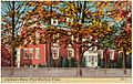
Children's Home, West Hazleton
-
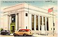
The Miners Bank and War Memorial, West Hazleton
.jpg)
.jpg)
See also
 In Spanish: West Hazleton para niños
