West Point, Alabama facts for kids
Quick facts for kids
West Point, Alabama
|
|
|---|---|

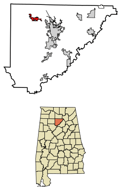
Location of West Point in Cullman County, Alabama
|
|
| Country | United States |
| State | Alabama |
| County | Cullman |
| Incorporated | October 15, 1977 |
| Area | |
| • Total | 3.875 sq mi (10.036 km2) |
| • Land | 3.848 sq mi (9.966 km2) |
| • Water | 0.027 sq mi (0.071 km2) |
| Elevation | 919 ft (280 m) |
| Population
(2020)
|
|
| • Total | 584 |
| • Estimate
(2022)
|
624 |
| • Density | 171.1/sq mi (66.08/km2) |
| Time zone | UTC−6 (Central (CST)) |
| • Summer (DST) | UTC−5 (CDT) |
| ZIP Code |
35179
|
| Area code(s) | 256 and 938 |
| FIPS code | 01-81528 |
| GNIS feature ID | 0128791 |
West Point is a small town located in Cullman County, Alabama, in the United States. In 2020, about 584 people lived there. The town officially became a town on October 15, 1977.
Contents
Where is West Point Located?
West Point is found in the northwest part of Cullman County, Alabama. Its exact location is 34°14′19″N 86°57′33″W / 34.23861°N 86.95917°W.
The town covers a total area of about 3.875 square miles (10.036 square kilometers). Most of this area is land, which is about 3.848 square miles (9.966 square kilometers). A very small part, about 0.027 square miles (0.071 square kilometers), is water.
Who Lives in West Point?
Population Changes Over Time
| Historical population | |||
|---|---|---|---|
| Census | Pop. | %± | |
| 1970 | 162 | — | |
| 1980 | 248 | 53.1% | |
| 1990 | 257 | 3.6% | |
| 2000 | 295 | 14.8% | |
| 2010 | 586 | 98.6% | |
| 2020 | 584 | −0.3% | |
| 2022 (est.) | 624 | 6.5% | |
| U.S. Decennial Census 2020 Census |
|||
The number of people living in West Point has changed over the years. In 2020, the town had 584 residents. There were 240 households and 186 families living in the town. There were also 247 housing units available.
Schools in West Point
West Point has a good school system for its young residents. All the schools are part of the Cullman County Board of Education.
The schools include:
- West Point Elementary School (for grades K-3)
- West Point Intermediate School (for grades 4-5)
- West Point Middle School (for grades 6-8)
- West Point High School (for grades 9-12)
See also
 In Spanish: West Point (Alabama) para niños
 | Ernest Everett Just |
 | Mary Jackson |
 | Emmett Chappelle |
 | Marie Maynard Daly |

