Westendorf, Tyrol facts for kids
Quick facts for kids
Westendorf
|
||
|---|---|---|

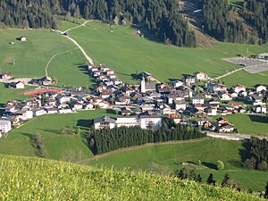
Center of Westendorf
|
||
|
||
|
.
Location of Westendorf within Tyrol
|
||
| Country | Austria | |
| State | Tyrol | |
| District | Kitzbühel | |
| Area | ||
| • Total | 95.49 km2 (36.87 sq mi) | |
| Elevation | 783 m (2,569 ft) | |
| Time zone | UTC+1 (CET) | |
| • Summer (DST) | UTC+2 (CEST) | |
| Postal code |
6363
|
|
| Area code | 05334 | |
| Vehicle registration | KB | |
| Website | www.westendorf.tirol.gv.at | |
Westendorf is a lovely village and a municipality in the Tyrol region of Austria. It's part of the Kitzbühel area. You can find it about 13.7 kilometers (8.5 miles) west of Kitzbühel and 12 kilometers (7.5 miles) southeast of Wörgl. Westendorf is located in the beautiful Brixental valley.
This community is super popular for both winter sports, like skiing, and summer holidays. Many people come here for fun trips and walking tours. Westendorf was first written about in old documents way back in 1234. It has 21 smaller village parts that make up the whole area.
Contents
Exploring Westendorf's Geography
Westendorf sits on a sunny, flat area in the Brixental valley, right at the bottom of a mountain called the Choralpe. The main village is clustered together, but there are also smaller groups of houses and farms spread out in the surrounding countryside. There's even an industrial area.
To the south, you'll find the Windautal valley. This is a favorite spot for people to relax and enjoy nature. A long time ago, many of the forests here were cleared to make space for farming.
Rivers Flowing Through Westendorf
Two important rivers flow through the Westendorf area:
- The Brixentaler Ache
- The Windauer Ache
Westendorf's Tall Mountains
Westendorf is surrounded by impressive mountains. Some of the most well-known ones include:
- The Hohe Salve, which is 1,828 meters (5,997 feet) tall.
- The Steinbergstein, standing at 2,215 meters (7,267 feet).
- The Kröndlhorn, reaching 2,444 meters (8,018 feet) high.
- The Brechhorn, which is 2,032 meters (6,667 feet) tall.
Westendorf's Population Over Time
The number of people living in Westendorf has changed quite a bit over the years. Here's a look at how the population has grown:
| Historical population | ||
|---|---|---|
| Year | Pop. | ±% |
| 1869 | 1,324 | — |
| 1880 | 1,370 | +3.5% |
| 1890 | 1,300 | −5.1% |
| 1900 | 1,367 | +5.2% |
| 1910 | 1,605 | +17.4% |
| 1923 | 1,648 | +2.7% |
| 1934 | 1,802 | +9.3% |
| 1939 | 1,783 | −1.1% |
| 1951 | 2,034 | +14.1% |
| 1961 | 2,228 | +9.5% |
| 1971 | 2,681 | +20.3% |
| 1981 | 2,810 | +4.8% |
| 1991 | 3,157 | +12.3% |
| 2001 | 3,454 | +9.4% |
| 2011 | 3,597 | +4.1% |
See also
 In Spanish: Westendorf (Tirol) para niños
 | Mary Eliza Mahoney |
 | Susie King Taylor |
 | Ida Gray |
 | Eliza Ann Grier |


