Westgate, Iowa facts for kids
Quick facts for kids
Westgate, Iowa
|
|
|---|---|

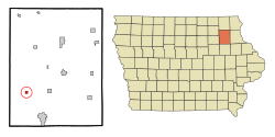
Location of Westgate, Iowa
|
|
| Country | |
| State | |
| County | Fayette |
| Incorporated | July 6, 1896 |
| Area | |
| • Total | 0.36 sq mi (0.94 km2) |
| • Land | 0.36 sq mi (0.94 km2) |
| • Water | 0.00 sq mi (0.00 km2) |
| Elevation | 1,093 ft (333 m) |
| Population
(2020)
|
|
| • Total | 192 |
| • Density | 527.47/sq mi (203.79/km2) |
| Time zone | UTC-6 (Central (CST)) |
| • Summer (DST) | UTC-5 (CDT) |
| ZIP code |
50681
|
| Area code(s) | 563 |
| FIPS code | 19-84180 |
| GNIS feature ID | 0462940 |
Westgate is a small city in Fayette County, Iowa, in the United States. In 2020, about 192 people lived there. This number was a bit smaller than in 2000, when 234 people called Westgate home.
Contents
A Look Back at Westgate
Westgate had a big party called "Westgate Days" on July 16, 2011. This celebration was for its 125th birthday!
Where is Westgate?
Westgate is located in Iowa. You can find it at these coordinates: 42.768467 degrees North and 91.995265 degrees West.
The United States Census Bureau says that Westgate covers a total area of about 0.36 square miles (0.94 square kilometers). All of this area is land, with no water.
Who Lives in Westgate?
| Historical populations | ||
|---|---|---|
| Year | Pop. | ±% |
| 1900 | 260 | — |
| 1910 | 232 | −10.8% |
| 1920 | 255 | +9.9% |
| 1930 | 268 | +5.1% |
| 1940 | 247 | −7.8% |
| 1950 | 226 | −8.5% |
| 1960 | 214 | −5.3% |
| 1970 | 204 | −4.7% |
| 1980 | 263 | +28.9% |
| 1990 | 207 | −21.3% |
| 2000 | 234 | +13.0% |
| 2010 | 211 | −9.8% |
| 2020 | 192 | −9.0% |
| Source: and Iowa Data Center Source: |
||
Population in 2020
In 2020, there were 192 people living in Westgate. These people lived in 92 households, and 57 of these were families. The city had about 527 people per square mile. Most people (94.3%) were White. A small number were from other backgrounds.
About 30% of households had kids under 18. Many households were married couples. Others were single parents or people living alone. The average age in Westgate was 42.7 years old.
Population in 2010
In 2010, Westgate had 211 people living there. They lived in 88 households, with 56 of these being families. The population density was about 586 people per square mile. Most residents (98.6%) were White.
About 27% of households had children under 18. Many were married couples. The average age was 42.6 years.
What's in Westgate?
Even though Westgate is a small city, it has some important places. You can find a restaurant, a fire department, and a public library there. There is also a church called St. Peter's Lutheran. The number of people looking for jobs in Westgate is lower than the national average.
Schools in Westgate
The West Central Community School District is in charge of the public schools in the Westgate area.
See also
 In Spanish: Westgate (Iowa) para niños
 | May Edward Chinn |
 | Rebecca Cole |
 | Alexa Canady |
 | Dorothy Lavinia Brown |

