Whataroa facts for kids
Quick facts for kids
Whataroa
|
|
|---|---|
|
Town
|
|
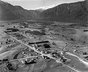
Whites Aviation photo of Whataroa in 1958
|
|
| Country | New Zealand |
| Region | West Coast |
| District | Westland District |
| Electorates | West Coast-Tasman Te Tai Tonga |
| Population | |
| • Total | 288 |
| Time zone | UTC+12 (NZST) |
| • Summer (DST) | UTC+13 (NZDT) |
| Postcode |
7886
|
| Area code(s) | 03 |
| Local iwi | Ngāi Tahu |
Whataroa is a small town in the southern part of the West Coast region of New Zealand's South Island. It sits on flat land next to the Whataroa River. State Highway 6, a main road, goes right through Whataroa. It connects the town to Ross in the north and Franz Josef / Waiau in the south.
In 2013, about 288 people lived in Whataroa and the areas nearby. This number was a bit lower than in 2006.
Whataroa is mostly a farming area, with dairying (milk farming) being the main activity. The town has a school, two churches, and a dairy shop with tearooms. Whataroa is also the starting point for trips to the nearby Waitangiroto Nature Reserve. This reserve is special because it's the only place in New Zealand where the rare kōtuku, or white heron, breeds.
Contents
What's in a Name?
The original Māori name for this area was Matainui. You can still see this name in Matainui Creek, which flows through the town.
In the 1930s, a post office was built in the town centre. It was first called Matainui P.O. Later, when the post office moved, locals asked for it to be renamed "Wataroa". This name came from the nearby river and flats. For many years, "Wataroa" was the usual spelling and how locals often said it. In 1951, the post office's official name became "Whataroa".
The Māori word whata means a raised platform. The word roa means "long" or "tall".
Whataroa's Past
Whataroa's history is linked to the Ōkārito gold rush. Ōkārito was a busy port in 1865–66. It supplied other gold-mining towns along the coast and inland. By the late 1860s, most of the gold was gone. The number of people in the area dropped a lot.
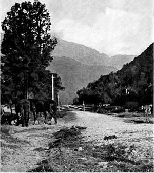
Around 1860, surveyors explored the Whataroa area. In 1866, Gerhard Mueller explored the inland area. He was the first European to see the white heron nesting colony. In the 1870s, Harry Friend started raising cattle on the Whataroa flats. He supplied meat to the gold miners. More farmers followed, and a track was made inland.
Before 1900, the flat land was used for grazing sheep, horses, and cattle. Farmers worked together to manage their animals. In 1897, the first telephone line reached the Whataroa post office. By 1900, a new road was built. This road helped farmers sell their produce. Flax and sawmills also started operating. Paynter Sawmills was a big employer for many years.
In 1904, the prime minister, Richard Seddon, visited. This led to the building of the Whataroa Bridge in 1907–08. The bridge opened in 1909. It meant that Ōkārito was no longer needed as a port.
In 1913, Henry Burrough divided his land, and many farmers arrived. Dairy farming became popular for a short time. A cheese and butter factory was built. But then, farmers started raising beef cattle instead. Cattle sales became very important. Cattle were driven from far south on a two-week journey. After a new road opened in 1960, trucks could take cattle south. The last cattle drive north to Whataroa was in 1961.
In the 1930s, a new post office was built in the town centre. Later, it moved to a modern building. A drapery (cloth shop) and butcher shop were built in the 1920s. A pub called The Better 'Ole also opened. The first doctor arrived in 1928. A nurse named Mabel Gunn opened a maternity hospital (for births) at Te Taho. In 1953, a five-bed hospital was built in Whataroa. Mabel Gunn was the head nurse there for ten years.
In 1937, the Arnold family started a garage. They built a new one in 1945. Their company became one of the biggest transport companies on the West Coast. At one point, the garage even supplied electricity to the town. In 1960, the Wahapo Power Station was built. It provided electricity to Whataroa. Later, the area was connected to the national electricity grid. The Wahapo Power Station was rebuilt in 1991 to make more power.
After 1945, farming on the Whataroa flats improved. New farm machines, fertilisers, and flood control helped. A telephone exchange, a bank, and community halls were built. In the 1960s, dairy farming became the main type of farming again. Milk was easily transported to a factory in Hokitika. Cattle sales still happened often. New bridges were built over the Whataroa and Waitangitāhuna Rivers. Sawmilling was also important to the town's economy.
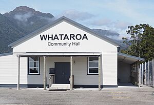
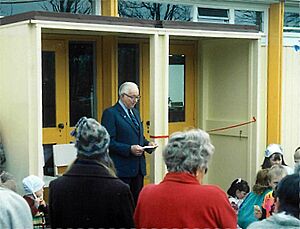
In 2019, the Whataroa Community Hall was renovated. It received a large grant to help with the work.
Whataroa's Location
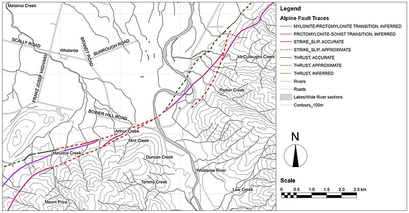
Whataroa is located near the Alpine Fault. This is an active geological fault that runs almost the entire length of the South Island. It marks the boundary between two large tectonic plates. The fault passes about 4 km (2.5 mi) southeast of Whataroa.
In 2017, scientists drilled into the Alpine Fault near Whataroa. They found very hot water at a shallow depth. Water at 100°C (212°F) was found at 630 meters (2,070 ft) deep. Usually, water this hot is found much deeper, more than 3 km (1.9 mi) down. Scientists believe this discovery could be very important for New Zealand.
Waitangiroto Nature Reserve
The Waitangiroto Nature Reserve is a protected area near Whataroa. It covers about 1,530 hectares (3,780 acres). The reserve has lowland kahikatea swamp forest along the Waitangiroto River.
This reserve is famous for being the only place in New Zealand where the kōtuku, or white heron (Ardea alba modesta), breeds. Many visitors come to see the breeding colony. However, you need a special permit to enter the rest of the nature reserve. Sometimes, people mistakenly call it the "Okarito" white heron colony, even though Ōkārito is further south.
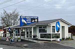
White Heron Sanctuary Tours in Whataroa is the only company allowed to take tourists to the white heron colony. The Arnold family, who have lived in Whataroa for generations, started the company in 1987.
During the breeding season (mid-September to February), visitors take a minibus to the edge of the reserve. Then, they walk through native bush to a special viewing hide. From there, they can watch the colony. Other birds like royal spoonbills and little shags can also be seen. The Arnold family helps the Department of Conservation control predators around the reserve.
Churches in Whataroa
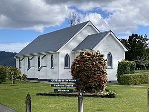
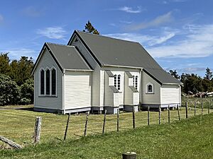
Our Lady of the Woods
Our Lady of the Woods is a Catholic church in Whataroa. It is located at 7 Whataroa Flat Road. Mass is held here twice a month, on the first and third Sundays.
In the 1880s, there were three Catholic groups in South Westland. A priest from Ross would travel by horseback to visit them. In 1907, Father Bogue helped build a church in Whataroa. The land was given by John Butler and Duncan Scalley. As the population in other areas dropped, their churches were no longer needed.
In 1934, a new Catholic parish was created in Whataroa. Father James Quinn was the priest. Mrs Butler donated the land for the current church and presbytery (priest's house). The Bishop of Christchurch, Matthew Brodie, laid the foundation stone on April 22, 1934. The church was officially opened later that year, on September 30.
St Luke's
St Luke's Church is an Anglican church. It is part of the Ross and South Westland parish. The church is about 0.85 km (0.53 mi) north of Our Lady of the Woods on Whataroa Flat Road.
In 1916, money was raised to build a new Anglican church. It used materials from an old church. Bishop Julius dedicated the church on July 10, 1919. It cost £190 to build. The church has a special stained-glass window behind the altar. It was donated by Henry Burrough and his sister to remember their brother Joseph, who died in World War I. The first couple married in the church was Mabel Baker and Frank Gunn in 1921.
A bell was hung in 1923. In 1945, it was moved to a separate tower.
Education in Whataroa
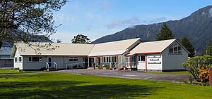
The first school in the area opened on July 1, 1879. It had 12 students. This school was also used for community events. The population was low, so the school closed in 1912. Other small schools operated in homes. The Whataroa School was built in 1916. The district schools celebrated their 100th birthday in 1979 and their 125th in 2004. A small school at Te Taho closed in 1947. Its students then took a bus to Whataroa.
The school, first called Wataroa School, was originally on Purcell's Road. In the 1920s, with 44 students and one teacher, it moved to its current location. A two-room building was built, and a second teacher was hired. By the 1950s, there were four teachers, and the school was renamed "Whataroa School". In 1962, the old building was rebuilt with new classrooms, a staff room, and an office.
Today, Whataroa School is a coeducational primary school for years 1–8. In the 1970s, the school added a dental clinic, a pool, and a library. In 1975, a library was added to the main building with about 1000 books. In June 1991, it became the Whataroa School Community Library. This was the first time a community and school library merged in Westland.
Events and Sports
In the early days, sports and wood-chopping events were held regularly. The annual Whataroa Races were also popular. Whataroa hosts the South Westland A&P Show every February. This show started in 1951. It includes horse riding, dairy cattle judging, dog trials, and family entertainment.
In 1933, the South Westland Rugby Union was formed. The Woodham Shield is an annual rugby competition. Whataroa and nearby towns like Franz Josef, Fox Glacier, Haast, Hari Hari, and Ross compete for the shield. Also in 1933, the Wataroa Aero Club was founded. It closed in 1953, and its land became a public park. Memorial gates were put up to honor Constable Ted Best, a club founder who died in a shooting incident.
 | Emma Amos |
 | Edward Mitchell Bannister |
 | Larry D. Alexander |
 | Ernie Barnes |


