Wheatcroft, Kentucky facts for kids
Quick facts for kids
Wheatcroft, Kentucky
|
|
|---|---|

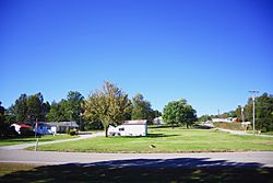
Houses in Wheatcroft
|
|

Location of Wheatcroft in Webster County, Kentucky.
|
|
| Country | United States |
| State | Kentucky |
| County | Webster |
| Area | |
| • Total | 0.25 sq mi (0.64 km2) |
| • Land | 0.25 sq mi (0.64 km2) |
| • Water | 0.00 sq mi (0.00 km2) |
| Elevation | 377 ft (115 m) |
| Population
(2020)
|
|
| • Total | 105 |
| • Density | 426.83/sq mi (165.04/km2) |
| Time zone | UTC-6 (Central (CST)) |
| • Summer (DST) | UTC-5 (CDT) |
| ZIP code |
42463
|
| Area code(s) | 270 |
| FIPS code | 21-82200 |
| GNIS feature ID | 0506516 |
Wheatcroft is a small city in Webster County, Kentucky, United States. It is a "home rule-class city," which means it has the power to manage its own local government. In 2020, about 105 people lived there.
A Look Back: Wheatcroft's History
Wheatcroft got its name from a man named Irving Horace Wheatcroft. He was from England. In 1899, he bought some land from Elijah Cullen. Then, he planned and started the city.
Irving Wheatcroft also opened coal mines in the area. Coal mining was a very important industry back then. He also built a railway called the Kentucky Western Railway. This railway connected nearby Blackford to Dixon. The Wheatcroft post office opened on September 10, 1900. A.S. Logsdon was the first postmaster. The city officially became a city in 1902.
Where is Wheatcroft?
Wheatcroft is located in Kentucky. You can find it at these coordinates: 37°29′20″N 87°51′48″W / 37.48889°N 87.86333°W. The city is along Kentucky Route 109. It is northwest of Clay. It is also southeast of the line between Webster and Union counties.
The United States Census Bureau says that Wheatcroft covers a total area of about 0.2 square miles (0.64 square kilometers). All of this area is land.
Who Lives in Wheatcroft?
| Historical population | |||
|---|---|---|---|
| Census | Pop. | %± | |
| 1910 | 490 | — | |
| 1920 | 400 | −18.4% | |
| 1930 | 705 | 76.3% | |
| 1940 | 617 | −12.5% | |
| 1950 | 418 | −32.3% | |
| 1960 | 317 | −24.2% | |
| 1970 | 229 | −27.8% | |
| 1980 | 325 | 41.9% | |
| 1990 | 206 | −36.6% | |
| 2000 | 173 | −16.0% | |
| 2010 | 160 | −7.5% | |
| 2020 | 105 | −34.4% | |
| U.S. Decennial Census | |||
In 2000, there were 173 people living in Wheatcroft. There were 68 households, which are groups of people living together. About 49 of these households were families. The city had about 698 people per square mile.
Many types of households lived in Wheatcroft. About 27.9% of households had children under 18. Half of the households (50.0%) were married couples. Some households (14.7%) had a female head with no husband. About 25.0% of households were single individuals. Some people (11.8%) lived alone and were 65 or older. The average household had 2.54 people. The average family had 2.98 people.
The population of Wheatcroft had people of all ages. About 25.4% were under 18 years old. About 8.7% were between 18 and 24. A larger group, 28.3%, was between 25 and 44. Another 25.4% were between 45 and 64. Finally, 12.1% were 65 years or older. The average age in the city was 38 years old.
See also
- In Spanish: Wheatcroft (Kentucky) para niños
 | John T. Biggers |
 | Thomas Blackshear |
 | Mark Bradford |
 | Beverly Buchanan |

