White Rock, South Dakota facts for kids
Quick facts for kids
White Rock, South Dakota
|
|
|---|---|

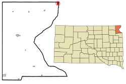
Location in Roberts County and the state of South Dakota
|
|
| Country | United States |
| State | South Dakota |
| County | Roberts |
| Area | |
| • Total | 1.57 sq mi (4.07 km2) |
| • Land | 1.57 sq mi (4.07 km2) |
| • Water | 0.00 sq mi (0.00 km2) |
| Elevation | 974 ft (297 m) |
| Population
(2020)
|
|
| • Total | 6 |
| • Density | 3.82/sq mi (1.47/km2) |
| Time zone | UTC-6 (Central (CST)) |
| • Summer (DST) | UTC-5 (CDT) |
| Area code(s) | 605 |
| FIPS code | 46-71380 |
| GNIS feature ID | 1267654 |
White Rock is a small town located in Roberts County, South Dakota, United States. It sits right next to the Bois de Sioux River. In 2020, only 6 people lived there. White Rock is special because it's the most northeastern town in South Dakota. It's very close to the border with Minnesota and just a mile south of North Dakota.
Contents
History of White Rock
A post office opened in White Rock in 1885. It served the community for many years until it closed in 1965. The town got its name from a large white granite rock that was once near where the town was first built. Sadly, this special boulder was later removed to make space for a grain elevator. Today, a historical marker stands at the corner of Haggert Avenue and 2nd Street. This marker helps people remember the town's unique history and its namesake rock.
Geography of White Rock
White Rock covers a total area of about 1.57 square miles (4.07 square kilometers). All of this area is land, meaning there are no lakes or large rivers within the town's boundaries. The town's location along the Bois de Sioux River makes it a notable spot on the state map.
Population Changes in White Rock
The number of people living in White Rock has changed a lot over the years.
| Historical population | |||
|---|---|---|---|
| Census | Pop. | %± | |
| 1900 | 170 | — | |
| 1910 | 368 | 116.5% | |
| 1920 | 353 | −4.1% | |
| 1930 | 281 | −20.4% | |
| 1940 | 220 | −21.7% | |
| 1950 | 113 | −48.6% | |
| 1960 | 76 | −32.7% | |
| 1970 | 35 | −53.9% | |
| 1980 | 10 | −71.4% | |
| 1990 | 7 | −30.0% | |
| 2000 | 18 | 157.1% | |
| 2010 | 3 | −83.3% | |
| 2020 | 6 | 100.0% | |
| U.S. Decennial Census 2013 Estimate |
|||
White Rock's Population in 2010
According to the census taken in 2010, there were 3 people living in White Rock. These 3 people made up 3 households. No families were living in the town at that time.
The town had 8 housing units, which are places where people can live. The population density was about 1.9 people per square mile. This means there weren't many people living close together.
Most of the households were made up of single individuals. One-third of the people living alone were 65 years old or older. The average household size was 1 person.
The average age of people in White Rock in 2010 was 60.5 years. All residents were 45 years or older. Two-thirds of the residents were between 45 and 64 years old. One-third of the residents were 65 years or older. All the residents counted in 2010 were male.
See also
 In Spanish: White Rock (Dakota del Sur) para niños
 | Jessica Watkins |
 | Robert Henry Lawrence Jr. |
 | Mae Jemison |
 | Sian Proctor |
 | Guion Bluford |

