Whitefish River (Saskatchewan) facts for kids
Quick facts for kids Whitefish River |
|
|---|---|
|
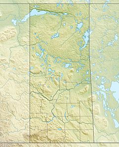
Location of the mouth of the Whitefish River in Saskatchewan.
|
|
| Country | Canada |
| Province | Saskatchewan |
| Census Division | No. 18 |
| Physical characteristics | |
| Main source | Unnamed lake 464 m (1,522 ft) 55°53′08″N 105°11′27″W / 55.88556°N 105.19083°W |
| River mouth | Rowe Lake 381 m (1,250 ft) 55°42′56″N 105°21′31″W / 55.71556°N 105.35861°W |
| Length | 24 km (15 mi) |
| Basin features | |
| River system | Churchill River drainage basin |
The Whitefish River is a river located in northern Saskatchewan, Canada. It flows through a part of Saskatchewan known as Division No. 18. This river is an important part of the larger Hudson Bay and Churchill River drainage basins. A drainage basin is like a giant funnel. It collects all the rain and melted snow from an area and directs it into a river or lake.
The River's Journey: Whitefish River Course
The Whitefish River starts its journey in an unnamed lake. This lake is quite high up, at about 464 metres (1,522 ft) above sea level. From there, the river flows first towards the south, then turns to the northeast.
After that, it changes direction again, heading southwest. Its journey ends when it flows into Rowe Lake. Rowe Lake is at a lower elevation of about 381 metres (1,250 ft). This lake is located about 65 kilometres (40 mi) north of a community called La Ronge.
The water from Rowe Lake doesn't stop there. It continues to flow through another lake called Shadd Lake. Finally, it reaches Black Bear Island Lake, which is part of the larger Churchill River system. This shows how different rivers and lakes are all connected.
Understanding Drainage Basins
A drainage basin is a really important concept when we talk about rivers. Imagine a huge bowl or a giant bathtub. All the water that falls inside that bowl, whether it's rain or melting snow, will eventually flow towards the lowest point. For a river, that lowest point is usually the river itself, and then it flows towards a larger body of water like a lake or an ocean.
The Whitefish River is part of two big drainage basins: the Hudson Bay basin and the Churchill River basin. This means that all the water from the land around the Whitefish River eventually makes its way to the Churchill River, and then onward to Hudson Bay. It's like a network of waterways all connected together.
 | Mary Eliza Mahoney |
 | Susie King Taylor |
 | Ida Gray |
 | Eliza Ann Grier |


