
Whitemarsh Island, Georgia facts for kids
Quick facts for kids
Whitemarsh Island, Georgia
|
|
|---|---|

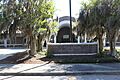
Islands High School
|
|

Location in Chatham County and the state of Georgia
|
|
| Country | United States |
| State | Georgia |
| County | Chatham |
| Area | |
| • Total | 6.65 sq mi (17.21 km2) |
| • Land | 5.82 sq mi (15.06 km2) |
| • Water | 0.83 sq mi (2.15 km2) |
| Elevation | 3 ft (0.9 m) |
| Population
(2020)
|
|
| • Total | 6,983 |
| • Density | 1,200.86/sq mi (463.64/km2) |
| Time zone | UTC-5 (Eastern (EST)) |
| • Summer (DST) | UTC-4 (EDT) |
| FIPS code | 13-82636 |
| GNIS feature ID | 1867247 |
Whitemarsh Island is a community in Chatham County, Georgia, United States. It is not an official city but is recognized as a special area for counting people. In 2020, about 6,983 people lived there. Whitemarsh Island is part of the larger Savannah area. Many people who live here work in Savannah.
Contents
Island Location and Features
Whitemarsh Island is located at 32 degrees North and 81 degrees West. It is surrounded by water. To the north is Richardson Creek, and to the east is Turner Creek. The Wilmington River is to the south and west. All these are tidal waters, meaning their levels change with the ocean tides.
Travel and Connections
U.S. Route 80 goes across the island. This road connects Whitemarsh Island to Savannah in the west. It also leads east to Tybee Island and the Atlantic Ocean. The Islands Expressway is another road. It goes northwest from Whitemarsh Island for about 6.5 miles to downtown Savannah.
Size of the Island
The total area of Whitemarsh Island is about 17.2 square kilometers (6.65 square miles). Most of this is land, about 14.6 square kilometers (5.82 square miles). The rest, about 2.6 square kilometers (0.83 square miles), is water. This means about 15% of the area is water.
Island Population Changes
Whitemarsh Island was first counted as a special place in the 1990 U.S. Census. Since then, its population has grown steadily.
Population Growth Over Time
The number of people living on Whitemarsh Island has increased over the years.
- 1990: 2,554 people
- 2000: 5,824 people
- 2010: 6,792 people
- 2020: 6,983 people
Who Lives on Whitemarsh Island?
The 2020 United States census showed that 6,983 people lived on Whitemarsh Island. These people lived in 2,752 households. About 1,704 of these households were families. The island is home to people from many different backgrounds.
| Race / Ethnicity (NH = Non-Hispanic) | Pop 2000 | Pop 2010 | Pop 2020 | % 2000 | % 2010 | % 2020 |
|---|---|---|---|---|---|---|
| White alone (NH) | 4,717 | 5,469 | 5,497 | 80.99% | 80.52% | 78.72% |
| Black or African American alone (NH) | 530 | 567 | 379 | 9.10% | 8.35% | 5.43% |
| Native American or Alaska Native alone (NH) | 13 | 9 | 12 | 0.22% | 0.13% | 0.17% |
| Asian alone (NH) | 334 | 417 | 455 | 5.73% | 6.14% | 6.52% |
| Pacific Islander alone (NH) | 7 | 3 | 2 | 0.12% | 0.04% | 0.03% |
| Some Other Race alone (NH) | 13 | 9 | 39 | 0.22% | 0.13% | 0.56% |
| Mixed race or Multiracial (NH) | 70 | 113 | 339 | 1.20% | 1.66% | 4.85% |
| Hispanic or Latino (any race) | 140 | 205 | 260 | 2.40% | 3.02% | 3.72% |
| Total | 5,824 | 6,792 | 6,983 | 100.00% | 100.00% | 100.00% |
Schools and Libraries
Whitemarsh Island is part of the Savannah-Chatham County Public Schools system. This means students on the island attend schools managed by this district.
Local Schools
There are several schools located on Whitemarsh Island:
- Islands High School
- Coastal Middle School
- Marshpoint Elementary School
Community Library
The Live Oak Public Libraries system has a branch on the island. It is called the Islands Library. It provides books and resources for everyone in the community.
-
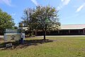
Coastal Middle School
-
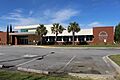
Marshpoint Elementary School
-
Live Oak Public Libraries, Whitemarsh Island


See also
 In Spanish: Whitemarsh Island para niños
