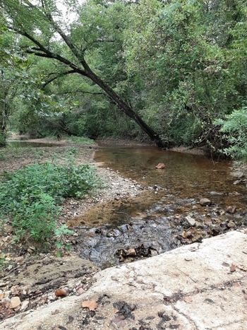
Whites Creek (Hunter Creek tributary) facts for kids
Quick facts for kids Whites Creek |
|
|---|---|

Whites Creek adjacent to Missouri Route 14 six miles east of Ava
|
|
| Country | United States |
| State | Missouri |
| Region | Douglas County |
| Physical characteristics | |
| Main source | 1,250 ft (380 m) 36°54′22″N 92°38′18″W / 36.90611°N 92.63833°W |
| River mouth | 863 ft (263 m) 36°55′28″N 92°32′36″W / 36.92444°N 92.54333°W |
Whites Creek is a small stream located in Douglas County, Missouri. It flows through the beautiful Ozark region. This creek is a branch, or tributary, of another stream called Hunter Creek.
About Whites Creek
Whites Creek starts high up in the hills and then flows downhill. The place where it begins, called the headwaters, is about 1,250 feet (381 meters) above sea level. The place where it ends, called the mouth, is much lower, at about 863 feet (263 meters) above sea level.
Where Does Whites Creek Flow?
The creek begins on the south side of a place called Table Rock Knob, which is just southeast of Ava. At first, it flows south for a short distance. Then, it turns and flows towards the east.
Whites Creek runs right next to Missouri Route 14, a local road. There's a bridge over the creek where the road turns south. You can also find Hoffmeister Spring along the north side of the creek, not far from this bridge. This spring comes out of a bluff, which is a steep cliff.
How Whites Creek Got Its Name
The creek was named after an early settler in the area. This pioneer citizen had the last name White, and that's how Whites Creek got its name!
 | Delilah Pierce |
 | Gordon Parks |
 | Augusta Savage |
 | Charles Ethan Porter |

