Whitesville, West Virginia facts for kids
Quick facts for kids
Whitesville, West Virginia
|
||
|---|---|---|

Whitesville
|
||
|
||

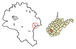
Location of Whitesville in Boone County, West Virginia.
|
||
| Country | United States | |
| State | West Virginia | |
| County | Boone | |
| Area | ||
| • Total | 0.33 sq mi (0.86 km2) | |
| • Land | 0.31 sq mi (0.80 km2) | |
| • Water | 0.02 sq mi (0.06 km2) | |
| Elevation | 837 ft (255 m) | |
| Population
(2020)
|
||
| • Total | 361 | |
| • Estimate
(2021)
|
351 | |
| • Density | 1,390.88/sq mi (536.74/km2) | |
| Time zone | UTC-5 (Eastern (EST)) | |
| • Summer (DST) | UTC-4 (EDT) | |
| ZIP code |
25209
|
|
| Area code(s) | 304 | |
| FIPS code | 54-86836 | |
| GNIS feature ID | 1555976 | |
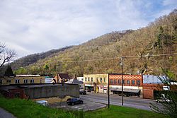
Whitesville is a small town in Boone County, West Virginia, United States. It is located along the Big Coal River. The town was once a place where many people worked in coal mines.
In 2020, about 361 people lived in Whitesville. The town officially became a town on August 15, 1935. It was named after B. W. White, who was one of the first people to settle there. Before it was called Whitesville, it had other names like Jarrold's Valley and Pritchard City.
Contents
Where is Whitesville Located?
Whitesville is found at 37.981297 degrees north and 81.534055 degrees west. The town sits on a narrow strip of land next to the Big Coal River. This area stretches from where Toms Branch joins the river to just north of where Seng Creek joins it.
West Virginia Route 3, also known as Coal River Road, goes through Whitesville. This road connects the town to Sylvester in the northwest and the Beckley area in the southeast.
The United States Census Bureau says that Whitesville covers about 0.33 square miles (0.86 square kilometers). Most of this area, about 0.31 square miles (0.80 square kilometers), is land. The rest, about 0.02 square miles (0.06 square kilometers), is water.
How Many People Live in Whitesville?
| Historical population | |||
|---|---|---|---|
| Census | Pop. | %± | |
| 1940 | 942 | — | |
| 1950 | 1,017 | 8.0% | |
| 1960 | 774 | −23.9% | |
| 1970 | 781 | 0.9% | |
| 1980 | 689 | −11.8% | |
| 1990 | 486 | −29.5% | |
| 2000 | 520 | 7.0% | |
| 2010 | 514 | −1.2% | |
| 2020 | 361 | −29.8% | |
| 2021 (est.) | 351 | −31.7% | |
| U.S. Decennial Census | |||
Population in 2010
In 2010, there were 514 people living in Whitesville. These people lived in 247 homes. About half of these homes (125) were families. The town had about 1658 people per square mile. There were 304 housing units in total.
Most of the people in Whitesville (98.1%) were White. A small number (0.2%) were African American. About 1.8% of the people were from two or more races.
In the homes, 23.1% had children under 18 years old. About 36.4% were married couples. Some homes (12.1%) had a female head of household without a husband. A very small number (2.0%) had a male head of household without a wife. Almost half of the homes (49.4%) were not families.
Many homes (44.5%) had only one person living in them. About 20.6% of homes had someone 65 years old or older living alone. The average home had 2.08 people, and the average family had 2.92 people.
The average age of people in Whitesville was 42.5 years. About 20.4% of residents were under 18. About 8.5% were between 18 and 24. A quarter of residents (24.7%) were between 25 and 44. About 28% were between 45 and 64. And 18.5% were 65 years old or older. Slightly more than half of the residents (52.3%) were female, and 47.7% were male.
Upper Big Branch Miners Memorial
Whitesville is home to an important memorial. It is called the Upper Big Branch Miners Memorial. This monument honors the miners who died in a mining accident. The accident happened in April 2010 at the Upper Big Branch Mine disaster near Montcoal.
See also
 In Spanish: Whitesville (Virginia Occidental) para niños
 | Calvin Brent |
 | Walter T. Bailey |
 | Martha Cassell Thompson |
 | Alberta Jeannette Cassell |

