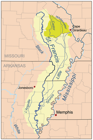
Map of the St. Francis River watershed showing Little River. The Castor/Whitewater headwaters (darker shade on the map) were historically part of the St. Francis watershed via Little River but are now diverted to the Mississippi by the Headwater Diversion Channel.
The Whitewater River was once a long stream, about 120 kilometers (75 miles) in length. It started near a place called Womack in St. Francois County. From there, it flowed south through several other counties: Perry, Bollinger, Cape Girardeau, and Stoddard. Eventually, it joined the Little River close to Bell City.
How the Whitewater River Changed
In the early 1900s, a big project called the Headwater Diversion Channel was built. This channel cut right through the Whitewater River. Because of this, the northern part of the river was redirected into the new channel. This meant the northern section no longer flowed into the Little River. It also separated the southern part of the river from its original starting point.
Renaming the River Sections
In 2007, a group called the Board on Geographic Names decided to give new names to the two separate parts of the river. The northern section is now known as Upper Whitewater Creek. This part now flows through the Headwater Diversion Channel and empties into the Mississippi River just south of Cape Girardeau. The southern section is now called Lower Whitewater Creek.


