Whitleyville, Tennessee facts for kids
Quick facts for kids
Whitleyville, Tennessee
|
|
|---|---|

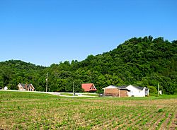
Buildings along SR 56 in Whitleyville
|
|
| Country | United States |
| State | Tennessee |
| County | Jackson |
| Elevation | 531 ft (162 m) |
| Time zone | UTC-6 (Central (CST)) |
| • Summer (DST) | UTC-5 (CDT) |
| ZIP code |
38588
|
| Area code(s) | 931 |
| GNIS feature ID | 1274422 |
Whitleyville is a small, quiet place in Jackson County, Tennessee, United States. It's what we call an unincorporated community. This means it's not officially a city or town with its own local government. Instead, it's a collection of homes and businesses in a rural area.
About Whitleyville
Whitleyville is located near a stream called Jennings Creek. This creek eventually flows into the Cumberland River, which is a much larger river. The community is mainly found along two state roads, State Route 56 and State Route 135.
What You Can Find There
Even though it's a small community, Whitleyville has some important services. You can find a small bank branch office there, which is helpful for local residents. There's also a post office that serves the area with the ZIP code 38588.
Life in Whitleyville
If you visit Whitleyville, you'll see homes spread out among farm fields and open grassy areas. It's a peaceful place where people live close to nature. The community is about 6.2 miles (10.0 km) north of a larger town called Gainesboro.


