Whitsand Bay facts for kids
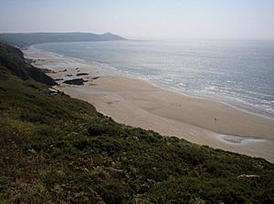
Whitsand Bay is a beautiful bay located in south east Cornwall, England, United Kingdom. It stretches from Rame Head in the east all the way to Portwrinkle in the west. This area is famous for its tall, steep cliffs, amazing views, and long sandy beaches. The popular South West Coast Path also runs along the entire length of the bay, perfect for walks!
Contents
Exploring Whitsand Bay's Landscape
The bay is watched over by Rame Head, a hill shaped like a cone. At its top, you can see the old ruins of a chapel from the 1300s, dedicated to St Michael.
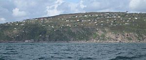
Near Captain Blake's Point, you'll find long sandy areas mixed with rocky parts and smaller coves. Many of these smaller bays disappear when the tide is high. Two holiday villages, Freathy and Tregonhawke, are built on flat areas, like steps, on the cliff sides.
There's a special place called Sharrow Point, looked after by the National Trust. Here, you can find a small cave that was dug by hand in 1874 by a hermit named Lugger. He even wrote poems on the ceiling to pass the time! Lugger's Cave is now fenced off to keep it safe.
The headland, including Rame Head and Whitsand Bay, is a Site of Special Scientific Interest (SSSI). This means it's a very important place for both its unique rocks and its wildlife. It's home to two rare plant species: early meadow-grass and slender bird’s-foot-trefoil.
Important Information About Whitsand Bay
For many years, there has been a campaign to stop the dumping of mud and waste from the River Tamar and Plymouth port into the bay. Even though a review in 2010 said there wasn't much environmental harm, the dumping still continues.
Part of Whitsand Bay is used by the UK Ministry of Defence as a firing range. This area, between Tregantle Fort and Trethill Cliffs, is closed when they are doing firing practice. You'll see a red flag when it's closed.
Whitsand Bay is a favourite spot for divers. In 2004, a former Royal Navy ship, HMS Scylla, was purposely sunk here to create a new underwater reef for marine life. The Scylla lies near another shipwreck, the James Eagan Layne, which sank during World War II.
Another interesting wreck is HMS A7, an early Royal Navy submarine. It sank in Whitsand Bay on January 16, 1914, during a practice torpedo attack. All her crew were lost. Today, the submarine lies about 40 meters (130 feet) deep. Since 2001, it has been a "Controlled Site" under a special law, meaning you need permission to dive there.
The beach itself doesn't have public toilets, and the paths down to the sand are steep, narrow, and can be slippery. Whitsand Bay is also a very popular place for surfing. The RNLI provides a lifeguard service from May to September at the bottom of Tregonhawke cliff, where you can also find a surf school and a cafe.
Staying Safe at Whitsand Bay
It's important to know that there can be dangerous rip currents in the water. Always be careful when swimming.
Remember, the western part of the beach is closed when the Tregantle Fort firing range is active. Look for the red flag to know if it's safe to enter.
The paths leading to the beaches at Sharrow Point, Withnoe, Tregonhawke, and Freathy are steep and can be slippery. They are not suitable for wheelchairs. Also, be aware that you can get cut off by the tide in some areas, so always check tide times.
Historic Forts of Whitsand Bay
In 1859, a special group called the Royal Commission on the Defence of the United Kingdom decided that Whitsand Bay was a weak spot in the defenses of Plymouth. They suggested building two forts, known as Palmerston Forts, to protect the area. These were Polhawn Battery at the east end and Tregantle Fort at the west end.
Polhawn Battery
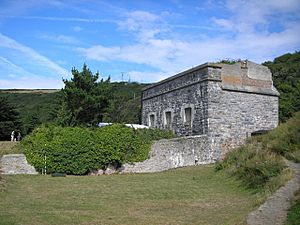
This fort was designed by Captain Edmund Frederick Du Cane and finished in 1864. It's a two-story building made of limestone and granite, sitting on the cliff overlooking the bay. The top floor had seven gun positions, originally holding large 68-pounder guns. The bottom floor had rooms for soldiers and a place to store ammunition.
In 1885, the old guns were replaced with newer 64-pounder rifled guns. The fort was sold by the War Office in 1927 and became a hotel and tea room, changing its name to Polhawn Fort. It was sold again in 1968 and has been restored as a hotel and a popular place for weddings.
Tregantle Fort
At the western end of Whitsand Bay, Tregantle Fort stands about 110 meters (360 feet) above sea level. It has a six-sided shape and is surrounded by a ditch on three sides. The fort was finished in 1865 and included barracks that could house 1,000 soldiers.
It was meant to have 22 large 7-inch guns, but only seven were ever put in place. During World War I, it was used for rifle training, and in World War II, it was used for gas warfare training and as a place for US troops to stay. Today, it's still part of the Defence Estate and is regularly used as a live firing range. Remember to look for the red flag warnings, as the path to the beach below will be closed during firing.
Whitsand Bay Battery
Later, in 1887, it was realized that new naval guns were so powerful that enemy ships could anchor in Whitsand Bay and attack Plymouth without being hit by the existing forts. To stop this, a new battery was built near Stone Farm, at the top of Tregonhawke Cliff.
This battery was completed in 1893. It had three very large 12.5-inch guns and two 6-inch guns. The battery was also strongly protected against attacks from land with a dry moat and special defensive structures.
The 6-inch guns were removed in 1897, and the larger guns were taken out in 1920. During World War II, the battery was used for radar training. In 1951, the military left the site, and it became a caravan park. Even though the ditch has been filled in, you can still see many of the original parts of the fort today.
 | Madam C. J. Walker |
 | Janet Emerson Bashen |
 | Annie Turnbo Malone |
 | Maggie L. Walker |


