Willamette Floodplain facts for kids
Quick facts for kids Willamette Floodplain |
|
|---|---|

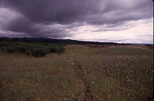
Grassland of the Willamette Floodplain
|
|
| Lua error in Module:Location_map at line 420: attempt to index field 'wikibase' (a nil value). | |
| Location | Benton County, Oregon, US |
| Nearest city | Corvallis |
| Area | 713 acres (289 ha) |
| Designated | 1987 |
| Administered by | U.S. Fish and Wildlife Service |
The Willamette Floodplain is a special natural area in Oregon. It has about 713 acres (289 hectares) of natural grassland. This area is close to the Willamette River. In May 1987, it became a National Natural Landmark. This means it's a very important natural place in the United States.
This floodplain is part of the William L. Finley National Wildlife Refuge. It is located about 10 miles (16 km) south of Corvallis. You can find it in Benton County, Oregon.
What Makes the Willamette Floodplain Special?
The Willamette Floodplain is unique because it is the largest piece of native grassland that has never been plowed. It is a "bottomland" grassland, meaning it's in a low-lying area near a river. Most other grasslands like this in the North Pacific Border region have been farmed or turned into places for animals to graze.
Why is it a Natural Landmark?
This area was chosen as a National Natural Landmark because grasslands and shrublands like it are very rare. Most have been changed by people. The Willamette Floodplain helps us see what these natural areas looked like long ago. It protects an important part of Oregon's natural history.
 | Misty Copeland |
 | Raven Wilkinson |
 | Debra Austin |
 | Aesha Ash |

