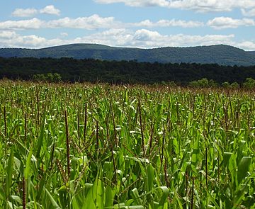
Williamsburg Mountain facts for kids
Quick facts for kids Williamsburg Mountain |
|
|---|---|

Williamsburg Mountain (viewed from west)
|
|
| Highest point | |
| Elevation | 2,350 ft (720 m) |
| Geography | |
| Location | Blair / Huntingdon counties, Pennsylvania, U.S. |
| Parent range | Appalachian Mountains |
| Topo map | Williamsburg Quad. |
| Climbing | |
| Easiest route | drive then walk |
Williamsburg Mountain is a cool natural feature in Pennsylvania, USA. It's not a typical mountain peak you might see on a map. Instead, it's a high, curvy part of the much longer Tussey Mountain ridge, which stretches for about 150 miles!
What is Williamsburg Mountain?
This mountain gets its name from the nearby town of Williamsburg. Even though it's well-known locally, you won't find "Williamsburg Mountain" on official maps from the USGS. People in the area often call it "The Loop" because of its unique "S" shape when you look at it from above.
How High is it?
The top of Williamsburg Mountain rises very high above the town and the Frankstown Branch of the Juniata River. It stands over 1,500 feet (about 457 meters) above them! This makes it a prominent landmark in the area.
Reaching the Summit
If you want to get close to the top of Williamsburg Mountain, you can drive most of the way. You'd use State Route 866. After that, there's an access road you can walk to reach the very summit.
What's at the Top?
At the very top of the mountain, you'll find some interesting things. There's an old lookout tower, which is now closed. You'll also see several communication towers, which help with things like cell phone signals and radio broadcasts. A large area of land on the mountain, including the summit, is part of Pennsylvania State Game Lands 118. These lands are protected and used for wildlife and outdoor activities.
 | Janet Taylor Pickett |
 | Synthia Saint James |
 | Howardena Pindell |
 | Faith Ringgold |

