Wilmot and Crampton Bay facts for kids
Quick facts for kids Wilmot and Crampton Bay |
|
|---|---|
| Location | Adelaide Peninsula |
| Coordinates | 68°11′N 98°45′W / 68.183°N 98.750°W |
| Ocean/sea sources | Arctic Ocean |
| Basin countries | Canada |
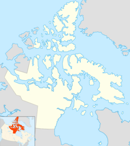
Wilmot and Crampton Bay is a cool waterway in the Arctic, located in a part of Canada called the Kitikmeot Region in Nunavut. It sits on the eastern side of the Queen Maud Gulf, right next to the western coast of the Adelaide Peninsula, and it's south of a big island called King William Island.
Discovering Wilmot and Crampton Bay
This bay is a quiet spot in the vast Canadian Arctic. It's part of the huge Arctic Ocean and is known for its cold waters and remote location. Even though it's far away, this bay became famous because of an important discovery made there.
Finding the Lost Ship: HMS Erebus
On September 2, 2014, something amazing happened in Wilmot and Crampton Bay. A team of underwater archaeologists from Parks Canada found the wreck of HMS Erebus. This was a very famous ship! It was the main ship of Sir John Franklin's lost expedition. His expedition tried to find a way through the Arctic in the 1840s but both ships, HMS Erebus and HMS Terror, went missing. For many years, no one knew what happened to them.
Protecting the Shipwreck Site
After HMS Erebus was found, Parks Canada decided to protect the area. They made a special zone in the bay where the ship was discovered. This area is now part of the Wrecks of HMS Erebus and HMS Terror National Historic Site. It's a rectangular area west of the peninsula, about 25 km (16 mi) northeast of O'Reilly Island. This helps keep the historic shipwreck safe for future study and preservation. The protected area runs from Point A (68°14′44.8″N 98°52′22.3″W / 68.245778°N 98.872861°W) to Point B (68°17′44.2″N 98°40′17.9″W / 68.295611°N 98.671639°W) to Point C (68°13′15.4″N 98°32′16.2″W / 68.220944°N 98.537833°W) to Point D (68°10′16.5″N 98°44′19.3″W / 68.171250°N 98.738694°W).
 | Mary Eliza Mahoney |
 | Susie King Taylor |
 | Ida Gray |
 | Eliza Ann Grier |


