Wolfforth, Texas facts for kids
Quick facts for kids
Wolfforth, Texas
|
|
|---|---|
 |
|
| Motto(s):
"The place to be"
|
|

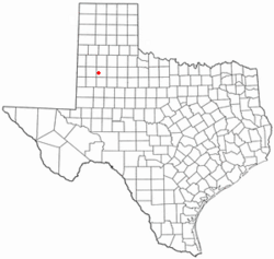
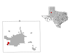
Location of Wolfforth, Texas
|
|
 |
|
| Country | United States |
| State | Texas |
| County | Lubbock |
| Area | |
| • Total | 3.07 sq mi (7.96 km2) |
| • Land | 3.06 sq mi (7.93 km2) |
| • Water | 0.01 sq mi (0.03 km2) |
| Elevation | 3,317 ft (1,011 m) |
| Population
(2020)
|
|
| • Total | 5,521 |
| • Density | 1,798.4/sq mi (693.6/km2) |
| Time zone | UTC-6 (Central (CST)) |
| • Summer (DST) | UTC-5 (CDT) |
| ZIP code |
79382
|
| Area code(s) | 806 |
| FIPS code | 48-79972 |
| GNIS feature ID | 1371874 |
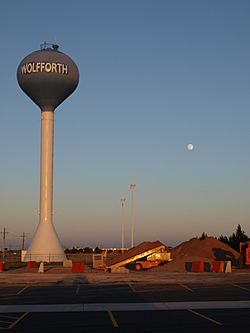
Wolfforth is a town in Lubbock County, Texas, United States. It is a town located southwest of Lubbock. In 2020, the population was 5,521 people.
Contents
History of Wolfforth
Wolfforth was started in 1916. It grew because of the railroad. A railway line, the Panhandle and Santa Fe Railway, was built through the area. This made Wolfforth a "railroad town," which means it became important for moving goods and people by train.
The town is named after two brothers, George and Eastin Wolfforth. They had settled in this area. George was a rancher, and Eastin was the Lubbock County Sheriff around 1900. The city honors George (who lived from 1866 to 1950) and his wife, Charlotte Lottie Alma Hunt (1879–1952).
Geography and Location
Wolfforth is located at 33.503968 degrees North latitude and -102.011973 degrees West longitude.
The city covers a total area of about 8.0 square kilometers (3.07 square miles). A very small part of this area, about 0.03 square kilometers (0.01 square miles), is water.
Population Changes
| Historical population | |||
|---|---|---|---|
| Census | Pop. | %± | |
| 1960 | 597 | — | |
| 1970 | 1,090 | 82.6% | |
| 1980 | 1,701 | 56.1% | |
| 1990 | 1,941 | 14.1% | |
| 2000 | 2,554 | 31.6% | |
| 2010 | 3,670 | 43.7% | |
| 2020 | 5,521 | 50.4% | |
| U.S. Decennial Census | |||
Wolfforth's Population in 2020
The United States Census counts how many people live in an area. This helps us understand the population.
| Race | Number of People | Percentage |
|---|---|---|
| White (NH) | 3,582 | 64.88% |
| Black or African American (NH) | 125 | 2.26% |
| Native American or Alaska Native (NH) | 27 | 0.49% |
| Asian (NH) | 53 | 0.96% |
| Pacific Islander (NH) | 1 | 0.02% |
| Some Other Race (NH) | 16 | 0.29% |
| Mixed/Multi-Racial (NH) | 186 | 3.37% |
| Hispanic or Latino | 1,531 | 27.73% |
| Total | 5,521 |
In 2020, there were 5,521 people living in Wolfforth. These people lived in 1,771 households, and 1,313 of these were families.
Education in Wolfforth
Students in Wolfforth attend schools in the Frenship Independent School District. This school district has a total of fourteen schools. Four of these schools are located right in Wolfforth. Nine schools are in the city of Lubbock, and one is in Lubbock County outside of any city.
Transportation Routes
Several important roads help people travel in and around Wolfforth. US 62 and US 82 are major highways. They are also known as the Marsha Sharp Freeway. These roads form part of the town's edge and go around the south side of Wolfforth.
Farm to Market Road 179, also called Dowden Road, is the main road that runs north and south through the town. Loop 193, known as Main Street, goes through the town. It serves as a local business route for US 62 and US 82.
The Lubbock and Western Railway also serves the city. This railway is part of a company called Watco.
See also
 In Spanish: Wolfforth (Texas) para niños
 | Misty Copeland |
 | Raven Wilkinson |
 | Debra Austin |
 | Aesha Ash |

