Wyoming, Rhode Island facts for kids
Quick facts for kids |
|
|
Wyoming Village Historic District
|
|

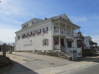
Wood River Inn
|
|
| Location | Roughly bounded by RI 138, RI 3, Old Nooseneck Hill Rd., Bridge and Prospect Sts., Richmond, Rhode Island |
|---|---|
| Architectural style | Greek Revival, Late Victorian, Federal |
| NRHP reference No. | 74000014 |
| Added to NRHP | May 2, 1974 |
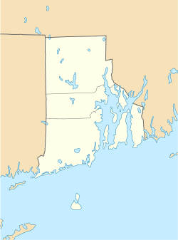
Wyoming is a small village in southern Rhode Island, United States. It sits right on the Wood River. Most of Wyoming is in the town of Richmond, but a part of it crosses the river into the town of Hopkinton. In 2010, about 270 people lived here. Wyoming is also home to a special area called the Wyoming Village Historic District and has its own post office.
Contents
History of Wyoming Village
The village of Wyoming was first settled in 1757. It became an important place for factories early on because the river provided lots of hydropower (energy from moving water). This power helped run machines.
By 1787, a place called Brand's Iron Works was making iron products on the Hopkinton side of the river. In 1814, Brothers Cotton Mill started making cloth on the Richmond side of Wyoming. A major road, the New London Turnpike (Rhode Island Route 3), was built through the area in 1815. That same year, a tavern (like an inn or restaurant) opened to serve travelers on the turnpike. Two more textile mills (factories that make fabric) were built around 1830 and 1845, but they were later destroyed by fire.
In 1970, a big highway called Interstate 95 was built close to Wyoming. There's an exit near the village, which has led to new shops, businesses, and homes being built in the area.
Wyoming's Historic District
The Wyoming Village Historic District is a special area that protects old buildings and places. It's roughly located near Rhode Island Routes 138 and 3, Old Nooseneck Hill Road, Bridge Street, and Prospect Street in Richmond.
This district includes Brand's Ironworks and shows off different styles of old buildings. You can see Greek Revival, Late Victorian, and Federal architecture designs. This important district was added to the National Register of Historic Places in 1974.
Prospect Street, on the Hopkinton side of the river, is a neighborhood that grew in the mid-1800s. Many of the houses there were built between 1846 and 1850. The historic district covers about 570 acres (almost one square mile) across both Richmond and Hopkinton.
Geography of Wyoming
Wyoming is about 0.91 square miles (2.3 square kilometers) in total size. Most of this area, about 0.86 square miles (2.2 square kilometers), is land. The rest, about 0.05 square miles (0.1 square kilometers), is water.
People in Wyoming
The part of Wyoming that is in Hopkinton is also included in the census-designated place of Hope Valley.
2020 Census Information
The 2020 United States census counted 415 people living in Wyoming. There were 182 households (groups of people living together) and 80 families.
Most of the people, about 92%, were white or European American. A small number of people were Native American, Asian, or from two or more races. About 2% of the population was Hispanic or Latino.
About 12% of the people were under 18 years old. The median age (the middle age) in Wyoming was 47.5 years.
See also
 In Spanish: Wyoming (Rhode Island) para niños
 | Emma Amos |
 | Edward Mitchell Bannister |
 | Larry D. Alexander |
 | Ernie Barnes |


