Xenia, Kansas facts for kids
Quick facts for kids
Xenia, Kansas
|
|
|---|---|

|
|
| Country | United States |
| State | Kansas |
| County | Bourbon |
| Founded | 1858 |
| Elevation | 1,047 ft (319 m) |
| Time zone | UTC-6 (CST) |
| • Summer (DST) | UTC-5 (CDT) |
| Area code | 620 |
| FIPS code | 20-80600 |
| GNIS ID | 474541 |
Xenia (pronounced ZEE-nee-uh) is a small, quiet community in Kansas, United States. It's an unincorporated area, which means it doesn't have its own city government. Instead, it's part of Franklin Township in Bourbon County, Kansas. Today, Xenia has only a few houses and no businesses.
History of Xenia
Early Settlers and Founding
The area where Xenia is located was first settled in 1856. This was just one year after Bourbon County was officially formed in 1855. Some of the first people to settle here were John Van Syckle, Samuel Stephenson, and Charles Anderson.
In 1858, John Van Syckle and his father planned out the village of Xenia. They named the community after a town called Xenia, Ohio. John Van Syckle also opened the very first store in the village. It sold many different kinds of goods.
Post Office and Growth
Xenia got its own post office on November 29, 1858. Before this, the post office for the area was in a place called Peru. Peru is now a "ghost town," meaning it's no longer inhabited. John Van Syckle, who owned the first store, also became Xenia's first postmaster.
The first church building in Xenia was built in 1876. It was built by the Methodists.
In 1878, Franklin Township, where Xenia is located, was one of the most populated areas in Bourbon County. It had 1,474 residents. The county seat, Fort Scott, was much larger with 5,081 people.
By 1910, Xenia had a post office where people could send money orders. At that time, about 115 people lived there. The Xenia Post Office eventually closed on August 31, 1926.
Geography of Xenia
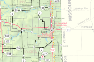
Xenia is located in the northwest corner of Bourbon County, Kansas. It sits at an elevation of 1,047 feet (about 317 meters) above sea level.
The community is found along K-65, a state highway. It's west of where the Little Osage River and Limestone Creek meet. Xenia is about 18 miles northwest of Fort Scott.
 | Delilah Pierce |
 | Gordon Parks |
 | Augusta Savage |
 | Charles Ethan Porter |

