Yarra Scenic Drive facts for kids
Quick facts for kids Yarra Scenic DriveVictoria |
|
|---|---|
| General information | |
| Type | Road |
| Length | 60 km (37 mi) |
| Tourist routes | |
| Major junctions | |
| East end | Warrandyte–Ringwood Road, Warrandyte |
| West end | Battery Road, Williamstown (Point Gellibrand) |
| Location(s) | |
| Major suburbs | Templestowe, Bulleen, Ivanhoe, Kew, Burnley, South Yarra, Southbank, Melbourne, Yarraville, Newport |
The Yarra Scenic Drive is a special road in Victoria, Australia. It takes you on a journey along the beautiful Yarra River. This drive is like a long, winding adventure. It stretches for about 60 kilometers (about 37 miles). The drive starts in a place called Warrandyte. Here, the river begins to flow away from the main roads. It then follows the river all the way to Williamstown. This is where the Yarra River finally meets the big Port Phillip Bay.
How to Find the Yarra Scenic Drive
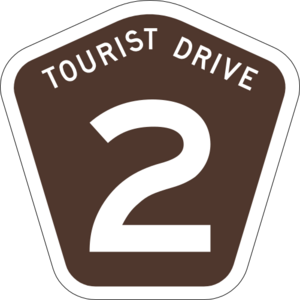
To help drivers find their way, the Yarra Scenic Drive has special signs. These signs are usually brown and shaped like a five-sided shield. They often appear in the middle of a small green and white sign. This sign clearly says Yarra Scenic Drive. These unique signs make it easy to follow the route.
Exploring the Yarra Scenic Drive
The Yarra Scenic Drive takes you through many different parts of Melbourne. It starts in Warrandyte and ends in Williamstown. Along the way, you'll travel on many streets. Some of the main areas it passes through include Templestowe, Bulleen, Ivanhoe, Kew, Burnley, Southbank, Melbourne city, Yarraville, and Newport. Because the road winds a lot, the whole trip takes at least a couple of hours to complete.
Warrandyte to Bulleen: Riverside Parks
In the outer north-eastern suburbs, the drive winds close to the Yarra River. You might not always see the river itself. However, the roads pass by many lovely parks right next to the Yarra. These include Pound Bend, Westerfolds Park, Finns Reserve, Birrarung Park, and Banksia Park. These parks are great places for a peaceful picnic. They offer nice views of the outer-suburban Yarra River. Here, the river is still clean enough for swimming and canoeing.
Heidelberg to Alphington: City Views
This part of the drive doesn't offer many direct views of the Yarra River. The best spot to see the river is along a road called The Boulevarde. This area also has many shops and some businesses.
Yarra Boulevard, Kew: Winding Roads and Golf Courses
The Yarra Boulevard in Kew is a winding road. It sits on the edge of a hill. This location gives amazing views of both the Yarra River and the inner suburbs of Melbourne. As you drive, you'll also see several golf courses right next to the road.
Burnley to Southbank: River Views and Gardens
For most of this section, the road runs right next to the Yarra River. The river gets wider after Dights Falls. You'll have clear views of the bridges and the areas around the river. This part of the drive also gives you access to the Royal Botanic Gardens and Birrarung Marr. However, Alexandra Avenue, which is part of this section, can get very busy with traffic.
Melbourne City: Famous Landmarks
The drive briefly goes through the heart of Melbourne city. As you pass through, you'll drive right by famous places. These include Crown Casino and the Melbourne Aquarium. It's a quick tour of some of the city's highlights.
West Gate Bridge: Panoramic City Views
The famous West Gate Bridge crosses the Yarra River at its widest point. From the bridge, you get an amazing panoramic view. You can see the whole city, the busy docks, the industrial western suburbs, and the vast Port Phillip Bay. Be aware that traffic can be very heavy during busy times of the day.
Yarraville to Williamstown: Beachfront Finish
This part of the drive takes you along the inner-western beachfront. It leads to the end of a small peninsula in Williamstown. The route finishes with beautiful scenery of blue skies, yellow sand, and marinas. This is a big change from the leafy green start in Warrandyte. This section also follows another route called the Bay West Trail, which is signed as Tourist Route 11.
 | James B. Knighten |
 | Azellia White |
 | Willa Brown |


