Yarrowyck, New South Wales facts for kids
Quick facts for kids YarrowyckNew South Wales |
|
|---|---|

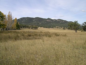
Mount Yarrowyck
|
|
| Population | 136 (2006 census) |
| Postcode(s) | 2358 |
| Elevation | 770 m (2,526 ft) |
| Location | |
| LGA(s) | Uralla Shire |
| State electorate(s) | Northern Tablelands |
| Federal Division(s) | New England |
Yarrowyck is a small community located in the beautiful Northern Tablelands, New South Wales, Australia. It's a quiet place, mostly known for its farms.
Yarrowyck is part of the Uralla Shire area. It is about 23 kilometers (14 miles) northwest of Uralla along Thunderbolts Way. It's also about 31 kilometers (19 miles) west of the city of Armidale. The area is great for farming, especially raising sheep and cattle. This is because it's located in the valley of the Rocky River.
Yarrowyck's Past
Long ago, Yarrowyck was a small village. Today, you will mostly find scattered farms. There is also an old timber church that is now a private home.
There used to be a small cemetery near the Gwydir River. It is thought that about ten people were buried there. However, their gravestones have now disappeared. A church hall was built around 1910. It was used for church services and community meetings. In 2006, about 136 people lived in the Yarrowyck area.
Exploring Mount Yarrowyck Nature Reserve
The Mount Yarrowyck Nature Reserve is a special place near Yarrowyck. It is located close to where Bundarra Road meets Thunderbolts Way. This reserve helps protect an important Aboriginal cave painting site. It also protects much of the natural environment around Mount Yarrowyck.
The reserve has an "Aboriginal cultural walk." This walking track is 3 kilometers (1.9 miles) long and goes to the cave painting site. The path goes along the granite slopes of the mountain. It passes through one of the few remaining natural bushland areas in the western part of the New England Tablelands. The walking track is clear and easy to follow. It is mostly flat and not too difficult to walk.
 | Aurelia Browder |
 | Nannie Helen Burroughs |
 | Michelle Alexander |


