Gwydir River facts for kids
Quick facts for kids Gwydir River |
|
|---|---|
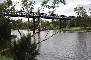
Gwydir River, near Bingara
|
|
| Native name | Guida |
| Other name(s) | Big Bundarra River, Bundara River, Big River, Rocky River |
| Country | Australia |
| State | New South Wales |
| IBRA | Northern Tablelands |
| District | New England, North West Slopes, Orana |
| Municipalities | Uralla, Gwydir, Moree Plains, Walgett |
| Physical characteristics | |
| Main source | Rocky River at Yarrowyck, near Uralla 760 m (2,490 ft) |
| 2nd source | Boorolong Creek |
| River mouth | confluence with the Barwon River north east of Collarenebri 144 m (472 ft) |
| Length | 488 km (303 mi) |
| Basin features | |
| River system | Barwon River, Murray–Darling basin |
| Basin size | 26,588 km2 (10,266 sq mi) |
| Tributaries |
|
| Reservoirs | Lake Copeton, Collymongle Lagoon |
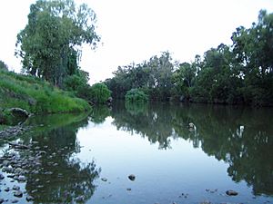
The Gwydir River (pronounced gwah-der) is a major river in New South Wales, Australia. It is an important part of the huge Murray–Darling basin river system. The river flows through different regions like the Northern Tablelands and North West Slopes. It is known for its beautiful landscapes and plays a big role in local farming.
The Gwydir River starts where the Rocky River and Boorolong Creek meet. This is near Yarrowyck, northwest of Uralla. The river then flows generally northwest and west. It is joined by over thirty-four smaller rivers and streams, called tributaries. These include the Horton River and Mehi River. Finally, the Gwydir River joins the Barwon River northeast of Collarenebri.
Along its course, the river drops about 616 meters (2,021 feet) over its 488-kilometer (303-mile) length. The river's flow is controlled by Copeton Dam. This dam stores water for towns, farms, and animals. The Gwydir River below Copeton Dam is also famous for whitewater rafting. The Gwydir Highway was named after this river.
Contents
Understanding the Gwydir River's Path
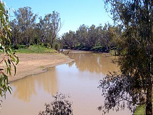
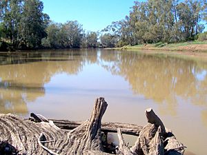
The Gwydir River begins in the southern part of the Northern Tablelands. It starts near the town of Uralla. From there, it flows about 668 kilometers (415 miles) first northwest, then west. As it reaches the flat plains, the river splits into several smaller channels. These channels eventually join the Barwon River. The main branch is the Mehi River, which splits off east of Moree and flows through the town.
The upper Gwydir River also passes through towns like Bundarra, Bingara, Gravesend, and Pallamallawa. Further downstream, above Moree, other channels like the Carole and GilGil Creek also flow into the Barwon River during times of heavy rain or water releases.
River Branches and Wetlands
West of Moree, the Gwydir River divides into two main branches, called anabranches. The southern channel is known as the Lower Gwydir or "Big Leather Watercourse." The northern branch is called the "Gingham Channel."
The Gingham Channel flows west and spreads out into wetlands and floodplains west of Moree. It only connects with the Ballone Creek and then the Barwon River during very large floods. Similarly, the Big Leather Watercourse also spreads into wetlands and only joins the Barwon River during big floods. The Mehi River, however, joins the Barwon River near the town of Collarenebri.
From its source at 760 meters (2,493 feet) above sea level, the Gwydir River drops to 144 meters (472 feet) when it meets the Barwon River. Over its 488-kilometer (303-mile) length, it receives water from thirty-four tributaries. These include the Horton River, Warialda Creek, Laura Creek, and Moredun Creek.
History of the Gwydir River
The original owners of the land around the Gwydir River were the Aboriginal Kamilaroi peoples. They have lived there for thousands of years.
How the River Got Its Name
In 1827, an explorer named Allan Cunningham crossed the river at Gravesend. He named it after his supporter, Peter Burrell, Baron Gwydyr. Baron Gwydyr took his title from Gwydir Castle in Wales. In Australia, the name Gwydir is pronounced to rhyme with "wider." However, the original Welsh name is pronounced more like "Gwidd-eer."
The iron bridges that cross the Gwydir River at Bundarra and Bingara are very old and important. They were built during the colonial period.
Farming and Water Use
A lot of cotton is grown near Moree, using irrigation. Many other crops, livestock, and farms also operate in the area. The cotton industry needs a lot of water for irrigation. Recent droughts have severely reduced the amount of water available to farms. In 2006, it was found that the cotton industry used 87% of the agricultural water taken from the Gwydir River.
Water Management Challenges
Heavy irrigation in the upper Gwydir River has greatly reduced the natural flow of water downstream. This has affected landowners who traditionally used the wetlands and floodplains for grazing their animals. It also impacted areas where river water was used for animal drinking water and for watering small areas of crops. The reduced flow also stopped regular floods that used to fill creeks, watercourses, and wetlands in areas like Gingham and Mallowa.
These water conflicts led to the creation of committees to manage the river's water. The Gwydir Regulated River Management Committee was set up in 1997. Later, the Gwydir Water Sharing Plan began in 2004 to help share the water fairly.
River Environment and Wildlife
Gwydir Wetlands: A Special Place
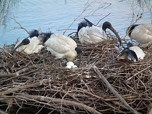
About 800 hectares (2,000 acres) of the privately owned Gwydir Wetlands are recognized as a Ramsar site. This means they are a wetland of international importance. This special status was given on June 14, 1999.
The Gwydir Wetlands are also an Important Bird Area because they are vital for many waterbirds. When there is enough water, more waterbirds breed here than anywhere else in Australia. Sometimes, over half a million nesting waterbirds can be found there. This includes more than 1% of the world's population of nankeen night herons, intermediate egrets, and white and straw-necked ibises. Rare and endangered birds like the Australasian bittern and Black-necked stork have also been seen here.
Unique River Animals
The Namoi River snapping turtle or Bell's turtle (Elseya belli) is a special type of turtle. It is found only in the upper parts of the Namoi, Gwydir, and Macdonald Rivers in New South Wales.
See also
 In Spanish: Río Gwydir para niños
 | Kyle Baker |
 | Joseph Yoakum |
 | Laura Wheeler Waring |
 | Henry Ossawa Tanner |


