New England (New South Wales) facts for kids
Quick facts for kids New EnglandNew South Wales |
|||||||||||||||
|---|---|---|---|---|---|---|---|---|---|---|---|---|---|---|---|
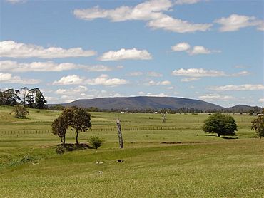
View of Mount Duval with farms in the foreground
|
|||||||||||||||
| Population | 185,160 (2021) | ||||||||||||||
| • Density | 4.00736/km2 (10.3790/sq mi) | ||||||||||||||
| Area | 46,205 km2 (17,839.9 sq mi) | ||||||||||||||
| Time zone | AEST (UTC+10) | ||||||||||||||
| • Summer (DST) | AEDT (UTC+11) | ||||||||||||||
| LGA(s) |
|
||||||||||||||
| State electorate(s) |
|
||||||||||||||
| Federal Division(s) | New England | ||||||||||||||
|
|||||||||||||||
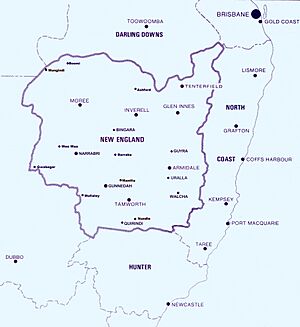
New England is a special area in the north of New South Wales, Australia. It's about 60 kilometres (37 miles) inland from the Tasman Sea. This region includes the Northern Tablelands (also called New England Tablelands) and the North West Slopes. In 2021, about 185,560 people lived here. More than a quarter of them live in the Tamworth Regional Council area.
Contents
History of New England
Early People and Explorers
For thousands of years, Indigenous Australians lived in the New England region. The Kamilaroi people lived in the west. In the highlands, people spoke languages like Anaiwan and Ngarbal, which are now no longer spoken. When Europeans first arrived, there were fewer Indigenous people in the tablelands compared to other areas. Sadly, many Indigenous people were affected by conflict and diseases.
The first European to explore this area was John Oxley in 1818. He crossed the southern part of the New England Range. Later, in 1827, Allan Cunningham traveled north along the western edge of the range. In 1831, Thomas Mitchell explored near Tamworth and followed the Namoi River.
First European Settlers
The first European settler in New England was Hamilton Collins Sempill in 1832. He started a sheep farm near Walcha. More settlers, called squatters, moved their sheep here in the 1830s. They were looking for new land. This led to the government dividing the area into nine pastoral districts. Each district had a small police force.
Around the same time, people started cutting down valuable Australian red cedar trees near the Macleay River. In 1838, convicts began building a road, called Major's Line, to connect Walcha with Port Macquarie. This road is now known as the Oxley Highway.
On May 22, 1839, the New England District was officially named. Its boundaries were described, but the northern part was still unknown. By 1848, there were 132 licensed farms in the area. In 1843, the Darling Downs area was separated from New England.
Later History and Population
In the 1860s, a famous bushranger named Captain Thunderbolt robbed farms, mail coaches, and hotels in the region. He was shot and killed in May 1870 near Uralla.
The population of the New England Region grew over time. In 1957, there were about 143,788 people. By 2006, it had grown to 180,000 people.
Mining in New England
Gold was found in 1851 at Rocky River, near Uralla. This started a "gold rush" to the area. More gold was found at Hanging Rock in 1852. Later, people also found and mined antimony at places like Hillgrove. They even built hydro-electric power plants to run the mines!
Tin was discovered in 1881 near Torrington. Copper mining started in 1892 near Barraba. At its busiest in 1901, this copper mine was one of the biggest in New South Wales. Asbestos was also mined near Barraba from 1919 to the 1980s. Mining helped many towns like Bingara, Emmaville, and Nundle grow.
Railway Services
Building railway lines in the Northern Tablelands began in the 1870s. The Main North railway line reached Tamworth in 1878 and Armidale in 1883. It reached the Queensland border in 1888. Today, this line is closed north of Armidale.
Other lines were built to connect towns like Gunnedah, Narrabri, and Moree. These railways helped transport goods and people across the region.
Major Natural Disasters
The New England region has experienced some big weather events:
- June 1950: The Barwon River flooded, and many sheep were lost near Moree.
- February 1955: Almost every home in Narrabri was flooded.
- January 1962: Walcha had its worst flood, with many businesses and homes underwater.
- February 1971: Five people died, and there was $25 million damage to farms in the flooded Namoi area.
- September 1996: A severe storm with strong winds and hail hit Armidale, causing a lot of damage.
- November 2000: The worst floods in 50 years hit Gunnedah, Narrabri, and Wee Waa.
What is New England?
New England doesn't have clear, fixed borders. Its size can change depending on who is talking about it. For example, local councils and government areas might define it differently.
The main towns in New England are Tenterfield, Inverell, Glen Innes, Moree, Armidale, Narrabri, Tamworth, Gunnedah, Quirindi, and Wee Waa. Tamworth and Armidale are the biggest commercial centers.
The Northern Tablelands
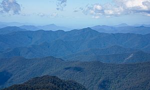
The most common way to think of New England is as the Northern Tablelands. This is a highland area that is part of the Great Dividing Range. It stretches about 320 kilometres (200 miles) long and 130 kilometres (81 miles) wide. This area is often over 900 metres (2,953 feet) above sea level. It has a cooler climate and unique plants.
The highest point in this area is Round Mountain, which is 1,585 metres (5,200 feet) high. Other tall peaks include Point Lookout and Mount Duval. Towns in this highland region include Tenterfield, Glen Innes, Guyra, Inverell, Armidale, and Walcha.
New England North West
A wider definition of New England, covering about 98,574 square kilometres (38,059 square miles), includes the North West Slopes region and the Liverpool Plains. This larger area is often called New England North West. It includes the western valleys of the Gwydir River and Namoi River. Towns like Moree, Narrabri, Gunnedah, Tamworth, and Quirindi are part of this bigger region.
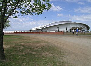
The two main cities in New England are Tamworth and Armidale. Armidale is home to the University of New England, one of Australia's oldest universities. Tamworth is known as the center of Australian country music. It also has the Australian Equine and Livestock Events Centre (AELEC).
Geography and Nature
The New England region is mostly a high plateau called the Northern Tablelands. Rivers on the eastern side flow quickly towards the coast, often forming deep gorges and waterfalls. Famous waterfalls include the Apsley Falls and Wollomombi Falls. Many National Parks are found along these rugged eastern edges, like New England National Park and Cathedral Rock National Park.
The western side of the plateau is less rugged. Rivers here, like the Severn River, Gwydir River, and Namoi River, flow west into the Murray-Darling Basin. There are large dams on these rivers, such as Copeton Dam and Keepit Dam. The Nandewar Range is a major mountain range on the western side, with Mount Kaputar near Narrabri.
The climate in New England is generally mild. It doesn't get too hot or too cold. Winters on the Northern Tablelands often have frosts, and sometimes snow. Most rain falls between late summer and early autumn.
Plants of New England
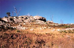
Many types of trees grow in the Northern Tablelands, including wattles (Acacias), native apples (Angophora floribunda), and different kinds of Eucalyptus trees like New England blackbutt and peppermint. River oaks grow along creeks and rivers.
Some rare plants are found only in specific spots, like the Bolivia Hill boronia and Bolivia wattle near Bolivia Hill. The Hillgrove spotted gum is also rare and found near Hillgrove.
On the Western Slopes, you'll find different trees like ironbarks, river red gums, and white cypress pine.
Unfortunately, some invasive weeds have also spread in the New England region. These include blackberry, lantana, and Patterson's curse. They can harm native plants and animals.
Animals of New England
You can see many common animals in New England, such as kangaroos, echidnas, wallabies, possums, and wombats. Birds like cockatoos, currawongs, magpies, and kookaburras are also common. On the western slopes, you might even see emus. Snakes, lizards, and goannas are also present.
Some endangered species live here too. The brush-tailed rock-wallaby can be found in parts of Oxley Wild Rivers National Park. Bundarra is one of only three places in New South Wales where the endangered regent honeyeater breeds. The rare Hastings River mouse lives in Werrikimbe National Park. The Namoi River snapping turtle is a special turtle found only in the upper parts of the Namoi, Gwydir, and Macdonald Rivers.
Sadly, pest animals like foxes, rabbits, feral goats, and feral pigs are also found in the region.
Economy of New England
The New England region has many different natural resources. It has large coal deposits near Werris Creek and Boggabri. Other valuable minerals like antimony, gold, sapphires, and tin have also been mined here.
Many businesses operate in the region, from small local shops to large international companies. For example, BAE Systems in Tamworth provides aviation training.
Farming is a very important part of the economy. Cattle and sheep have been raised here since Europeans first settled. The Northern Tablelands are known for producing fine wool and beef cattle. The western slopes are major areas for growing cotton and wheat. Other farm products include dairy, grains, lamb, pork, fruit, and poultry. There's also timber production, wine making, and fish farming.
Transport and Communication
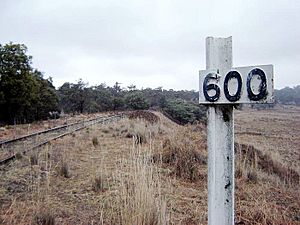
New England has five main highways and many smaller roads. The New England Highway connects towns like Tamworth, Armidale, and Glen Innes. It's a key route between New South Wales and Queensland. The Newell Highway is another important road that links Victoria and Queensland, passing through Narrabri and Moree.
Other important roads include Thunderbolts Way, the Oxley Highway, Gwydir Highway, and the beautiful Waterfall Way. The Kamilaroi Highway runs northwest from Willow Tree through Gunnedah and Narrabri. Fossickers Way is a special tourist route that goes through areas rich in gems.
Major towns have air, bus, and train services. The Main North railway line used to go all the way to the Queensland border, but now it's only used for passengers up to Armidale and Moree.
Education in New England
The New England region has many schools, including 125 public schools.
Armidale is home to the University of New England, which is Australia's oldest university outside of a capital city. Armidale also has several private and public high schools, such as New England Girls' School (NEGS) and The Armidale School (TAS). Near Tamworth, Farrer Memorial Agricultural High School is a special public high school for boys. Tamworth also has other main high schools like Calrossy Anglican School.
The New England Institute of TAFE has campuses in many towns, including Tamworth, Armidale, Glen Innes, and Moree. TAFE colleges offer vocational training for jobs.
National Parks
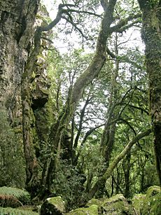
There are 27 main National Parks and over 30 nature reserves in the New England area. These parks protect amazing places like World Heritage listed rainforests, deep gorges, and wild rivers. Some of the most famous national parks include:
- Cathedral Rock National Park (home to the region's highest peak, Round Mountain)
- Guy Fawkes River National Park
- New England National Park
- Oxley Wild Rivers National Park
- Washpool National Park
- Werrikimbe National Park
New State Movement
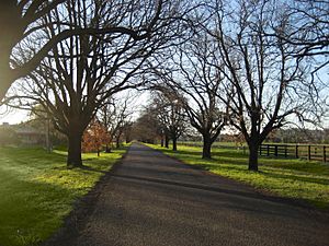
New England has been the place where people have tried the hardest to create a new state in Australia. In the 1930s and again in the 1960s, the New England New State Movement wanted New England to become its own state, separate from New South Wales.
On April 29, 1967, people in the region voted in a referendum about forming a new state. Most people voted "no" (54%). One reason for this was that the city of Newcastle, which is not really part of New England, was included in the proposed new state.
The Constitution of Australia allows new states to be formed, but only if the parliament of the existing state agrees.
 | Shirley Ann Jackson |
 | Garett Morgan |
 | J. Ernest Wilkins Jr. |
 | Elijah McCoy |


