Tenterfield, New South Wales facts for kids
Quick facts for kids TenterfieldNew South Wales |
|||||||||
|---|---|---|---|---|---|---|---|---|---|
|
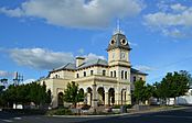
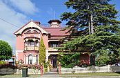
From left to right; Tenterfield Post Office, Historic Stannum House
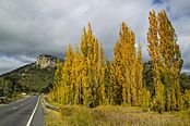
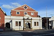
Bluff Rock near Tenterfield, the historic School of Arts |
|||||||||
| Population | 4,066 (2016 census) | ||||||||
| Established | 1851 | ||||||||
| Postcode(s) | 2372 | ||||||||
| Elevation | 850 m (2,789 ft) | ||||||||
| Location |
|
||||||||
| LGA(s) | Tenterfield Shire | ||||||||
| County | Clive | ||||||||
| State electorate(s) | Lismore | ||||||||
| Federal Division(s) | New England | ||||||||
|
|||||||||
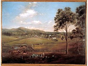
Tenterfield is a town in New South Wales, Australia. It sits where the New England and Bruxner highways meet. This area is part of the Northern Tablelands in the New England region. In 2016, about 4,066 people lived there. Tenterfield's location between Sydney and Brisbane helped it become important in the push for Australia to become one country.
Contents
- Exploring Tenterfield's Location
- A Look Back at Tenterfield's Past
- Historic Places in Tenterfield
- The Railway Line: Connecting Cities
- The Famous Tenterfield Oration
- Tenterfield's Population Over Time
- What Tenterfield Produces
- Media and News in Tenterfield
- Tenterfield's Natural Beauty
- Tenterfield's Weather
- The Mount Mackenzie Road Fire
- Famous People from Tenterfield
- Amazing Sporting Achievements
- Images for kids
Exploring Tenterfield's Location
Tenterfield is at the northern end of the New England area. It's where the New England Highway and Bruxner Highway cross paths. The town is the main centre for the Tenterfield Shire.
The closest big town is Stanthorpe, Queensland, which is about 56 kilometers north. Tenterfield is about three hours from Brisbane, Queensland (276 km). It's also about three hours from Byron Bay, New South Wales (205 km) and eight hours from Sydney (663 km). The town is on a high plateau, which is part of the Great Dividing Range. It sits in a valley below Mount Mackenzie, a tall peak at 1,287 meters.
A Look Back at Tenterfield's Past
The first people to live in the Tenterfield area were the Jukembal people. They traveled across this land, from near Glen Innes to Stanthorpe, Queensland.
In 1841, a man named Sir Stuart Donaldson started a sheep farm here. He called it Tenterfield Station, named after his family home in Scotland. Donaldson later became the first premier of New South Wales. His farm was huge, covering about 40,000 hectares of open land.
The Tenterfield Post Office opened on January 1, 1849. The town itself was officially created in 1851, and land was sold in 1854.
In 1858, gold was found nearby at Drake. More gold was found soon after at Timbarra and Boonoo Boonoo. This brought more people to the area. By 1870, Tenterfield had less than 900 people. But it had five hotels, a school of arts, and three churches. The current Tenterfield Post Office building was built in 1881.
In 1919, during the time of the Spanish flu, Queensland closed its borders. People traveling by train to Queensland had to get off at Tenterfield railway station. This was the last stop before the border. The showgrounds in Tenterfield became a temporary camp for up to 700 people. They stayed there for a week before they could enter Queensland.
During World War II, Tenterfield was seen as an important place if Japan were to invade Australia. In 1942, thousands of soldiers set up secret camps here. You can still see old tank traps and gun positions near the New England Highway. This highway was the only all-weather road from Sydney to Brisbane until the early 1950s.
Historic Places in Tenterfield
Tenterfield has many places that are important to its history. These are called heritage-listed sites. Some of them include:
- The Tenterfield railway station on Railway Avenue.
- The Tenterfield School of Arts on Manners Street.
- The Tenterfield Post Office on Rouse Street.
Other important historic buildings and sites are:
- Stannum House: Built around 1888, this house has fancy carpets and old furniture.
- Ayrdrie: A country house built around 1860.
- Court House, Gaol and Police Buildings: Built between 1874 and 1882.
- Church of Our Lady of Perpetual Succour (Tenterfield Catholic Church): This is the oldest church building still used in the Catholic Diocese of Armidale.
- Tenterfield Saddlery: Built around 1870, it was once a home and a bank before becoming a saddlery.
- Bald Rock National Park: About 25 km north of Tenterfield, home to a huge granite rock.
- Boonoo Boonoo National Park: About 23 km north-east of Tenterfield, known for its waterfalls.
- Aldershot Cottage, Deloraine Cottage, and a house at 124 High Street: All built around the 1860s.
- Flanagan's Men's Shop: This is the oldest men's wear shop in Australia.
The Railway Line: Connecting Cities
The railway line reached Tenterfield on October 28, 1884. By 1886, it went all the way to Wallangarra and Jennings on the Queensland border. This connected Sydney and Brisbane by train for the first time!
At Wallangarra, trains had to change because the tracks were different sizes. This was called a "break-of-gauge." Later, a new railway line, the North Coast line, was built. It had the same size tracks all the way from Sydney to Brisbane and opened in 1932. This new line made the Tenterfield railway less important. Now, the railway line north of Armidale is closed. The Tenterfield railway station is now a museum.
The Famous Tenterfield Oration
Sir Henry Parkes gave a very important speech in Tenterfield. It's known as the "Tenterfield Oration." He gave it at the Tenterfield School of Arts on October 24, 1889. He was traveling from Brisbane to Sydney by train.
This speech helped to restart the discussion about Australia becoming one country. This idea, called Federation, finally happened on January 1, 1901. Sadly, Henry Parkes passed away five years before Federation happened.
Tenterfield's Population Over Time
| Historical population | ||
|---|---|---|
| Year | Pop. | ±% |
| 1921 | 2,493 | — |
| 1933 | 2,622 | +5.2% |
| 1947 | 3,046 | +16.2% |
| 1954 | 3,268 | +7.3% |
| 1961 | 3,105 | −5.0% |
| 1966 | 3,270 | +5.3% |
| 1971 | 3,239 | −0.9% |
| 1976 | 3,563 | +10.0% |
| 1981 | 3,402 | −4.5% |
| 1986 | 3,370 | −0.9% |
| 1991 | 3,310 | −1.8% |
| 1996 | 3,205 | −3.2% |
| 2001 | 3,172 | −1.0% |
| 2006 | 3,130 | −1.3% |
| 2011 | 2,997 | −4.2% |
| 2016 | 2,914 | −2.8% |
| 2021 | 2,826 | −3.0% |
| Source: Australian Bureau of Statistics data. | ||
The 2016 census showed that 4,066 people lived in Tenterfield.
- About 5.0% of the people were Aboriginal and Torres Strait Islander.
- Most people (80.6%) were born in Australia.
- Most people (86.7%) spoke only English at home.
- The most common religions were Anglican (24.7%), Catholic (24.3%), and No Religion (19.1%).
What Tenterfield Produces
The main jobs in the Tenterfield area are raising beef cattle and producing very fine wool. This wool comes from Merino sheep. There are also ten state forests in the Tenterfield area, covering about 7,540 hectares.
Media and News in Tenterfield
Tenterfield has a few radio stations:
- Rebel FM 93.7 and The Breeze 102.5 are commercial stations.
- Ten FM is a local community radio station. It also broadcasts to Stanthorpe.
- ABC New England North West and ABC Radio National also broadcast here.
The local newspaper is The Tenterfield Star. It comes out every Wednesday and has been published for over 170 years.
For TV, Tenterfield gets regional news from channels like Seven and Nine.
Tenterfield's Natural Beauty
The area around Tenterfield is known for its large granite rocks and mountains. The most famous are Bald Rock, in Bald Rock National Park, and Bluff Rock. Bluff Rock is about a 12-minute drive south of Tenterfield.
Other important natural spots near Tenterfield include:
- Mount Mackenzie: This mountain is 1,258 meters tall and is the highest point in the Tenterfield Shire. It has TV and phone towers and a 141-hectare nature reserve.
- Doctor's Nose: This peak is 1,165 meters tall and has a 66-hectare nature reserve. It's named because it looks like a local doctor's nose!
Tenterfield's Weather
Tenterfield has an oceanic climate, which means it has cool winters and warm, wet summers. Temperatures can change a lot between day and night because it's in a valley. The town is 850 meters above sea level, so freezing temperatures are common in winter. Tenterfield usually has about 47 days a year where the temperature drops below 0°C.
Sometimes, Tenterfield gets light to moderate snowfalls, but this only happens about once every 20–30 years. It does get occasional sleet. Mount Mackenzie, which is 1,287 meters tall, usually gets light snow every year. The last time it snowed in Tenterfield was in 2015. Snow fell on Mount Mackenzie and other high points in June 2019.
Summers are usually warm and steady. Most summer days reach 23°C or higher, and nights usually don't drop below 9°C. Most of the rain comes from thunderstorms, which can be strong. The hottest temperature ever recorded in Tenterfield was 39.9°C on February 12, 2017. The coldest was -10.6°C on July 10, 2006.
| Climate data for Tenterfield (Federation Park, 1907–2024, rainfall to 1870); 838 m AMSL; 29.05° S, 152.02° E | |||||||||||||
|---|---|---|---|---|---|---|---|---|---|---|---|---|---|
| Month | Jan | Feb | Mar | Apr | May | Jun | Jul | Aug | Sep | Oct | Nov | Dec | Year |
| Record high °C (°F) | 38.3 (100.9) |
39.9 (103.8) |
35.6 (96.1) |
32.9 (91.2) |
27.1 (80.8) |
24.6 (76.3) |
23.3 (73.9) |
30.0 (86.0) |
31.2 (88.2) |
33.9 (93.0) |
36.2 (97.2) |
36.8 (98.2) |
39.9 (103.8) |
| Mean daily maximum °C (°F) | 27.1 (80.8) |
26.1 (79.0) |
24.6 (76.3) |
21.7 (71.1) |
18.0 (64.4) |
15.0 (59.0) |
14.5 (58.1) |
16.1 (61.0) |
19.5 (67.1) |
22.4 (72.3) |
24.8 (76.6) |
26.6 (79.9) |
21.4 (70.5) |
| Mean daily minimum °C (°F) | 14.4 (57.9) |
14.3 (57.7) |
12.4 (54.3) |
8.5 (47.3) |
4.9 (40.8) |
2.4 (36.3) |
1.0 (33.8) |
1.8 (35.2) |
4.7 (40.5) |
8.0 (46.4) |
10.8 (51.4) |
13.0 (55.4) |
8.0 (46.4) |
| Record low °C (°F) | 4.5 (40.1) |
4.0 (39.2) |
−3.0 (26.6) |
−5.0 (23.0) |
−8.8 (16.2) |
−9.3 (15.3) |
−10.6 (12.9) |
−9.5 (14.9) |
−7.2 (19.0) |
−3.4 (25.9) |
−2.0 (28.4) |
1.2 (34.2) |
−10.6 (12.9) |
| Average rainfall mm (inches) | 113.7 (4.48) |
93.1 (3.67) |
82.6 (3.25) |
47.5 (1.87) |
48.3 (1.90) |
49.5 (1.95) |
52.6 (2.07) |
43.3 (1.70) |
49.8 (1.96) |
75.8 (2.98) |
84.5 (3.33) |
105.3 (4.15) |
845.1 (33.27) |
| Average rainy days (≥ 1.0 mm) | 8.8 | 8.1 | 7.9 | 5.6 | 5.7 | 5.9 | 5.7 | 5.2 | 5.3 | 7.0 | 7.5 | 8.7 | 81.4 |
| Average afternoon relative humidity (%) | 56 | 58 | 58 | 58 | 61 | 60 | 56 | 50 | 46 | 47 | 53 | 53 | 55 |
| Source: Bureau of Meteorology, | |||||||||||||
The Mount Mackenzie Road Fire
On September 6, 2019, a grass fire started near Mount Mackenzie Road. Strong, dry winds and unusual heat made the fire spread quickly. It became an emergency threat within an hour. The fire moved across the southern edge of the town and even jumped over the New England Highway.
All schools in Tenterfield were evacuated, and power to the town was cut. Firefighters worked hard to save homes. They saved 65 homes in the area. One home was destroyed, and four others were badly damaged. Two car yards, a pistol club, and 12 other buildings were also destroyed. A volunteer firefighter was seriously injured while trying to protect a property.
The fire continued to burn with an emergency warning overnight. The next day, it was downgraded as cooler weather helped firefighters. Large teams of firefighters and many aircraft helped to control the blaze.
Famous People from Tenterfield
Many interesting people have connections to Tenterfield:
- Peter Allen: A famous entertainer who spent much of his childhood here. His song "Tenterfield Saddler" is about his grandfather, George Woolnough, who owned the saddlery.
- Bronwyn Bancroft: An Indigenous Australian artist.
- William Blakely: A botanist and plant collector born in Tenterfield in 1875.
- Sir Harry Chauvel: The first Australian to lead a military Corps, born nearby.
- Robert Guy Howarth: A scholar, writer, and poet born in Tenterfield in 1906.
- Sir Clarence McKerihan: A banker and president of the Rural Bank of New South Wales.
- Billy Moore: A well-known rugby league player.
- A.B. "Banjo" Paterson: A famous Australian poet.
- Jenny Saville: A professional golfer.
- Gary Shearston: A singer and songwriter.
- Dr. Leonard Smith: An Aboriginal Artist, writer, rugby league player, and Australian Army Veteran.
- Charlie Tapscott: A two-time Paralympian silver medalist.
- Major J.F. Thomas: A lawyer known for defending Harry "Breaker" Morant. He also owned The Tenterfield Star newspaper.
- Edward Reeves Whereat: An important community leader in the past.
- George Woolnough: Peter Allen's grandfather and the saddler who inspired his famous song.
- Oliver Woodward: A decorated World War I veteran and metallurgist.
Amazing Sporting Achievements
Tenterfield has a history of breaking records in sports:
- The first ever campdraft (a horse riding sport) was held in Tenterfield around 1885.
- In 1926, the Australian showjumping record was broken here. A horse named "Lookout" jumped 7 feet 10¼ inches!
- In 1936, the world showjumping record was broken in Tenterfield. The same horse, "Lookout," jumped an amazing 8 feet 3½ inches!
- In 2004, local Police Sergeant Troy Grant set a Guinness World Record at the Tenterfield Golf Club. He played the most holes of golf in 7 days.
Images for kids
 | Jessica Watkins |
 | Robert Henry Lawrence Jr. |
 | Mae Jemison |
 | Sian Proctor |
 | Guion Bluford |


