
Darling Downs facts for kids
Quick facts for kids Darling DownsQueensland |
|||||||||||||||
|---|---|---|---|---|---|---|---|---|---|---|---|---|---|---|---|
 |
|||||||||||||||
| Population | 241,537 (2010) | ||||||||||||||
| • Density | 3.121089/km2 (8.08358/sq mi) | ||||||||||||||
| Established | 1840 | ||||||||||||||
| Area | 77,388.7 km2 (29,879.9 sq mi) | ||||||||||||||
| LGA(s) | Goondiwindi, Southern Downs, Toowoomba, Western Downs | ||||||||||||||
| State electorate(s) | Condamine, Nanango, Southern Downs, Toowoomba North, Toowoomba South, Warrego | ||||||||||||||
| Federal Division(s) | Groom, Maranoa | ||||||||||||||
|
|||||||||||||||
The Darling Downs is a large farming area in southern Queensland, Australia. It sits on the western side of the Great Dividing Range. This region is west of South East Queensland and is one of Queensland's main areas.
The name "Darling Downs" was given in 1827 by Allan Cunningham. He was the first European explorer to reach this land. The name honors Ralph Darling, who was the Governor of New South Wales at that time.
This region has a strong and varied farming industry. This is mostly thanks to its special soils called vertosols. These are cracking clay soils, especially black ones, that are very good for growing crops. They hold a lot of water and are quite fertile. Other important industries include making things (manufacturing) and mining, especially for coal.
The landscape here has rolling hills covered in different types of grass. You can also see fields of vegetables, legumes like soy beans, and other crops. These include cotton, wheat, barley, and sorghum.
Between the farms, there are many roads, bushy ridges, and winding creeks. You'll also see herds of beef and dairy cattle, pigs, and sheep. Other common sights are irrigation systems and windmills. These windmills pump water from the Great Artesian Basin. You might also spot small planes crop-dusting fields.
The Darling Downs is considered a special part of Queensland's history and culture. It is listed as one of Queensland's Q150 icons.
Contents
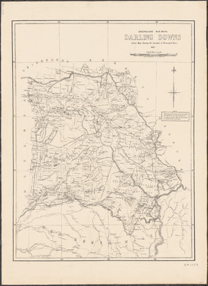
Where is the Darling Downs?

The biggest city and main business hub in the Darling Downs is Toowoomba. It is about 132 kilometers (82 miles) west of Brisbane. Other towns in the area include Dalby, Warwick, Stanthorpe, and Goondiwindi.
Major roads like the New England Highway and Warrego Highway cross through the region. A new road, the Toowoomba Second Range Crossing, helps heavy trucks avoid driving through Toowoomba city.
Many important water storage places are found here. These include Coolmunda Dam, Leslie Dam, and Glenlyon Dam. The Toowoomba Wellcamp Airport is located west of Toowoomba.


The Darling Downs is located in the river basins of the Condamine River and Maranoa River. The Condamine River's flood plain has very good soils. These soils were formed by basaltic alluvium, which is rich volcanic soil. To the north of the Downs are the Bunya Mountains and the Bunya Mountains National Park.
What is the Climate Like?
Most of the Darling Downs has a humid subtropical climate. This means it has warm, humid summers and mild winters. Some parts have a semi-arid (dry) or subtropical highland climate (cooler due to higher elevation).
In summer, temperatures usually range from 28 to 34 degrees Celsius (82 to 93 degrees Fahrenheit). In winter, they are typically between 13 and 19 degrees Celsius (55 to 66 degrees Fahrenheit). The amount of rain each year varies. It can be 600 mm (24 inches) in the west and up to 1000 mm (39 inches) in the east.
In the southeast, winter temperatures can drop below -5 degrees Celsius (23 degrees Fahrenheit). There can be heavy frost and sometimes even snow. In the northwest, summer temperatures can go above 45 degrees Celsius (113 degrees Fahrenheit). Strong thunderstorms and damaging floods can happen. Bushfires are also a risk in dry years.
The Southern Downs Area
A part of the Darling Downs is called the Southern Downs. This area includes towns like Allora, Clifton, and Warwick. It also has a rocky area in the south known as the Granite Belt. The Dumaresq River and MacIntyre River are in this part of the region. This name is also used for political areas and to promote tourism.
History of the Darling Downs


The Baranggum people are the traditional owners of some of this land. Their Australian Aboriginal language is also called Baranggum. This language area includes places like Dalby, Tara, and Chinchilla.
Long ago, the Darling Downs was covered with many native grasses. These grasses were perfect for feeding animals for most of the year. The Aboriginal people of the Darling Downs would burn these dry grasses each year. This practice earned them the name "Goonneeburra," meaning "Fire Blacks," from coastal Aboriginal groups. The local tribes spoke a common language called Waccah. So, other tribes knew them as the Wacca-burra.

Allan Cunningham explored the area west of Moreton Bay in 1827. He crossed the Great Dividing Range and traveled north. In June 1827, he climbed Mount Dumaresque. He wrote in his diary that this rich area was perfect for settlement. Cunningham found a pass, now called Cunninghams Gap. He returned in 1828 to map the route through the pass to the Darling Downs.
News of the rich pastures spread quickly. This led to many people trying to claim land. Patrick Leslie was the first European to settle here in 1840. He started a sheep farm at Canning Downs on the Condamine River. Other early homes include Glengallan Homestead and Jimbour House. Ludwig Leichhardt started his expedition to the Northern Territory from Jimbour House in 1844.
By 1844, there were 26 properties, including many sheep stations. They had over 150,000 sheep. Local Aboriginal people and European settlers lived together in the area from the late 1840s. The Darling Downs became known for its wealthy settlers who lived in comfortable homes.
The Spicers Gap Road opened up the area in the 1850s. Later, the growth of Queensland Rail's train lines and Cobb and Co's stagecoach services made it much easier to reach the region. Gold was found around this time, but farming was what truly made the area boom.
The 1891 Australian shearers' strike began at Jondaryan. The Darling Downs faced a water crisis when the Condamine River dried up during a severe drought in 1994-1995.
In the early 1900s, dairy farming was a very important industry. By the 1930s, it was at its peak. There were 6,500 dairy farms and over 200,000 milking cows. The Downs Co-operative Dairy Association built or bought at least 10 butter and cheese factories. The last factory in Toowoomba closed in 2006.
In 2010, the population of the Darling Downs was about 241,537 people.
Industries and What They Produce
The Queensland Gas Pipeline and the Roma to Brisbane Pipeline (Australia's first natural gas pipeline) both cross the region. There are three coal mines here: New Acland Mine, Kogan Creek Mine, and Cameby Downs coal mine. Several power stations are also located on the Downs, such as the Millmerran Power Station and Kogan Creek Power Station.
The Dingo Fence starts at the town of Jimbour. It stretches across the country to the Great Australian Bight. Mining companies have exploration permits for over 90% of the Darling Downs. The western part of the Downs has many coal seam gas wells.
After farming and mining, manufacturing is the next most important industry. Manufacturing mainly focuses on food and drinks. It also includes making machinery, equipment, and metal products.
Farming in the Darling Downs
The Darling Downs produces about a quarter of all the farm goods in Queensland. Water for irrigation mostly comes from groundwater found in underground layers called aquifers. Water is also taken from streams and dams.
The cooler summers in the Stanthorpe and Killarney areas allow farmers to grow crops like lettuce, celery, and potatoes. The Darling Downs has Australia's largest area of rich black farming soils. A common grass called Bambatsi is great for grazing animals. This is because it grows well in the heavy clay soils found here.
Brothers Friedrich Wilhelm Ernst Ziesemer and Theodor Martin Peter Ziesemer were important in starting large-scale wheat farming on the Darling Downs.
Meat Production

This area has the most cattle feedlots in Australia. Feedlots are places where cattle are kept and fed before they are processed for meat. In 2014, the Oakey Abattoir, one of Australia's largest meat processing plants, started a project to create green energy from its waste water. This was the first time a special covered pond was used to treat waste water in this way.
Wine Making
In the Southern Downs region, near Stanthorpe, there is an area called the Granite Belt. Here, you can find over sixty wineries and vineyards. The wine industry started with growing table grapes. By the mid-1960s, farmers began planting grapes for wine.
This region has a special subtropical highland climate. This is different from the rest of Queensland because it is much higher up. Altitudes from 680 meters (2,230 feet) to over 1200 meters (3,900 feet) above sea level make it perfect for producing high-quality wine.
Fun Things to See and Do

The Darling Downs is a popular place for tourists. It has many natural and historical attractions. These include the Goomburra State Forest, Cunninghams Gap, and the Queen Mary Falls. Queen Mary Falls are near Killarney in the Main Range National Park. Lake Broadwater is the only natural lake on the tablelands.
The town of Jandowae became famous for offering empty blocks of land for just $1. This was done to encourage more people to move to the small town.
The Cobb & Co Museum shows horse-drawn vehicles and tells the history of the Darling Downs. The Jondaryan Woolshed is a historic shearing shed. A tourist operator has gathered many related buildings at this site. The region also has a small zoo, the Darling Downs Zoo, near Clifton.
Important megafauna (large ancient animals) fossils have been found in the region. These discoveries support the idea that humans were not the main reason these ancient species died out. Many fossils here are from the Pleistocene era. They include species like Diprotodon optatum, which was the largest ever marsupial. In 2021, a partial skull found here showed a new species of large crocodile. It was the biggest extinct crocodile species ever found in Australia.
The Darling Downs Golf Association has 21 golf clubs in the area.

Environment and Nature
Before Europeans settled, many parts of the Darling Downs were rich wilderness. For example, around Ma Ma Creek, there were wet swamps. These swamps were home to many animal species that are not found on the Downs today. Sadly, the Darling Downs hopping mouse and the paradise parrot have both become extinct since cattle farming began.
The planned expansion of the New Acland Mine, north of Oakey, has been delayed. This is due to some of the largest environmental court cases in Australian history.
Awards and Recognition
In 2009, as part of the Q150 celebrations, the Darling Downs was named one of the Q150 Icons of Queensland. This was for its important role as a "location" in the state's history.
In Stories and Books
Steele Rudd (whose real name was Arthur Davis) wrote a series of funny books about country life. The first one was On Our Selection (1899). It was about Dad, Mother, and Dave Rudd from Snake Gully. Their small farm was next to a sheep station in the Darling Downs. These stories were later made into films and a radio series.
See also
 In Spanish: Darling Downs para niños
