South West Queensland facts for kids
Quick facts for kids South West QueenslandQueensland |
|
|---|---|
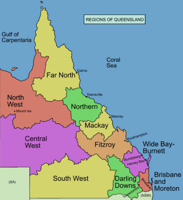
Regions of Queensland
|
|
| Population | 26,489 (2011) |
| • Density | 0.0828278/km2 (0.214523/sq mi) |
| Area | 319,808 km2 (123,478.6 sq mi) |
| LGA(s) | Maranoa Region, Shire of Balonne, Shire of Paroo, Shire of Murweh, Shire of Bulloo, Shire of Quilpie |
| State electorate(s) | Warrego |
| Federal Division(s) | Maranoa |
South West Queensland is a huge, remote area in the Australian state of Queensland. It covers about 319,808 square kilometres, which is a really big space! This region is south of Central West Queensland and west of the Darling Downs. It includes the Maranoa district and parts of the Channel Country. People here mostly work with cattle, grow cotton, mine for opals, and find oil and gas.
The whole region is part of the Division of Maranoa for federal government. Local councils in the area include the Maranoa Region, Shire of Balonne, Shire of Paroo, Shire of Murweh, Shire of Bulloo, and the Shire of Quilpie. About 26,489 people live in South West Queensland. You can listen to the ABC Western Queensland radio station here.
Contents
A Journey Through Time: History of South West Queensland
First Peoples: Indigenous History
Long ago, Aboriginal people in South West Queensland traded items they needed. This also helped them stay connected. The South West region was a main source of a plant called Duboisia hopwoodii. People used this plant to make a traditional chewing tobacco.
Several Aboriginal languages were spoken here. The Kamilaroi language (also called Gamilaroi) is from South West Queensland. It is similar to Yuwaalaraay and Yuwaalayaay. The Kamilaroi language area includes the Shire of Balonne. This covers towns like Dirranbandi, Thallon, and Talwood. It also reaches into New South Wales.
The Yuwaalaraay language was spoken in the same area, including Dirranbandi and Hebel. The Yuwaalayaay language is also closely related. Its region includes Dirranbandi and extends to the Narran Lakes in New South Wales.
European Explorers and Settlers
In 1845, explorer Thomas Mitchell explored the eastern parts of the region. Later, in 1862, William Landsborough explored the area. After his journey, settlers started to set up farms for animals.
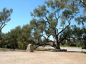
A famous expedition happened in 1860. Robert O'Hara Burke and William John Wills led a trip from Melbourne to the Gulf of Carpentaria. They wanted to explore the unknown parts of inland Australia. A key meeting spot for them was the Bullah Bullah Waterhole on Cooper Creek.
The explorers tried to reach the northern coast but couldn't. They ran low on supplies on their way back. Sadly, Charles Gray died. Burke and Wills made it back to Cooper Creek on April 21, 1861. But the other part of their group had left just nine hours earlier!
At the camp, a tree was marked to show where food was hidden. This tree also became the resting place for Burke, who died from lack of food. Wills also died nearby. John King was the only one from their group who survived the trip to the gulf. The maps and journals from their expedition helped more settlers move into Queensland.
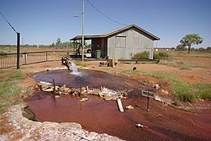
Early farming in the region was hard because there wasn't much water. Western parts get only about 150 mm (6 inches) of rain each year. Further east, around St. George, it's about 500 mm (20 inches). But then, people found water in the Great Artesian Basin. This allowed them to raise sheep, not just cattle.
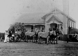
A Cobb & Co factory was built in Charleville in 1893. Cobb & Co was a famous company that provided coach services. They carried passengers and mail across Australia. Their coaches were known for being strong and comfortable.
In 1922, QANTAS started its first regular flights from Charleville.
Exploring the Land: Geography of South West Queensland
The northern part of the Sturt Stony Desert is in this region. This is near a spot called Cameron Corner. Part of the Cooper Basin is also here. This basin holds Australia's most important natural gas and oil deposits found on land. Australia's first natural gas was found near Roma at Hospital Hill. Oil was discovered in the region in 1961. The Eromanga Basin is also in South West Queensland. Gas was first found there in 1976, and oil in 1978. There's also a huge hidden impact crater in the region.
Towns and Communities
Some of the main towns in South West Queensland are Quilpie, Charleville, Roma, Thargomindah, St George, and Cunnamulla. Cunnamulla has the biggest wool-loading station on Queensland's railway. Australia's largest cotton farm, Cubbie Station, is near St George. It covers a massive 93,000 hectares.
Smaller towns include Amby, Injune, Jackson, Mitchell, Muckadilla, Mungallala, Surat, Wallumbilla, Yuleba, and many others. Cooladdi is a very small town with only six people. Eromanga is home to 'Cooper', Australia's largest dinosaur. Cooper was identified in 2021 as a new type of Titanosauria called Australotitan cooperensis.
Rivers and Waterways
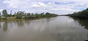
Many rivers flow through South West Queensland. These include the Warrego, Maranoa, Merivale, and Balonne. The Balonne River is used for a large irrigation system. The Bulloo River system is special because it's the only closed river system in Australia. This means its water doesn't flow into the ocean.
Nature's Retreats: Protected Areas
Several national parks protect the natural beauty of the region. These include Alton National Park, Chesterton Range National Park, Culgoa Floodplain National Park, and Currawinya National Park. Other parks are Diamantina National Park, Idalia National Park, Lake Bindegolly National Park, Mariala National Park, Thrushton National Park, and Tregole National Park. Bowra Sanctuary is a nature reserve near Cunnamulla. It is looked after by the Australian Wildlife Conservancy.
Getting Around: Transport in South West Queensland
Major roads help people travel through the region. The Mitchell Highway comes from New South Wales. The Balonne Highway goes east from St George to Cunnamulla. The Warrego Highway crosses the north of the region from east to west. The Castlereagh Highway also passes through the southeast, ending at St George. The Carnarvon Highway and the Diamantina Development Road are also important routes.
The region has seven airports. These include Dirranbandi Airport, Roma Airport, St George Airport, and Charleville Airport. The Western railway line reached Charleville in 1888. A branch line to Cunnamulla opened in 1898. Today, The Westlander passenger train travels between Brisbane and Charleville. The South Western railway line also goes through Thallon.
Nature's Wonders: Environment of South West Queensland
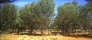
The area includes the Mulga Lands. Mulga is a type of shrub or small tree that grows in dry parts of Australia. It has special ways to survive in the dry conditions. There's a unique group of rufous-crowned emu-wren birds living here. They live in spinifex shrubland. The Dingo Fence, the world's longest fence, also runs through this region.
The ground in the region is mostly red, brown, and grey clays. Red sands and earths are common, which is typical for dry parts of Australia.
Hidden Treasures: Opals in South West Queensland
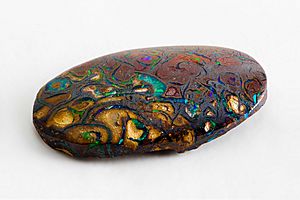
Australia's first opal was found in Adavale. The town of Yowah is built on an opal field. People started finding opals there in the 1870s. Opals are also found at Koroit opal field, Quilpie, and Eulo. The rock layer that holds opals in South West Queensland is called the Winton Formation.
 | Charles R. Drew |
 | Benjamin Banneker |
 | Jane C. Wright |
 | Roger Arliner Young |


