
Yuleba facts for kids
Quick facts for kids YulebaQueensland |
|||||||||||||||
|---|---|---|---|---|---|---|---|---|---|---|---|---|---|---|---|

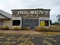
Post office at Yuleba
|
|||||||||||||||

Yuleba
Location in Queensland
|
|||||||||||||||
| Established | 1865 | ||||||||||||||
| Postcode(s) | 4427 | ||||||||||||||
| Area | 87.7 km2 (33.9 sq mi) | ||||||||||||||
| Time zone | AEST (UTC+10:00) | ||||||||||||||
| Location | |||||||||||||||
| LGA(s) | Maranoa Region | ||||||||||||||
| State electorate(s) | Warrego | ||||||||||||||
| Federal Division(s) | Maranoa | ||||||||||||||
|
|||||||||||||||
Yuleba (pronounced YOO-l-BAH) is a small town and area in the Maranoa Region of Queensland, Australia. It is located in the south-west part of the state. In 2021, about 271 people lived in Yuleba.
Contents
Exploring Yuleba's Location
Yuleba is located in Queensland, Australia. It is about 327 kilometers (203 miles) east of Charleville. The town is also 61 kilometers (38 miles) east of Roma. You can find Yuleba 294 kilometers (183 miles) west of Toowoomba. It is also 82 kilometers (51 miles) west of Miles. Yuleba is about 420 kilometers (261 miles) west of Brisbane, the state capital. The Warrego Highway runs right through the town.
Yuleba's Indigenous Roots
The Mandandanji language is an Australian Aboriginal language. It was spoken by the Mandandanji people. Their language area included the land around Roma, Yuleba, and Surat. It also stretched east towards Chinchilla. To the south-west, it reached Mitchell and St George.
The name Yuleba is thought to come from an Aboriginal word. It means "the place of water lilies".
A Look at Yuleba's Past
Yuleba was first named in 1865. It started as a small settlement along Yuleba Creek. In 1879, the town moved to a new spot by the railway crossing. It was officially called Baltinglass then.
How Yuleba Got Its Name
The name Baltinglass was changed to Yuleba in 1901. However, there was a mistake on the railway station sign. For a while, the station and town were known as Yeulba. In 1938, the name was finally corrected back to Yuleba.
Early Schools in Yuleba
Baltinglass Provisional School opened on November 10, 1880. It was later renamed Yeulba State School in 1884. When the town's name was corrected, the school's name changed too. In 1939, it became Yuleba State School.
Yuleba's Role in Transport
Yuleba was an important stop for trains. It was a railhead, meaning it was where goods from the west were loaded onto trains. This was very important until the railway line was extended further to Roma in 1910.
The last Cobb and Co stagecoach ran through Yuleba in 1924. This coach service connected Yuleba with Surat.
Community Buildings and Art
In 1954, a memorial hall was built in Yuleba. It honored those from the area who served in World War II. The hall was opened on May 15, 1954.
A large mural was added to the Yuleba Memorial Hall in 1964. It shows many scenes from war. A local artist named Robert (Fred) Doyle painted this mural.
The Yuleba Public Library was updated in 2015. The Maranoa Regional Council helped with these improvements.
Who Lives in Yuleba?
In 2006, Yuleba had a population of 183 people. By 2016, the number of people living in Yuleba grew to 207. The most recent count in 2021 showed 271 people living in the area.
Education Opportunities
Yuleba State School is a primary school for children from Prep to Year 6. It is located on Perry Street. In 2022, the school had 31 students.
There isn't a high school in Yuleba itself. The closest school offering secondary education up to Year 10 is Wallumbilla State School. For Years 11 and 12, students can go to Roma State College in Roma. This is about 61 kilometers (38 miles) west of Yuleba. Another option is Miles State High School in Miles, which is 81 kilometers (50 miles) east.
Yuleba's Economy Today
Today, Yuleba is home to a modern mining and processing site. This facility works with a special type of silica rock. Silica is used in many products, like glass and electronics.
Getting Around Yuleba
Yuleba is connected by the Western Railway Line. This line goes all the way to Charleville.
Train Services
The Yuleba Railway Station is a stop for the Westlander train service. This train runs twice a week.
- The train heading west to Charleville stops on Wednesdays and Fridays.
- The train heading east to Roma Street (in Brisbane) stops on Thursdays and Saturdays.
Highway Connections
Yuleba is also located on the Warrego Highway. This highway is a major route connecting Brisbane to Darwin.
Bus Services
The Yuleba Hotel - Motel is a stop for Greyhound Australia buses. These buses offer daily services to different cities.
- Buses travel between Brisbane and Mount Isa.
- Buses also travel between Brisbane and Charleville.
Community Amenities
The Maranoa Regional Council runs a public library in Yuleba. It is located on Stephenson Street. The library has a fast internet connection for everyone to use.
Images for kids
-
This garage on Stephenson Street was built in 1952.

