Wide Bay–Burnett facts for kids
Quick facts for kids Wide Bay–BurnettQueensland |
|
|---|---|
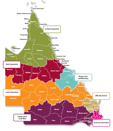
Queensland Regions
|
|
| Population | 273,276 (2011 census) |
| • Density | 5.623148/km2 (14.56389/sq mi) |
| Area | 48,598.4 km2 (18,763.9 sq mi) |
| LGA(s) | Bundaberg, Cherbourg, Fraser Coast, Gympie, North Burnett, South Burnett |
| State electorate(s) | Bundaberg, Burnett, Callide, Gympie, Maryborough, Nanango |
| Federal Division(s) | Wide Bay, Hinkler, Maranoa, Flynn |
Wide Bay–Burnett is an exciting region in Queensland, Australia. It's located about 170 to 400 kilometers north of Brisbane, the state capital. Many people are choosing to live here, and the population has been growing faster than the rest of Queensland for the last 20 years. This area is special because it balances growth with protecting its beautiful natural spaces.
The name "Wide Bay" was given by the famous explorer James Cook. He saw this wide coastal area while sailing past Double Island Point. Later, as the Port of Maryborough grew, ships often passed through Wide Bay to reach the port.
Contents
Discover the Geography of Wide Bay–Burnett
The Wide Bay–Burnett region has a mix of coastal areas and inland landscapes. The main coastal city is Maryborough. Inland, you'll find mountain ranges that feed the Burnett River. In the southeast, there's a unique coastal area called Cooloola.
This region is made up of several local government areas. These are like local councils that help manage the different towns and communities.
| Local Area | Population (2021) | Size |
|---|---|---|
| Bundaberg Region | 96,936 | 6,449.2 km2 (2,490.1 sq mi) |
| Fraser Coast Region | 102,080 | 7,116.7 km2 (2,747.8 sq mi) |
| Gympie Region | 49,334 | 6,897.5 km2 (2,663.1 sq mi) |
| North Burnett Region | 11,805 | 19,706.5 km2 (7,608.7 sq mi) |
| South Burnett Region | 33,040 | 8,397.1 km2 (3,242.1 sq mi) |
| Aboriginal Shire of Cherbourg | 1,260 | 31.7 km2 (12.2 sq mi) |
Sometimes, Noosa is also included in this region, especially for tourism. However, official government groups usually consider it a separate area.
Fraser Island: World's Largest Sand Island
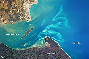
Fraser Island is a truly amazing place located off the southern coast of Queensland. It's about 200 kilometers north of Brisbane. This island is huge, stretching about 120 kilometers long and 24 kilometers wide. It's separated from the mainland by the Great Sandy Strait.
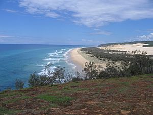
Fraser Island is known as the largest sand island in the world! It covers an area of 1840 square kilometers. The island has incredible landscapes, including rainforests, eucalyptus forests, and even mangrove swamps. It also features huge sand dunes and coastal heaths. The sand on the island has been building up for about 750,000 years.
You can find a variety of animals on Fraser Island. It's home to different mammals, birds, reptiles, and amphibians. Sometimes, you might even spot a saltwater crocodile! The island is protected as part of the Great Sandy National Park.
South Burnett: Peanuts and Wine Country
The South Burnett is a lovely inland area known for growing peanuts and making wine. It's located on the western slopes of the Great Dividing Range, north of the Darling Downs. The beautiful Bunya Mountains form the southern edge of this region.
You'll find several dams in the South Burnett, including Bjelke-Petersen Dam, Gordonbrook Dam, and Boondooma Dam. These dams are important for water supply. The Tarong Power Station and the peaceful Tarong National Park are also located in the southern part of the Burnett.
Cooloola: Ancient Sand Dunes
The Cooloola area is famous for its massive sandmass. This sandmass is actually connected to Fraser Island. Long ago, when sea levels were lower, it stretched even further east. Large, vegetated sand dunes here have created a unique landscape. Scientists find these dunes very important because they show the longest known history of coastal dunes in the world, going back 730,000 years!
A Glimpse into Wide Bay–Burnett's History
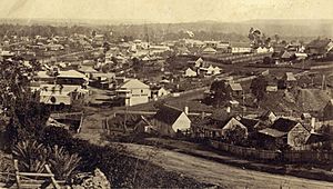
The land of Wide Bay–Burnett has a rich history. The Wakka Wakka people are the traditional owners of this area. Their language region includes places like Cherbourg, Murgon, Kingaroy, Gayndah, Eidsvold, and Mundubbera.
A big moment in the region's history was the discovery of gold near Gympie by James Nash in 1867. This led to a gold rush! Railways were built to connect towns like Maryborough and Gympie to Brisbane, helping the region grow. The city of Bundaberg was officially named and surveyed in 1870.
More recently, in January 2013, Cyclone Oswald brought very heavy rain and flooding to eastern Queensland. The Wide Bay–Burnett region was hit hard, especially Bundaberg, which experienced significant flooding.
Main Towns and Cities
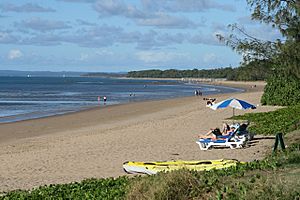
The main cities in the Wide Bay–Burnett region are Bundaberg, Gympie, Hervey Bay, and Maryborough. There are also many other notable towns, including Bargara, Biggenden, Blackbutt, Burnett Heads, Cherbourg, Childers, Eidsvold, Gayndah, Gin Gin, Howard, Imbil, Kilkivan, Kingaroy, Monto, Mundubbera, Murgon, Nanango, Rainbow Beach, Tin Can Bay, and Wondai.
Hervey Bay is especially famous for its calm waters, which are a perfect spot for migrating humpback whales. Many tourists visit Hervey Bay to see these amazing creatures, earning it the title of Australia's whale watching capital!
Learning and Education in the Region
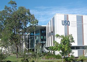
The Wide Bay–Burnett region offers great opportunities for learning. It has two universities: Central Queensland University in Bundaberg and the University of Sunshine Coast's Fraser Campus in Hervey Bay.
There are also TAFE campuses (Technical and Further Education) where students can learn practical skills. The Wide Bay Institute of TAFE has campuses in Bundaberg, Gympie, Hervey Bay, and Maryborough. Another TAFE campus, part of the Southern Queensland Institute of TAFE, is located in Kingaroy.
Getting Around Wide Bay–Burnett
The Wide Bay–Burnett region has good transport links. There are four main airports: Hervey Bay, Bundaberg, Maryborough, and Kingaroy. Hervey Bay and Bundaberg airports have regular flights for passengers.
Major highways connect the region to other parts of Queensland. The Bruce Highway links it to Brisbane, Rockhampton, Townsville, and Cairns. The Burnett Highway and Isis Highway provide inland routes to places like Toowoomba and central New South Wales.
For train travel, Queensland Rail operates daily high-speed Tilt Train services to Gympie, Maryborough, and Bundaberg. Local buses connect these railway stations to the towns. Public transport in the inland areas is less frequent, with buses linking main towns to each other and to Brisbane.
 | Stephanie Wilson |
 | Charles Bolden |
 | Ronald McNair |
 | Frederick D. Gregory |


