
Gympie facts for kids
Quick facts for kids GympieQueensland |
|||||||||||||||
|---|---|---|---|---|---|---|---|---|---|---|---|---|---|---|---|

Gympie Town Hall, 2015
|
|||||||||||||||

Gympie
Location in Queensland
|
|||||||||||||||
| Population | 22,424 (2021 census) (60th) | ||||||||||||||
| • Density | 322.65/km2 (835.7/sq mi) | ||||||||||||||
| Established | 1867 | ||||||||||||||
| Postcode(s) | 4570 | ||||||||||||||
| Elevation | 73 m (240 ft) | ||||||||||||||
| Area | 69.5 km2 (26.8 sq mi) | ||||||||||||||
| Location |
|
||||||||||||||
| LGA(s) | Gympie Region | ||||||||||||||
| State electorate(s) | Gympie | ||||||||||||||
| Federal Division(s) | Wide Bay | ||||||||||||||
|
|||||||||||||||
|
|||||||||||||||
Gympie (/ˈɡɪmpi/ GHIM-pee) is a city and a locality in the Gympie Region, Queensland, Australia. It is about 170.7 kilometres (106.1 miles) north of Brisbane, the state capital. The city sits on the Mary River, which sometimes floods Gympie. The area of Gympie is the main business centre for the city and the local government area. In 2021, Gympie had about 22,424 people living there.
Gympie is well-known for its gold field. It also has many old buildings that are listed on the Queensland Heritage Register because of their history.
Contents
History of Gympie


The name Gympie comes from the Gubbi Gubbi word gimpi-gimpi. This word means "stinging tree" and refers to a plant called Dendrocnide moroides. This tree has large, round leaves that can sting you, like stinging nettles. The city was first called Nashville, after James Nash. He found gold here in 1867. The name was changed to Gympie in 1868.
Gold Discovery and Growth
European settlers first used the land for grazing animals. Then, on October 16, 1867, James Nash found "payable" gold. At that time, Queensland was in a very bad economic situation. Nash's gold discovery helped save Queensland from going broke. A special fountain in Gympie's park honours Nash's important find. Today, the Gympie Gold Rush Festival celebrates this event with 10 days of cultural activities in October.
Gold mining is still important to the area. Other key industries include farming (especially dairy), timber, and tourism. The quick growth during the gold rush meant that the streets were built in an unplanned way.
Early Buildings and Services
The first post office, called Gympie Creek Post Office, opened on December 1, 1867. It was renamed Gympie in 1868. In 1868, a simple hut was built behind a hotel. It was called the Miner's Bethel and was used for church services by different Christian groups.
Many schools and churches were built as Gympie grew.
- A Catholic primary school started in 1868. It became St Patrick's Catholic Primary School.
- One Mile State School was the first public school, opening in 1869.
- Gympie Central Boys State School opened in 1869.
- The railway from Maryborough reached Gympie in 1881. The North Coast railway connected Gympie to Brisbane in 1891.
- Gympie State High School opened in 1912. It is one of Queensland's oldest public high schools.
- In 1882, some macadamia seeds from Gympie trees were taken to Hawaii. These seeds became the start of Hawaii's macadamia industry.
Flooding in Gympie

The Mary River has caused many big floods in Gympie. Some major floods happened in 1870, 1873, 1893, 1999, 2011, 2013, and 2022. Most floods happen between December and April. They are usually caused by heavy rain in the areas where the river starts.
The highest flood ever recorded in Gympie was on February 2, 1893. The river reached 25.45 metres (83.5 feet). In 1999, Gympie was declared a natural disaster area during a flood. On February 27, 2022, the river peaked at 22.96 metres (75.3 feet), which was higher than the 1999 flood. After the 2011 floods, many roads were fixed.
People of Gympie
In 2021, Gympie had an urban population of 22,424 people. About 3.9% of the people were Aboriginal and Torres Strait Islander. Most people (82.4%) were born in Australia. The next most common birthplaces were England (2.6%) and New Zealand (1.9%). About 89.6% of people spoke only English at home.
Historic Places

Gympie has many places listed on the Queensland Heritage Register. These buildings are important because of their history and special design. Some of these include:
- Gympie Town Hall
- Gympie Court House
- Old Gympie Post Office
- Surface Hill Uniting Church
- Gympie State High School buildings
- Gympie and Widgee War Memorial Gates
- Railway Hotel
- Gympie railway station
Climate
Gympie has a humid subtropical climate. This means it has hot, rainy summers and mild, dry winters with cool nights. On average, Gympie gets about 1117.4 millimetres (44 inches) of rain each year, mostly in summer. The temperature can range from a very cold -4.3 degrees Celsius (24.3 degrees Fahrenheit) to a very hot 42.4 degrees Celsius (108.3 degrees Fahrenheit).
| Climate data for Gympie (26º10'48"S, 152º38'24"E, 65 m AMSL) (1908-2024 normals, extremes 1965-2024, rainfall to 1870) | |||||||||||||
|---|---|---|---|---|---|---|---|---|---|---|---|---|---|
| Month | Jan | Feb | Mar | Apr | May | Jun | Jul | Aug | Sep | Oct | Nov | Dec | Year |
| Record high °C (°F) | 42.4 (108.3) |
41.3 (106.3) |
38.1 (100.6) |
35.6 (96.1) |
32.8 (91.0) |
29.2 (84.6) |
30.2 (86.4) |
34.3 (93.7) |
38.2 (100.8) |
40.1 (104.2) |
42.2 (108.0) |
42.0 (107.6) |
42.4 (108.3) |
| Mean daily maximum °C (°F) | 31.2 (88.2) |
30.4 (86.7) |
29.3 (84.7) |
27.3 (81.1) |
24.5 (76.1) |
22.1 (71.8) |
21.9 (71.4) |
23.4 (74.1) |
26.1 (79.0) |
28.3 (82.9) |
30.2 (86.4) |
31.3 (88.3) |
27.2 (80.9) |
| Mean daily minimum °C (°F) | 19.6 (67.3) |
19.7 (67.5) |
18.2 (64.8) |
14.7 (58.5) |
10.9 (51.6) |
8.0 (46.4) |
6.4 (43.5) |
7.1 (44.8) |
10.3 (50.5) |
13.9 (57.0) |
16.5 (61.7) |
18.6 (65.5) |
13.7 (56.6) |
| Record low °C (°F) | 12.0 (53.6) |
12.3 (54.1) |
9.8 (49.6) |
3.6 (38.5) |
−0.9 (30.4) |
−3.3 (26.1) |
−4.3 (24.3) |
−1.8 (28.8) |
1.3 (34.3) |
4.6 (40.3) |
3.5 (38.3) |
10.1 (50.2) |
−4.3 (24.3) |
| Average precipitation mm (inches) | 160.1 (6.30) |
168.9 (6.65) |
143.9 (5.67) |
81.6 (3.21) |
71.5 (2.81) |
59.3 (2.33) |
51.5 (2.03) |
39.3 (1.55) |
44.7 (1.76) |
72.3 (2.85) |
87.4 (3.44) |
135.7 (5.34) |
1,117.4 (43.99) |
| Average precipitation days (≥ 1.0 mm) | 8.9 | 9.3 | 10.0 | 7.3 | 6.2 | 4.9 | 4.5 | 3.9 | 4.2 | 5.7 | 6.5 | 7.8 | 79.2 |
| Average afternoon relative humidity (%) | 56 | 60 | 58 | 57 | 56 | 52 | 47 | 42 | 41 | 46 | 50 | 52 | 51 |
| Average dew point °C (°F) | 19.2 (66.6) |
19.5 (67.1) |
18.1 (64.6) |
15.6 (60.1) |
13.1 (55.6) |
10.0 (50.0) |
8.2 (46.8) |
7.5 (45.5) |
9.6 (49.3) |
12.8 (55.0) |
15.8 (60.4) |
17.8 (64.0) |
13.9 (57.1) |
| Source: Bureau of Meteorology (1908-2024 normals, extremes 1965-2024, rainfall to 1870) | |||||||||||||
Things to See and Do

Gympie has many fun and interesting places to visit:
- The Gympie Gold Mining and Historical Museum shows items from the early gold mining days. It also has displays about military, farming, transport, and steam engines in Australia.
- The WoodWorks Museum teaches about the timber industry and how people lived long ago. You can see old hand tools, a 1925 truck, and bullock wagons.
- The Valley Rattler is a special steam train for tourists. It travels along the Mary River through forests to Amamoor. The train starts and ends at the Old Gympie Railway Station, which is an original station from the 1900s gold rush.
- About 25 kilometres (16 miles) south of Gympie, the town of Amamoor hosts the yearly Gympie Music Muster. This is Australia's biggest outdoor country music festival. It happens over six days and nights in August in the Amamoor Forest Reserve.
- Gympie's Mary Street has many bars, cafes, and shops. Many buildings here have beautiful 19th-century Victorian architecture.
- Mothar Mountain Speedway is Gympie's local race track. It is known for its unique right-hand turn. Many types of race cars compete here.
- The yearly Heart of Gold International Short Film Festival takes place in Gympie in March.
- About 24 kilometres (15 miles) south-east of Gympie, Woondum National Park has rainforests, creeks, and granite rocks. It's a great place for picnics and bushwalking.
- About 30 minutes' drive east of Gympie is Tin Can Bay. Here, you can hand-feed Indo-Pacific hump-backed dolphins. This feeding is carefully managed to protect the dolphins.
- Gympie and the area around it are part of the Great Sandy Biosphere Reserve. This is a world conservation site listed by UNESCO.
- The Gympie Family History Society runs Gympie Cemetery crawls. You can learn about the town's first families who settled there.
Education
Gympie has many schools for different age groups:
- Gympie Central State School (Prep-6)
- Gympie West State School (Early Childhood-6)
- One Mile State School (Prep-6)
- St Patrick's Primary School (Prep-6)
- Gympie Special School (Prep-12) for students with special needs.
- Gympie State High School (7-12)
- James Nash State High School (7-12)
- St Patrick's College (7-12)
- Gympie Flexible Learning Centre (7-12)
Gympie also has a campus of the Wide Bay Institute of TAFE. The University of the Sunshine Coast (USC) also has a campus in Gympie. Here, students can study primary education, nursing, business, and commerce.
Community Services
- The Gympie Regional Council runs a public library at 8–14 Mellor Street. It opened in 1995.
- The Gympie branch of the Queensland Country Women's Association meets at the St Johns Ambulance Rooms.
- Gympie has two lawn bowls clubs: Gympie Bowls Club and The Albert Bowls Club.
Getting Around
You can reach Gympie by road using the Bruce Highway. Trains connect Gympie via QR's North Coast railway line. There are daily Citytrain services to Brisbane and longer-distance Traveltrain services. Most people in Gympie use cars, as there are not many public buses.
Gympie Airport is a small local airport south of the city. It is used for general aviation, recreational flying, and gliding. The closest airport for domestic flights is Sunshine Coast Airport. The nearest international airport is Brisbane Airport.
Local Government
Eight councillors are chosen to lead the Gympie Region local government area. The electoral district of Gympie was created in 1873. It includes towns like Tin Can Bay, Rainbow Beach, and parts of the Mary Valley.
In 1893, Andrew Fisher was elected as the Labor member for Gympie. He later became the fifth Prime Minister of Australia. Since 2015, Tony Perrett from the Liberal National Party has been the member for Gympie in the Queensland Legislative Assembly.
Traveston Crossing Dam Project
The Queensland government once planned to build a dam on the Mary River at Traveston Crossing, about 16 kilometres (10 miles) south of Gympie. They said the area was suitable and that the region needed more water because of climate change and population growth. However, this project was stopped in 2010.
The proposed dam would have flooded about 900 properties. Many landowners and local residents protested against the dam. There was also strong opposition from environmental groups around the world. They were worried about endangered animals like the Mary River cod, Mary River turtle, and Queensland lungfish. These concerns helped to stop the dam project.
Famous People from Gympie
- The Amity Affliction – a metalcore band
- Glen Boss – a jockey
- Andrew Fisher – a former Australian Prime Minister
- Sir Thomas William Glasgow – an Australian Army Major General
- Kaden Groves – a professional cyclist
- Tino Fa'asuamaleaui – an NRL Rugby League Player
- James Nash – the gold prospector
- Ann Caroline Sherry – a businesswoman
Images for kids
-
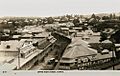
Lower Mary Street, circa 1925

See also
 In Spanish: Gympie para niños
