Noosa Heads, Queensland facts for kids
Quick facts for kids Noosa HeadsNoosa, Queensland |
|||||||||||||||
|---|---|---|---|---|---|---|---|---|---|---|---|---|---|---|---|
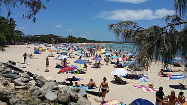
Noosa main beach
|
|||||||||||||||
| Population | 5,120 (2021 census) | ||||||||||||||
| • Density | 393.8/km2 (1,020/sq mi) | ||||||||||||||
| Postcode(s) | 4567 | ||||||||||||||
| Elevation | 21 m (69 ft) | ||||||||||||||
| Area | 13.0 km2 (5.0 sq mi) | ||||||||||||||
| Time zone | AEST (UTC+10:00) | ||||||||||||||
| Location |
|
||||||||||||||
| LGA(s) | Shire of Noosa | ||||||||||||||
| State electorate(s) | Noosa | ||||||||||||||
| Federal Division(s) | Wide Bay | ||||||||||||||
|
|||||||||||||||
Noosa Heads is a beautiful coastal town in Queensland, Australia. It is part of the Shire of Noosa. This town is a very popular place for holidays. Many people visit its beaches and national park. In 2021, about 5,120 people lived in Noosa Heads.
Contents
Exploring Noosa's Geography
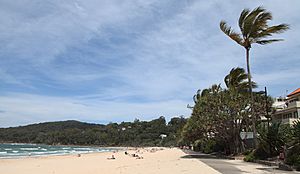
Noosa Heads is surrounded by water on three sides. Weyba Creek and the Noosa River are to the west. The amazing Coral Sea is to the north and east. A large part of the northeast area is inside the Noosa National Park. Noosa Heads, Noosaville, and Tewantin form one big town area. This area is at the northern end of the Sunshine Coast.
The highest point in Noosa Heads is Noosa Hill. It is 146 meters (about 479 feet) above sea level. You can find it in the national park. There is also Laguna Lookout. This spot offers great views near the town.
Amazing Coastal Spots
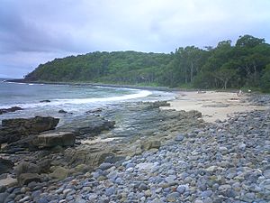
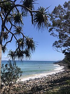
Noosa Heads has many cool places along its coastline. You can find headlands, lookouts, and bays. Many of these are along the walking track in the national park.
Here are some of the famous spots:
- Noosa Inlet: This is where the Noosa River meets the sea.
- Laguna Bay: A beautiful bay perfect for swimming.
- Noosa Beach: The main beach, very popular for relaxing.
- Boiling Pot Lookout: A great spot to watch waves crash.
- Tea Tree Bay: A quiet, pretty bay.
- Dolphin Point: A headland where you might spot dolphins.
- Granite Bay: Another lovely bay along the coast.
- Fairy Pools: These are natural rock pools. They are great for a dip.
- Noosa Head: A large headland with stunning views.
- Hell's Gates Lookout: Offers dramatic views of the ocean.
- Alexandria Bay: A long, beautiful beach.
- Roaring Cave: Also known as the Blowhole, it makes a roaring sound.
- Harrys Lookout: Another lookout with nice views.
- Devils Kitchen: A unique rock formation by the sea.
- Paradise Caves: Interesting caves to explore.
A Look Back at Noosa's History
The land around Noosa Heads belongs to the Gubbi Gubbi people. This is an Australian Aboriginal language. Their traditional country covers the Sunshine Coast and Gympie areas.
The name "Noosa" might come from the Kabi word nuthuru. This word means a ghost or a shadow. However, some old maps from the 1870s show the name as "Nusa River" and "Nusa Head". "Nusa" is an Indonesian word for island. The Noosa River does have islands like Makepeace Island.
Noosa Heads beach has been a popular place for tourists since the 1890s. Tourism grew a lot after World War II. In the 19th century, Noosa made its money from timber. But by the late 1920s, tourism became very important. Cafes and hotels were built along the beachfront.
The Noosa Heads Surf Lifesaving Club started in 1927. This club helps keep swimmers safe.
In 1988, the town was officially renamed Noosa Heads.
In 2009, Noosa was named one of the "Q150 Icons" of Queensland. This was for its role as a special "location."
The local newspaper, the Noosa News, stopped printing in 2020. It is now only available online.
In May 2021, Noosa was chosen as the top tourism town in Queensland. This shows how popular it is!
Who Lives in Noosa Heads?
In 2021, the town of Noosa Heads had a population of 5,120 people.
Important Places to See
Noosa Heads has some special places that are listed for their history. One of them is Halse Lodge at 17 Noosa Drive. These places are important parts of the town's heritage.
Learning and Community
There are no schools right in Noosa Heads. Kids usually go to Sunshine Beach State School or Sunshine Beach State High School. These schools are in the nearby area of Sunshine Beach.
The Noosa Shire Council has a mobile library service. It visits Lanyana Way in Noosa Junction. This means you can borrow books even if there isn't a big library building nearby.
There are also two jetties managed by the council. These are at Woods Bay and Ravenwood Park. Jetties are like small piers that go out into the water.
Fun Things to Do in Noosa Heads
Noosa National Park is home to many koalas. You can often see them in the trees there. It's important to protect them as their numbers are going down. You might also hear black and grey-headed flying foxes. These animals help plants grow by spreading seeds and pollen. Small bats also live here and help by eating insects.
Noosa Lions Park is a big grassy area. It's used for many large community events. These include the Noosa Triathlon and the Noosa Food and Wine Festival.
Noosa's main beach sometimes has problems with beach erosion. This is when sand is washed away. To fix this, a special sand pumping system was built. It brings sand back to the beach through a pipeline.
The main reason people visit Noosa Heads is its amazing beaches. The main beach and the small bays are famous for surfing. Noosa hosts big surfing events, like the Noosa Festival of Surfing. This festival brings many longboarders to the area.
Getting Around Noosa Heads
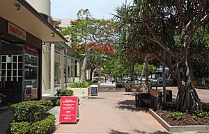
Noosa Heads is the main tourist area of Noosa. It has many restaurants and hotels. The most famous street is Hastings Street. This street is right behind the main beach.
You can catch buses from the Noosa Heads bus station to other parts of the Sunshine Coast. During busy holiday times like Easter and Christmas, there are free shuttle buses. These buses help tourists get around the Noosa area easily.
Noosa also has dedicated bike lanes. Riding a bike is a great way to explore the town. You'll find bike racks in shopping areas and near the beaches.
Motor scooters are another option for getting around. There are special parking spots for scooters on Hastings Street and in shopping areas.
If you need a ride, there are taxi ranks on Hastings Street and at Noosa Fair shopping centre.
Famous People from Noosa Heads
- Bob Ansett - a well-known business person, actor, and writer.
 | Audre Lorde |
 | John Berry Meachum |
 | Ferdinand Lee Barnett |


