
Noosa River facts for kids
Quick facts for kids Noosa River |
|
|---|---|
 |
|
| Country | Australia |
| State | Queensland |
| Physical characteristics | |
| Main source | Como Escarpment |
| River mouth | Pacific Ocean |
| Basin features | |
| Basin size | 854 km2 (330 sq mi) |
The Noosa River is a beautiful river located in South East Queensland, Australia. It begins in the Como Escarpment, near Mount Elliott, within the Great Sandy National Park. From there, it flows south through an area with several lakes, eventually reaching the town of Tewantin.
Many lakes are connected to the Noosa River. These include Lake Cooloola, Lake Como, Lake Cootharaba, Lake Cooroibah, and Lake Weyba. The land around the river is mostly covered by sand dunes. Two smaller streams, Kin Kin Creek and Teewah Creek, also flow into the Noosa River.
The Noosa River finally flows into the Coral Sea. This happens between Noosa Heads and Noosa North Shore. The river is also a home for many different kinds of migratory birds.
Contents
River History: How Noosa River Changed Over Time
Early Days: Logging and Sawmills
People started cutting down trees along the Noosa River in 1864. These logs were first sent north to a sawmill near Maryborough. But in 1870, a sawmill was built right on Lake Cootharaba, making it easier to process the timber.
Protecting the River: Changes and Challenges
For a long time, the Noosa beach and river entrance were naturally balanced. The beach was wide and could recover quickly after big storms like cyclones.
However, in the mid-1960s, a lot of building happened along the beachfront. A rock wall was even built along the beach. These changes made the beach narrower, and sometimes it would disappear completely at high tide.
In 1978, a special wall was built to move the river entrance to a new spot. This is where the river meets the sea today.
Fun Things to Do on the Noosa River

The Noosa River is a popular spot for visitors and locals. There are many ways to explore its waters.
Explore by Ferry: The Noosa Ferry
The Noosa Ferry is a great way to see the river. It travels from Noosa Heads to Noosaville and then to Tewantin. You can use it for regular trips or enjoy a special tourist cruise.
River Cruises: See the Canals
Other companies, like Noosa River & Canal Cruises, offer fun trips. They take you on the Noosa River and through its canals. These cruises usually start from Noosaville and Noosa Heads.
Images for kids
-
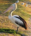
A pelican resting on the banks of the Noosa River.

