
Tewantin facts for kids
Quick facts for kids TewantinQueensland |
|||||||||||||||
|---|---|---|---|---|---|---|---|---|---|---|---|---|---|---|---|
 |
|||||||||||||||

Tewantin
Location in Queensland
|
|||||||||||||||
| Population | 11,164 (2021 census) | ||||||||||||||
| • Density | 426.1/km2 (1,104/sq mi) | ||||||||||||||
| Established | 1871 | ||||||||||||||
| Postcode(s) | 4565 | ||||||||||||||
| Area | 26.2 km2 (10.1 sq mi) | ||||||||||||||
| Time zone | AEST (UTC+10:00) | ||||||||||||||
| Location |
|
||||||||||||||
| LGA(s) | Shire of Noosa | ||||||||||||||
| State electorate(s) | Noosa | ||||||||||||||
| Federal Division(s) | Wide Bay | ||||||||||||||
|
|||||||||||||||
Tewantin is a town in Queensland, Australia. It's located in the Shire of Noosa. Tewantin was the very first settlement in the Noosa area. Today, it's one of the three main towns there. In 2021, about 11,164 people lived in Tewantin.
Contents
Exploring Tewantin's Location
Tewantin is bordered by Lake Cooroibah to the north. The Noosa River flows along its eastern side. This river then empties into the lake.
Most of Tewantin is covered by protected natural areas. The Great Sandy National Park is in the north. The Tewantin National Park is in the west and south. There's also the Harry Springs Conservation Park in the middle. The main town area is in the east. Doonella Lake is found in the southeast. The Cooroy-Noosa Road leads into town from the west.
Tewantin's Past: A Look at History


The name Tewantin comes from an Aboriginal word, dauwadhum. It means "place of dead logs." This name likely refers to the sawmill that used to be there.
Tewantin began as a town focused on timber. By 1869, it was the main river port for the Noosa area. In 1871, the town site was officially mapped out. Tewantin grew into a busy small town. Its economy relied on gold, fishing, and the timber industry.
In 1880, a Kabi bushranger named Johnny Campbell was caught near the town.
Schools and Community Buildings
Tewantin Provisional School first opened on August 2, 1875. It later became Tewantin State School in 1887.
The Tewantin Methodist Church opened in April 1910. The Tewantin R.S.S.I.L.A. (a community group for returned service members) opened in 1920.
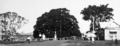
The Tewantin War Memorial honors those who served in World War I. It was officially opened in 1922. The Tewantin Noosa RSL & Citizens' Memorial Club opened in 1981.
The Noosa Marina, a popular spot, opened in 1996. Noosa Flexible Learning Centre, a school, started in 2006.
How Many People Live in Tewantin?
In 2016, Tewantin had a population of 10,920 people. By 2021, the number of people living in Tewantin grew to 11,164.
Tewantin's Weather
Tewantin has a warm, humid climate. Summers are hot and muggy. Winters are mild and not too cold. The town gets a lot of rain, especially in late summer. On average, it rains about 1597.2 mm each year.
| Climate data for Tewantin (26º23'24"S, 153º02'24"E, 6 m AMSL) (1996-2024 normals, extremes 1895-2024) | |||||||||||||
|---|---|---|---|---|---|---|---|---|---|---|---|---|---|
| Month | Jan | Feb | Mar | Apr | May | Jun | Jul | Aug | Sep | Oct | Nov | Dec | Year |
| Record high °C (°F) | 44.2 (111.6) |
39.7 (103.5) |
37.7 (99.9) |
34.4 (93.9) |
31.7 (89.1) |
28.9 (84.0) |
30.4 (86.7) |
33.9 (93.0) |
35.4 (95.7) |
40.0 (104.0) |
40.5 (104.9) |
39.7 (103.5) |
44.2 (111.6) |
| Mean daily maximum °C (°F) | 28.7 (83.7) |
28.6 (83.5) |
27.7 (81.9) |
25.9 (78.6) |
23.7 (74.7) |
21.7 (71.1) |
21.3 (70.3) |
22.4 (72.3) |
24.3 (75.7) |
25.7 (78.3) |
26.8 (80.2) |
28.2 (82.8) |
25.4 (77.8) |
| Mean daily minimum °C (°F) | 22.0 (71.6) |
22.0 (71.6) |
20.9 (69.6) |
18.1 (64.6) |
14.8 (58.6) |
12.6 (54.7) |
11.3 (52.3) |
11.7 (53.1) |
14.5 (58.1) |
17.0 (62.6) |
18.9 (66.0) |
20.8 (69.4) |
17.1 (62.7) |
| Record low °C (°F) | 12.2 (54.0) |
8.9 (48.0) |
8.4 (47.1) |
4.4 (39.9) |
1.0 (33.8) |
−2.8 (27.0) |
−2.2 (28.0) |
−1.1 (30.0) |
−0.2 (31.6) |
2.5 (36.5) |
7.1 (44.8) |
9.4 (48.9) |
−2.8 (27.0) |
| Average precipitation mm (inches) | 151.8 (5.98) |
236.4 (9.31) |
227.8 (8.97) |
149.4 (5.88) |
158.1 (6.22) |
114.8 (4.52) |
73.0 (2.87) |
73.5 (2.89) |
58.6 (2.31) |
116.3 (4.58) |
90.7 (3.57) |
142.4 (5.61) |
1,597.2 (62.88) |
| Average precipitation days (≥ 1.0 mm) | 10.7 | 12.5 | 14.2 | 11.6 | 10.3 | 8.8 | 7.3 | 5.3 | 5.9 | 7.9 | 7.5 | 9.8 | 111.8 |
| Average afternoon relative humidity (%) | 67 | 67 | 66 | 64 | 62 | 61 | 57 | 56 | 59 | 63 | 65 | 66 | 63 |
| Average dew point °C (°F) | 20.1 (68.2) |
20.1 (68.2) |
18.7 (65.7) |
16.7 (62.1) |
13.8 (56.8) |
11.8 (53.2) |
10.3 (50.5) |
10.7 (51.3) |
13.5 (56.3) |
15.7 (60.3) |
17.1 (62.8) |
19.1 (66.4) |
15.6 (60.2) |
| Source: Bureau of Meteorology (1996-2024 normals, extremes 1895-2024) | |||||||||||||
Learning in Tewantin: Schools
Tewantin State School is a primary school for students from Prep to Year 6. It is located on Werin Street. The school also has a special education program. In 2017, it had 603 students.
Tewantin does not have its own secondary school. Older students usually go to Sunshine Beach State High School in Sunshine Beach. Another option is Noosa District State High School. Its junior campus is in Pomona, and its senior campus is in Cooroy.
Getting Involved: Community Groups
The Tewantin Noosa branch of the Queensland Country Women's Association holds meetings. They meet at the CWA Hall on Pacific Avenue.
Places to Visit and Things to Do
,_Tewantin,_Queensland_01.jpg)
Poinciana Avenue is Tewantin's main street. Here you'll find the Tewantin RSL club. This club has a strong connection to Australia's military history. The street also features the historic Royal Mail pub. There's a War Memorial, shops, restaurants, and a town square.
Tewantin is home to the Australian Navy Cadet unit, NTS Sheean.
Special Events in Tewantin
Each year, there is an Anzac Day march through Tewantin. Students and staff from Tewantin State School lead this march.
Images for kids
-
Tewantin War Memorial, Town Square, circa 1931
