Tinbeerwah, Queensland facts for kids
Quick facts for kids TinbeerwahQueensland |
|||||||||||||||
|---|---|---|---|---|---|---|---|---|---|---|---|---|---|---|---|

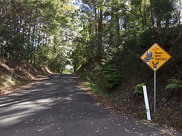
Coveys Rd, Tinbeerwah, 2016
|
|||||||||||||||
| Population | 1,160 (2021 census) | ||||||||||||||
| • Density | 52.5/km2 (136/sq mi) | ||||||||||||||
| Postcode(s) | 4563 | ||||||||||||||
| Area | 22.1 km2 (8.5 sq mi) | ||||||||||||||
| Time zone | AEST (UTC+10:00) | ||||||||||||||
| Location |
|
||||||||||||||
| LGA(s) | Shire of Noosa | ||||||||||||||
| State electorate(s) | Noosa | ||||||||||||||
| Federal Division(s) | Wide Bay | ||||||||||||||
|
|||||||||||||||
Tinbeerwah is a quiet area in the Shire of Noosa, Queensland, Australia. It's a place that feels a bit like the countryside. In 2021, about 1,160 people lived there.
Contents
What is Tinbeerwah Like?
Tinbeerwah is known for its natural beauty. A main road called Cooroy-Noosa Road goes right through it. This road connects Lake Macdonald in the west to Tewantin in the east.
Mount Tinbeerwah
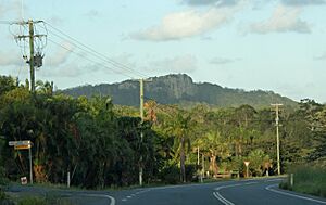
One of the most famous spots is Mount Tinbeerwah. It's a mountain located in the northern part of Tinbeerwah. This mountain stands about 265 meters tall.
Tewantin National Park
A large part of the northern area of Tinbeerwah is inside the Tewantin National Park. This park is a protected area of nature.
A Look at Tinbeerwah's Past
The name Tinbeerwah comes from the Aboriginal people. It means "place of grasstrees" or "high hill climbing up." This gives us a clue about what the area might have looked like long ago.
Early Schools in Tinbeerwah
A school called Tinbeerwah Provisional School first opened its doors on September 2, 1914. Two years later, in 1916, it became Tinbeerwah State School. However, this school closed down on August 9, 1963.
Changes in Local Government
From 2008 to 2013, Tinbeerwah was part of a bigger area called the Sunshine Coast Region. But in 2014, the Shire of Noosa was created again. This meant Tinbeerwah went back to being part of the Noosa area.
Who Lives in Tinbeerwah?
The number of people living in Tinbeerwah changes over time.
- In 2011, there were 1,262 people.
- By 2016, the population was 974 people.
- In 2021, the number went up to 1,160 people.
Where Do Kids Go to School?
There are no schools right inside Tinbeerwah itself. Students usually go to schools in nearby towns.
Primary Schools Nearby
Some of the closest primary schools are:
- Tewantin State School in Tewantin, which is to the east.
- Eumundi State School in Eumundi, to the south.
- Cooroy State School in Cooroy, to the south-west.
- Noosaville State School in Noosaville, also to the east.
Secondary Schools Nearby
For high school, students often attend Noosa District State High School. This school has two campuses:
- The junior campus (for younger high school students) is in Pomona, to the north-west.
- The senior campus (for older high school students) is in Cooroy, to the south-west.
 | Bessie Coleman |
 | Spann Watson |
 | Jill E. Brown |
 | Sherman W. White |


