Sunshine Coast, Queensland facts for kids
Quick facts for kids Sunshine CoastQueensland |
|||||||||
|---|---|---|---|---|---|---|---|---|---|
| Population | 398,840 (2021) (9th) | ||||||||
| • Density | 244.24/km2 (632.6/sq mi) | ||||||||
| Area | 1,633 km2 (630.5 sq mi)(2016 urban) | ||||||||
| Location | 100 km (62 mi) from Brisbane | ||||||||
| LGA(s) |
|
||||||||
| State electorate(s) | Buderim, Caloundra, Glass House, Kawana, Maroochydore, Nicklin, Noosa | ||||||||
| Federal Division(s) | |||||||||
|
|||||||||
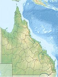
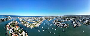
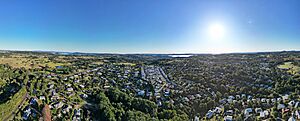
The Sunshine Coast is a busy area in South East Queensland, Australia. It's located about 100 kilometers (62 miles) north of Brisbane. This region stretches along the Coral Sea coastline. Its main towns cover about 60 kilometers (37 miles) of coast and inland areas, from Pelican Waters to Tewantin.
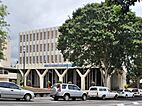
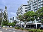
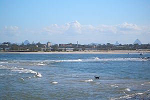
The Sunshine Coast has several popular beach towns. These include Caloundra, Kawana Waters, Maroochydore, and Noosa Heads. Inland, Nambour and Maleny are important business centers.
Since 2014, the Sunshine Coast has been managed by two local councils. These are the Sunshine Coast Region council and the Shire of Noosa council. They look after the southern and northern parts of the area.
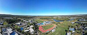
In June 2021, the Sunshine Coast had about 398,840 people living there. This makes it the fifth largest area in Queensland by population. It's also the ninth most populated area in Australia. The number of people living here has grown steadily over the years.
Contents
Exploring the History of the Sunshine Coast
The first people to live on the Sunshine Coast were the Gubbi Gubbi and Wakka Wakka Indigenous Australians. The Gubbi Gubbi people lived along the coast. The Wakka Wakka people lived inland to the west. These two groups were friendly and often married each other. They moved around to find food.
The Gubbi Gubbi language is an Australian Aboriginal language. It was spoken in the areas now known as the Sunshine Coast Region and Gympie Region. This includes towns like Caloundra, Noosa Heads, and Gympie.
Early European Sightings and Settlement
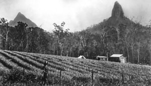
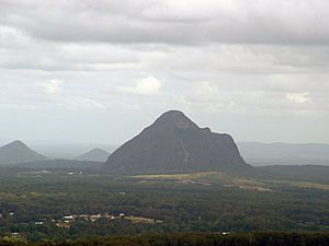
In 1770, Captain James Cook was the first known European to see the Glass House Mountains. These mountains are south-west of Caloundra.
Later, in the 1820s, some runaway convicts lived with the Kabi Kabi people for eight months. In the 1830s and 1840s, more convicts from the Moreton Bay (Brisbane) prison colony hid in this area.
In 1842, Governor George Gipps declared the Sunshine Coast a "Bunya Bunya Reserve." This was to protect the bunya trees. These trees were very important to Aboriginal culture. However, by the 1850s, loggers and cattle farmers started using the land. The Bunya Bunya Reserve was then removed in 1860.
Growth of Towns and Industries
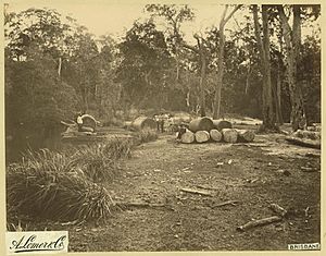
Many towns on the Sunshine Coast started as small ports. They were used for the timber industry in the 1860s and 1870s. The area had many large forests. Loggers used the rivers and lakes to float timber out to sea. This wood was even sent to Europe.
During the Gympie Gold Rush in 1867, people looked for easier ways to get to the gold fields. After a railway line was built to Gympie, many coastal towns were bypassed.
By the 1890s, small farms grew fruit and dairy products. Sugar cane and pineapples became very important crops. Many small towns began to appear. Farm produce was first taken by horse to Landsborough.
After World War I, "seaside shacks" became popular. These were cheap holiday homes near the coast. They were often built from recycled materials. After World War II, the Sunshine Coast became a popular place for holidays and surfing. This growth continued in the 1960s and 1970s.
Renaming and Modern Development
The area was once called the Near North Coast. In 1967, it was officially renamed the Sunshine Coast. This was done to make it more appealing to tourists. Around this time, new tourist attractions were built, like the Big Pineapple in Woombye.
After the 1980s, the Sunshine Coast grew very quickly. It became one of the fastest-growing regions in Australia. Many small farms have now disappeared. Instead, businesses like shops, restaurants, and tourism have become more important.
In 2008, three local areas merged to form the Sunshine Coast Region. However, many people in Noosa did not want this merger. In 2013, a vote allowed Noosa to become a separate council again. So, since 2014, the Sunshine Coast has two main local government areas.
Geography and Natural Beauty
The Sunshine Coast has several major rivers. These include the Noosa River, Maroochy River, and Mooloolah River. There are also lakes like Lake Cootharaba and Lake Weyba. Dams like Ewen Maddock Dam store water for the region.
Beautiful Beaches of the Sunshine Coast
The Sunshine Coast is famous for its long, beautiful beaches. Some stretches of coast have unbroken beaches for many kilometers. For example, from Sunshine Beach to Coolum Beach is 17 kilometers (11 miles) long.
Noosa Main Beach, Alexandra Headland, Mooloolaba, and Coolum Beach are well-known surfing spots.
Here are some of the notable beaches:
- Sunshine Beach in Noosa
- Sunrise Beach in Noosa
- Castaways Beach in Noosa
- Marcus Beach in Noosa
- Peregian Beach in Noosa
- Marcoola, Maroochydore
- Mudjimba, Maroochydore
- Kawana Waters, between Maroochydore and Caloundra
- Dicky Beach in Caloundra
- Moffat Beach in Caloundra
- Shelly Beach in Caloundra
- Kings Beach in Caloundra
- Golden Beach in Caloundra
National Parks and Wildlife
The Sunshine Coast has more national parks than any other region in Queensland. These parks protect the area's amazing nature. They include:
- Mapleton Falls National Park
- Kondalilla National Park
- The Glass House Mountains National Park
- Noosa National Park
- The Great Sandy National Park (which includes parts of Fraser Island)
Climate and Weather Patterns
The Sunshine Coast has a humid subtropical climate. This means summers are generally hot, but not too extreme. Winters have warm days and cooler nights. There is no dry season, and it rains quite a lot throughout the year.
The average sea temperature is warm. It ranges from about 21.2°C (70.2°F) in August to 27.1°C (80.8°F) in February at Mooloolaba.
| Climate data for Sunshine Coast Airport, 1994–2016 | |||||||||||||
|---|---|---|---|---|---|---|---|---|---|---|---|---|---|
| Month | Jan | Feb | Mar | Apr | May | Jun | Jul | Aug | Sep | Oct | Nov | Dec | Year |
| Record high °C (°F) | 41.3 (106.3) |
38.7 (101.7) |
36.2 (97.2) |
33.5 (92.3) |
31.5 (88.7) |
29.1 (84.4) |
31.4 (88.5) |
35.0 (95.0) |
35.7 (96.3) |
37.0 (98.6) |
41.0 (105.8) |
38.4 (101.1) |
41.3 (106.3) |
| Mean daily maximum °C (°F) | 29.1 (84.4) |
28.9 (84.0) |
27.9 (82.2) |
26.0 (78.8) |
23.6 (74.5) |
21.4 (70.5) |
21.2 (70.2) |
22.2 (72.0) |
24.4 (75.9) |
25.6 (78.1) |
27.3 (81.1) |
28.4 (83.1) |
25.5 (77.9) |
| Mean daily minimum °C (°F) | 21.3 (70.3) |
21.3 (70.3) |
20.2 (68.4) |
17.1 (62.8) |
13.7 (56.7) |
11.4 (52.5) |
9.6 (49.3) |
9.9 (49.8) |
12.9 (55.2) |
15.6 (60.1) |
17.9 (64.2) |
19.8 (67.6) |
15.9 (60.6) |
| Record low °C (°F) | 14.5 (58.1) |
14.4 (57.9) |
10.9 (51.6) |
7.3 (45.1) |
3.5 (38.3) |
1.5 (34.7) |
−0.7 (30.7) |
1.3 (34.3) |
3.4 (38.1) |
7.1 (44.8) |
5.7 (42.3) |
10.0 (50.0) |
−0.7 (30.7) |
| Average precipitation mm (inches) | 154.3 (6.07) |
193.0 (7.60) |
161.4 (6.35) |
165.4 (6.51) |
157.4 (6.20) |
117.2 (4.61) |
66.4 (2.61) |
82.2 (3.24) |
57.1 (2.25) |
72.3 (2.85) |
83.6 (3.29) |
147.2 (5.80) |
1,478.5 (58.21) |
| Average precipitation days (≥ 1 mm) | 10.6 | 11.3 | 11.4 | 11.6 | 10.0 | 9.5 | 6.8 | 5.5 | 5.6 | 6.9 | 6.7 | 9.9 | 105.8 |
| Average relative humidity (%) | 70 | 71 | 69 | 68 | 65 | 63 | 59 | 59 | 63 | 66 | 67 | 69 | 66 |
| Source: Bureau of Meteorology | |||||||||||||
Economy and Tourism
The Sunshine Coast's economy has grown faster than most other regions in Australia. This is because it has many different strong industries. These include healthcare, education, finance, and business services.
Popular Tourist Attractions
The Sunshine Coast is a major tourist spot. It attracts over 3.2 million visitors each year. There are many fun places to visit, such as:
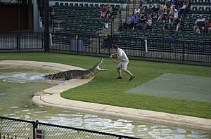
- Steve Irwin's Australia Zoo
- UnderWater World marine park
- Aussie World with the Ettamogah Pub
- The Buderim Ginger Factory
- The Big Pineapple
- The Eumundi Markets
- The Majestic Theatre, Pomona
The region also hosts several yearly sports events. These include the Mooloolaba Triathlon and Noosa Triathlon.
Tourists can fly into the Sunshine Coast Airport. Many also arrive from Brisbane Airport, which is about 100 kilometers (62 miles) south.
Since November 2020, the Sunshine Coast has been home to NightQuarter. This is a place with live music and food stalls. In the year ending September 2021, 3.6 million people visited the region. They spent about $2.7 billion, helping local businesses.
Agriculture and Farming
In 2017–18, the value of farm products from the Sunshine Coast was $217 million. This was 2% of Queensland's total farm production.
About 36% of the Sunshine Coast region is used for farming. The most common type of land use is for grazing animals.
The region has many different types of farms. The most valuable farm products were poultry (chickens), strawberries, and milk. These three products made up 60% of all farm production in the area.
See also
 In Spanish: Sunshine Coast para niños
 | Anna J. Cooper |
 | Mary McLeod Bethune |
 | Lillie Mae Bradford |


