Maroochy River facts for kids
Quick facts for kids Maroochy |
|
|---|---|

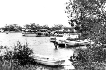
A river excursion, 1931
|
|
| Country | Australia |
| State | Queensland |
| Region | South East Queensland |
| Physical characteristics | |
| Main source | Blackall Range |
| River mouth | Maroochydore |
| Basin features | |
| Basin size | 630 km2 (240 sq mi) |
The Maroochy River is an important river in South East Queensland, Australia. It starts high up in the Blackall Range mountains. From there, it flows east through towns like Eumundi. Finally, it reaches the sea at Cotton Tree in Maroochydore.
Other towns near the river include Nambour, Eudlo, Yandina, and Coolum. There's even a suburb called Maroochy River located near the airport.
Contents
River's Journey: Where it Flows
The area around the Maroochy River covers about 630 square kilometers. This land has rolling hills and is used for farming and towns. There are three dams in this area that hold water. These dams are Wappa Dam, Cooloolabin Dam, and Poona Dam. Together, they can hold a lot of water, about 27,997 megalitres.
River Branches and Creeks
The Maroochy River has two main parts: the North Maroochy River and the South Maroochy River. Many smaller streams, called tributaries, flow into the river. These include Petrie Creek, Paynter Creek, Eudlo Creek, Coolum Creek, Doonan Creek, and Yandina Creek.
Canals and Islands
Some canal systems connect to the river. One is called Maroochy Waters. Another, Twin Waters, has limited access to the river. Many lake systems also drain into the river and its creeks. An example is Sunshine Cove.
The river also has several named islands. These include Pincushion Island, Goat Island, Channel Island, Chambers Island, and Bungee's Island.
Cultural Stories of the River
The name "Maroochy" means 'swan'. This river is very special to the Indigenous people of the area. Their old stories tell how the river was formed. These stories also explain how other important places like Mudjimba Island, Mount Coolum, and Mount Ninderry came to be.
Protecting the Environment
The Maroochy River is part of a special project called a "blue carbon" initiative. This is Australia's first partnership of its kind. It helps people use the land for fun activities or farming in ways that protect nature. The goal is to keep the environment healthy.
The 'Blue Heart' Area
This special area is called the 'Blue Heart'. It covers more than 5,000 hectares. The project aims to protect the natural benefits of the wetlands. It also works to improve the health of both people and the environment. A big goal is to reach zero net emissions.
The Maroochy River and its wetlands are bordered by several suburbs. These include Bli Bli, Marcoola, Mudjimba, Diddillibah, Twin Waters, and Maroochydore. Many parts of this area are considered "nationally important wetlands" and "protected areas" by the Australian government.
River Floods: When Waters Rise
The Maroochy River has had some big floods over the years. Important floods happened in 1893, 1951, 1974, and 1992. To help warn people, a flood warning system was set up in 1994. This system helps predict how high the river will get.
A Look Back: River History
In the past, when people first settled here, boats were the main way to travel. If you wanted to go from Yandina to Maroochydore, you would travel by boat along the Maroochy River.
By 1930, more towns grew in the Maroochy River area. This was because transport options improved. In 2009, an oil spill in southeast Queensland affected the river's mouth. The oil reached about 2 kilometers upstream to the Maroochy Bridge.
 | Janet Taylor Pickett |
 | Synthia Saint James |
 | Howardena Pindell |
 | Faith Ringgold |

