Biggenden facts for kids
Quick facts for kids BiggendenQueensland |
|||||||||||||||
|---|---|---|---|---|---|---|---|---|---|---|---|---|---|---|---|

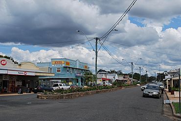
Biggenden's main street
|
|||||||||||||||
| Population | 788 (2021 census) | ||||||||||||||
| • Density | 3.6048/km2 (9.336/sq mi) | ||||||||||||||
| Established | 1889 | ||||||||||||||
| Postcode(s) | 4621 | ||||||||||||||
| Area | 218.6 km2 (84.4 sq mi) | ||||||||||||||
| Time zone | AEST (UTC+10:00) | ||||||||||||||
| Location |
|
||||||||||||||
| LGA(s) | North Burnett Region | ||||||||||||||
| State electorate(s) | Callide | ||||||||||||||
| Federal Division(s) | Hinkler | ||||||||||||||
|
|||||||||||||||
Biggenden is a small town in the North Burnett Region of Queensland, Australia. It's a rural area, meaning it's mostly countryside with farms and open spaces. In 2021, about 788 people lived in Biggenden.
Contents
Where is Biggenden?
Biggenden is located on the Isis Highway. It's about 287 kilometres (178 mi) north-west of Brisbane, which is the capital city of Queensland. It's also about 85 kilometres (53 mi) west of Maryborough.
A Look at Biggenden's Past
The name Biggenden comes from the Kabi language. The word bigindhan means "a place of stringybark". Stringybark is a type of tree.
Biggenden started in 1889. It was a place where people could stop and get supplies. This was important for people travelling to nearby gold rush towns like Paradise and Shamrock. It also served coach passengers heading west from Maryborough.
The town actually moved its main area in 1891! This happened when the railway line arrived. The new town centre was built right next to the train station. The Biggenden Post Office opened on May 16, 1891. One interesting old building was called the Live And Let Live Inn.
Schools and Churches
Biggenden Provisional School first opened its doors on May 9, 1892. It became Biggenden State School in 1900. In 1953, the school started offering high school subjects. A full secondary school section was added in 1958.
The Biggenden Methodist Church opened on May 23, 1910. Later, in 1977, it became the Biggenden Uniting Church. This happened when several churches joined together to form the Uniting Church in Australia.
Community Groups
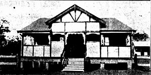
In 1926, local women decided to start a branch of the Queensland Country Women's Association (CWA). The CWA helps women and families in rural areas. Their building in Biggenden was officially opened in October 1928.
Mining History
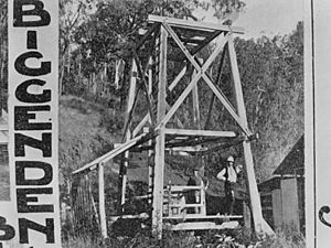
The Mt Biggenden mine was a big part of the town's history. It provided jobs for over 100 years. People mined gold, bismuth, and later magnetite (a type of iron ore) there. The mine closed its main operations in 1999.
How Biggenden Makes a Living
The main industry in the Biggenden area is farming. Farmers mostly raise beef and dairy cattle. Other important farm products include grain crops, pigs, peanuts, citrus fruits, and timber. The area also has many different minerals.
The Biggenden Mine, located about eight kilometres from town, was important for mining gold, bismuth, and magnetite.
Paradise Dam
In November 2005, the Queensland Government opened the Paradise Dam. It's about 30 minutes north-west of Biggenden on the Burnett River. This large dam can hold 300,000 megalitres of water. It helps provide water for nearby areas like Bundaberg and Childers.
Building the dam created over 400 jobs. The dam site has also become a popular place for tourists to visit. Before the dam was built, the old gold mining town of Paradise was submerged. Some items and buildings from Paradise were saved. They are now on display at the Biggenden Historical Society, which is located in the old Paradise courthouse building.
Education in Biggenden
Biggenden State School is a government school for students from Prep (the first year of school) up to Year 10. It teaches both boys and girls. In 2017, the school had 143 students.
For students who want to continue their education up to Year 12, the closest government high schools are Burnett State College in Gayndah and Isis District State High School in Childers.
Historic Places
Biggenden has several places that are listed as important heritage sites. These include:
- The former Biggenden Courthouse at 8 Edward Street, which is now the Biggenden Museum.
- The former Biggenden Butter Factory at 11 Edward Street & Airstrip Road.
- The Biggenden QCWA Building at 32 Edward Street.
What to Do in Biggenden
Biggenden has a public library where you can borrow books. There's also a swimming pool, a bowling club, and a golf club. The town has a memorial hall and a showground for events.
The North Burnett Regional Council runs the Biggenden Library, which is at 47 Edward Street.
The Biggenden branch of the Queensland Country Women's Association (CWA) meets at their hall at 32 Edward Street.
The Biggenden Uniting Church is located at 32 George Street.
Images for kids
 | Percy Lavon Julian |
 | Katherine Johnson |
 | George Washington Carver |
 | Annie Easley |


