Burnett River facts for kids
Quick facts for kids Burnett |
|
|---|---|

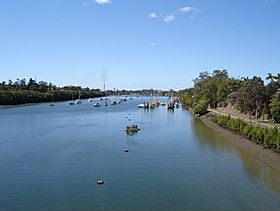
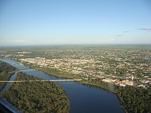
The Burnett River with the city of Bundaberg on either side
|
|
|
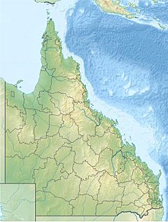
Location of Burnett River mouth in Queensland
|
|
| Country | Australia |
| State | Queensland |
| Regions | Central Queensland, Wide Bay–Burnett |
| Cities | Mundubbera, Gayndah, Wallaville, Bundaberg, Burnett Heads |
| Physical characteristics | |
| Main source | Mount Gaeta, Great Dividing Range near Monto 24°51′S 151°36′E / 24.850°S 151.600°E |
| River mouth | Coral Sea Burnett Heads 0 m (0 ft) 24°45′16″S 152°23′48″E / 24.75444°S 152.39667°E |
| Length | 435 km (270 mi) |
| Basin features | |
| Basin size | 32,220 km2 (12,440 sq mi) |
| Tributaries |
|
| Reservoir | Paradise Dam |
The Burnett River is an important river in Queensland, Australia. It flows through the Wide Bay–Burnett and Central Queensland areas.
Contents
Where Does the Burnett River Flow?

The Burnett River starts high up in the Great Dividing Range. This is near a place called Mount Gaeta, east of Monto. It flows south past towns like Eidsvold and Mundubbera. Then, it turns east, flowing near Gayndah and Wallaville.
Finally, the river reaches the city of Bundaberg. It then flows into the Coral Sea at Burnett Heads. This spot is about 20 kilometres (12 mi) from Bundaberg. The river drops 485 metres (1,591 ft) along its 435-kilometre (270 mi) path.
The land around the Burnett River is mostly used for farming. People grow a lot of sugar cane and other small crops here.
Important Creeks and Rivers Joining the Burnett
Three Moon Creek
Three Moon Creek begins near Kroombit Tops National Park. It flows south through Monto and Mulgildie. A dam near Cania Gorge forms Lake Cania. This creek then joins the Burnett River southeast of Abercorn.
Nogo River
The Nogo River starts in the hills northwest of Monto. It is dammed west of Abercorn, creating Wuruma Lake. This river then flows southeast to meet the Burnett near Ceratodus.
Auburn River
The Auburn River rises in the hills west of Cracow. It flows south, then northeast, passing through the Auburn River National Park. This park is a beautiful, untouched area of bushland. The Auburn River flows into the Burnett River west of Mundubbera.
Boyne River
The Boyne River starts in the Bunya Mountains National Park. It flows north and is dammed near Proston to form Lake Boondooma. This river joins the Burnett River near Mundubbera. It's only about 5 kilometres (3.1 mi) from where the Auburn River also joins the Burnett.
Barambah Creek
Barambah Creek begins in the hills between Kingaroy and the Sunshine Coast. It flows north and is dammed south of Murgon. This dam creates Lake Barambah, also known as Bjelke-Petersen Dam. Barambah Creek then meets the Burnett River northeast of Gayndah.
History of the Burnett River
First People
For a very long time, the Taribelang Aboriginal tribe lived along the Burnett River. This area was their home for thousands of years.
European Discovery
The river was named after James Charles Burnett. He was the first European explorer to visit the river in 1847.
Building Paradise Dam
The Paradise Dam was built on the Burnett River. It is about 80 kilometres (50 mi) upstream from Bundaberg. The dam was finished in November 2005. The water held back by the dam forms a large reservoir that can hold 300,000 megalitres (6.6×10¹⁰ imp gal; 7.9×10¹⁰ US gal) of water.
The dam is named after an old gold mining town called Paradise. This town is now underwater because of the dam. All the old buildings and items from Paradise were moved to the nearby town of Biggenden. The dam was built to be good for the environment. It has a special fish ladder. This ladder helps fish, like the unique Queensland lungfish, swim past the dam wall. They can travel both upstream and downstream.
Amazing Fish of the Burnett River
The Burnett River is special because it is home to the Queensland lungfish. This fish is one of the oldest living types of vertebrates (animals with backbones) on Earth. It's like a living fossil! The nearby Mary River also has these amazing fish.
 | Georgia Louise Harris Brown |
 | Julian Abele |
 | Norma Merrick Sklarek |
 | William Sidney Pittman |


