Port of Maryborough facts for kids
Quick facts for kids Port of Maryborough |
|
|---|---|
| Lua error in Module:Location_map at line 530: Unable to find the specified location map definition: "Module:Location map/data/yes" does not exist. | |
| Location | |
| Country | Australia |
| Location | Maryborough |
| Coordinates | 25°32′S 152°46′E / 25.533°S 152.767°E |
| Details | |
| Opened | 1859 |
| Owned by | North Queensland Bulk Ports |
| Type of harbor | Natural |
The Port of Maryborough in Queensland, Australia, was a very important place for trade and travel. It first opened in 1847. In 1859, it became a "port of entry." This meant that ships from other countries and colonies could come and go directly from Maryborough. For a while, some people outside Queensland called it "Wide Bay" instead of Maryborough.
Contents
Discovering the Mary River and Early Settlers
The river where the port is located was originally called Moonaboola River by the local Aboriginal people. Andrew Petrie explored this river in 1842. He was looking for good land for sheep.
The first European settler on the south side of the river was George Furber in 1847. He set up a trading post and an inn. In 1848, other settlers like Edgar Aldridge and Henry Palmer arrived. They crossed the river and settled on the north bank. This area was first called Wide Bay Village. It is now known as the Old Township Site.
The river was known as the Wide Bay River for some time. Later, it was renamed the Mary River. This was to honor Mary Fitz Roy, the wife of the Governor of New South Wales. After her death, Governor Fitz Roy renamed the river "Mary." The settlement's post office was then named Maryborough.
How the Port of Maryborough Grew
As ships got bigger, the river became harder for them to navigate. So, a new town area was planned in 1852. In 1854, a small steamship called the William Miskin visited the Old Township. It was likely the first steamship to come to the Mary River.
By 1856, people officially moved to the new town area. This is where the main port was set up. Wool became a very important product to export. In 1860, Maryborough exported £107,000 worth of goods. Wool made up £98,000 of that amount! Imports were £71,456. This meant Maryborough was the only port in the colony with more exports than imports.
Over the next ten years, things changed even more. Gold was discovered at Gympie, and the sugar industry began. Gold quickly became the most valuable export. Over two years, £756,000 worth of gold was shipped out. This was about nine tons of gold! Many ships visited the port during this time. The gold was kept safe in the vault of the Bank of New South Wales. The building that is now the Maryborough Heritage Centre was once this bank.
Maryborough: A Gateway for New Arrivals
From the 1850s until the end of the 1800s, the Port of Maryborough was one of Australia's busiest ports for immigrants. New workers were needed in the area. Companies advertised to bring people from Britain and Germany to Maryborough.
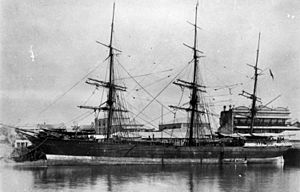
The first ship carrying immigrants directly to Maryborough was the Ariadne. This ship arrived on October 9, 1862. This was a huge moment for Maryborough and the Wide Bay region. The number of people from the Ariadne increased Maryborough's population by one-third!
Many more immigrants arrived over the years:
- Between 1863 and 1870: 3,142 people arrived.
- From 1872 to 1880: 9,164 people arrived (including many Germans and Scandinavians).
- Between 1881 and 1890: 7,332 people landed.
In total, almost 21,000 immigrants arrived directly at Maryborough before 1900. Even after that, some ships still brought passengers until about 1912.
People in Maryborough celebrate the arrival of the Ariadne and other immigrant ships. They plan to celebrate the 150th anniversary of each ship's arrival every year.
Moving to Deeper Waters at Urangan
As ships continued to grow larger, it became harder for them to travel up the Mary River to Maryborough. By 1882, people were worried about how the port would handle coal exports from Burrum. The river was dredged to keep it deep enough for ships. However, by 1911, it was clear Maryborough needed a deep-water port.
This led to plans for a long pier at Urangan in Hervey Bay. This pier would reach into the deeper water. The existing railway line from Maryborough to Pialba (which opened in 1896) was extended to the pier at Urangan. Construction of Urangan Pier began in 1913, and the railway line was finished in 1917.
Ships still came to Maryborough, but more and more went to Urangan. By 1963, commercial shipping to Maryborough had mostly stopped. Urangan had its own problems, though. Only one ship could dock at a time. By the 1950s, the port needed upgrades for even bigger ships.
However, the Urangan facilities were not improved. In 1958, the new Port of Bundaberg opened at Burnett Heads. This new port had better facilities and became a major competitor. In 1985, the MV Leonard was the last ship to dock at Urangan Pier. This marked the end of the Port of Maryborough's long history.
 | Kyle Baker |
 | Joseph Yoakum |
 | Laura Wheeler Waring |
 | Henry Ossawa Tanner |


