Macintyre River facts for kids
Quick facts for kids Macintyre |
|
|---|---|

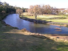
Macintyre River, at Inverell, New South Wales
|
|
| Other name(s) | Karaula River |
| Country | Australia |
| State | New South Wales, Queensland |
| Region | Northern Tablelands, Darling Downs, North West Slopes |
| Physical characteristics | |
| Main source | Great Dividing Range near Glencoe, New South Wales 1,260 m (4,130 ft) |
| River mouth | confluence with the Weir River to form the Barwon River west of Goondiwindi, Queensland 224 m (735 ft) 28°37′17″S 149°53′59″E / 28.62139°S 149.89972°E |
| Length | 319 km (198 mi) |
| Basin features | |
| River system | Barwon River catchment, Murray–Darling basin |
| Basin size | 49,470 km2 (19,100 sq mi) |
| Tributaries |
|
| Reservoir | Boggabilla Weir |
The Macintyre River is an important river in Australia. It is known as a "perennial river," which means it flows all year round. This river is part of the Border Rivers group and a larger system called the Murray–Darling basin.
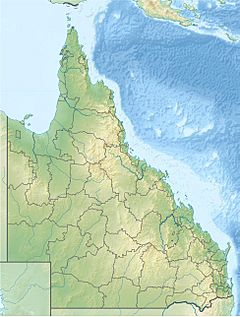
The Macintyre River flows through the Northern Tablelands and North West Slopes areas of New South Wales. It also goes through the Southern Downs region in Queensland. For part of its journey, the river actually forms the border between these two Australian states.
River's Journey and Features
The Macintyre River starts high up on the western side of the Great Dividing Range. This is a large mountain range in Australia. The river begins near Guyra and Glen Innes in New South Wales.
As it flows, the river travels mostly towards the northwest and west. Along the way, it is joined by twenty-two smaller rivers and streams. These are called tributaries. Important tributaries include the Severn River (New South Wales) and the Dumaresq River.
The Macintyre River eventually meets the Weir River. When these two rivers join, they form a new river called the Barwon River. This meeting point is located west of the town of Goondiwindi.
The Macintyre River flows for about 319-kilometre (198 mi) (198 miles). During its journey, it drops about 1,040 metres (3,410 ft) (3,412 feet) in height. It passes by towns like Inverell, Ashford, Yetman, and Boggabilla. A structure called the Boggabilla Weir helps to control the river's flow.
Bridges and Connections
The Goondiwindi Border Bridge crosses the Macintyre River at Goondiwindi. This bridge connects New South Wales and Queensland. The current bridge was opened in 1914. Before that, there was an older wooden bridge built in 1878.
Flooding and Protection
The Macintyre River can sometimes experience floods. The town of Goondiwindi is protected from these floods by special walls called levee banks. These banks are designed to keep the town safe even if the river water rises by nearly 11 metres (36 ft) (36 feet).
For example, during the big floods in Queensland in 2010–2011, the river reached a peak of 10.64 metres (34.9 ft) (34.9 feet). Other high flood levels were recorded in 1996 and 1976.
 | Georgia Louise Harris Brown |
 | Julian Abele |
 | Norma Merrick Sklarek |
 | William Sidney Pittman |


