Weir River (Queensland) facts for kids
Quick facts for kids Weir |
|
|---|---|
|
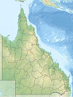
Location of Weir River mouth
on the Queensland-New South Wales border |
|
| Country | Australia |
| State | Queensland |
| Region | Darling Downs |
| Physical characteristics | |
| Main source | Great Dividing Range southwest of Cecil Plains 358 m (1,175 ft) 27°36′26″S 151°01′10″E / 27.60722°S 151.01944°E |
| River mouth | Barwon River northeast of Mungindi 166 m (545 ft) 28°49′57″S 149°06′04″E / 28.83250°S 149.10111°E |
| Length | 470 km (290 mi) |
| Basin features | |
| River system | Barwon River catchment, Murray–Darling basin |
| Waterhole | Wanda Wanda Waterhole |
The Weir River is a river in the Darling Downs region of Queensland, Australia. It is part of a group of rivers called the Border Rivers. The Weir River also flows into the Barwon River, which is part of the much larger Murray–Darling basin.
Where the Weir River Flows
The Weir River starts high up on the western side of the Great Dividing Range. This is a big mountain range in Australia. The river begins in the Dunmore State Forest and flows towards the southwest.
As it travels, the river goes through the Booroondoo State Forest. It then crosses the Leichhardt Highway. After that, it flows past places like Currajong and Goodar. The river then turns west. It runs almost next to the Barwon Highway near Bungunya.
Later, the river turns southwest again and crosses the highway just east of Talwood. It flows through a place called the Wanda Wanda Waterhole. Finally, it continues southwest until it joins the Barwon River. This meeting point is northeast of Mungindi, right on the border between Queensland and New South Wales. The Weir River travels about 470-kilometre (290 mi) (292 miles) and drops about 192 metres (630 ft) (630 feet) in height along its journey.
Part of the Border Rivers
The Weir River is one of several rivers known as the Border Rivers. These rivers flow along or near the border between Queensland and New South Wales. The other main Border Rivers are the Macintyre, Dumaresq, and two branches of the Severn (one in Queensland and one in New South Wales).
All these Border Rivers eventually feed into the huge Murray-Darling Basin. Together, they drain a large area of land, covering about 44,600 square kilometres (17,220 sq mi) (17,220 square miles). This makes them a very important part of Australia's river system.
 | Delilah Pierce |
 | Gordon Parks |
 | Augusta Savage |
 | Charles Ethan Porter |


