
Jandowae facts for kids
Quick facts for kids JandowaeQueensland |
|||||||||||||||
|---|---|---|---|---|---|---|---|---|---|---|---|---|---|---|---|

The commercial centre of Jandowae
|
|||||||||||||||

Jandowae
Location in Queensland
|
|||||||||||||||
| Population | 1,004 (2021 census) | ||||||||||||||
| • Density | 3.9512/km2 (10.234/sq mi) | ||||||||||||||
| Postcode(s) | 4410 | ||||||||||||||
| Area | 254.1 km2 (98.1 sq mi) | ||||||||||||||
| Time zone | AEST (UTC+10:00) | ||||||||||||||
| Location |
|
||||||||||||||
| LGA(s) | Western Downs Region | ||||||||||||||
| State electorate(s) | Callide | ||||||||||||||
| Federal Division(s) | Maranoa | ||||||||||||||
|
|||||||||||||||
Jandowae is a country town and area in the Western Downs Region of Queensland, Australia. In 2021, about 1,000 people lived in Jandowae.
Contents
Where is Jandowae?
Jandowae is about 259 kilometres (161 miles) west of Brisbane, the capital city of Queensland. The town is located on the traditional lands of the Barunggam people.
There is a small area called Bush Grove nearby. Jandowae also has an old, unused railway station.
Roads in Jandowae
Several roads connect Jandowae to other places. The Dalby–Jandowae Road comes from the south. The Kingaroy–Jandowae Road enters from the north-east. The Jandowae Connection Road goes to the north-west.
Jandowae's History
The land around Jandowae has a rich history. It is the traditional home of the Baranggum people, an Aboriginal group. Their language, Baranggum, is spoken in this area.
Early European Settlement
The first European settlers arrived in the 1860s. The town was first called Jindowie, which was an Aboriginal word for a waterhole. Later, a man named John Dowiae set up a camp for travellers. This led some people to call the area Jondowiae.
When the railway arrived in 1914, the name was changed to Jandowae. This was done to avoid confusion with another town called Jondaryan.
Growth and Development
The rich soil in Jandowae helped farming grow. The timber industry also became very important. This led to more businesses, churches, halls, and banks being built.
Jandowae's first school, Jondowaie Provisional School, opened in 1887 with 13 students. It became Jandowae State School in 1915. In 1988, it added a secondary department for students up to Year 10.
The first Post Office opened in 1890 and was renamed Jandowae in 1913. The town's cemetery opened in 1900.
Churches in Jandowae
The Immaculate Conception Catholic Church opened in 1909. A new Catholic church was built next to it in 1964.
St Paul's Anglican Church opened in 1917. The current church building was opened in 1957. Local volunteers helped build it, saving money.
The Jandowae Presbyterian Church opened in 1922. It was a wooden church that could hold 150 people.
A Methodist church was officially opened in 1949. Before this, Methodist services were held in the Presbyterian church.
In 1964, a Lutheran church opened. The building was moved from another town called Meringandan. It is now privately owned.
Modern Times
In 1974, the town got a sewerage system. The current Jandowae Public Library opened in 2000.
In 2001, the local council tried a special plan to help Jandowae grow. They sold 38 blocks of land for just one dollar each! This plan was very popular and made news around the world. It helped stop the town's population from shrinking and brought new businesses to Jandowae.
In January 2024, Jandowae was cut off by floodwaters after a lot of rain.

The Jandowae war memorial was officially revealed in 1935. It honours those who served in wars.
People of Jandowae
In 2021, the population of Jandowae was 1,004 people. The population has changed over the years:
- 2006: 1,006 people
- 2011: 1,246 people
- 2016: 1,047 people
- 2021: 1,004 people
Jandowae's Economy
Jandowae is in an area with very rich soil. It is one of Queensland's biggest areas for growing wheat. Farmers also grow other crops like barley, sorghum, and sunflower.
Raising beef and dairy cattle is also important here. In the past, Jandowae also had two large sawmills.
Town Facilities
Jandowae has many important facilities for its residents:
- Jandowae Police Station
- Jandowae Fire Station
- Jandowae SES Facility (State Emergency Service)
- Jandowae Ambulance Station
- Jandowae Hospital, which also has a heliport for helicopters.
- Jandowae Cemetery
- A sewage treatment plant
- An electrical sub-station for power
- A telephone exchange
What to Do in Jandowae
Jandowae has a post office, a government agent, and a bank.
There are three hotels in town, known as the Top pub, the Middle pub, and the Bottom pub. They all offer meals and places to stay.
For sports, you can enjoy bowls, golf, tennis, swimming, and squash. There is also a new skate park.
The Western Downs Regional Council runs a public library in Jandowae. The Jinghi Valley branch of the Queensland Country Women's Association meets at the Jandowae Tennis Clubhouse.
Places of Worship
- St Paul's Anglican Church
- The Immaculate Conception Catholic Church
- Jandowae-Warra Uniting Church
The Jandowae Memorial Hall can be booked for community events.
Education in Jandowae
Jandowae State School is a government school for boys and girls. It teaches students from Prep (the year before Year 1) up to Year 10. In 2018, the school had 152 students.
For students in Years 11 and 12, the closest high schools are in Dalby and Chinchilla.
Fun Activities
Jandowae's biggest event is the Jandowae Timbertown Festival. This festival happens every two years. It celebrates the town's history with the timber industry and brings thousands of people to Jandowae.
Other events include a professional-amateur golf tournament and the Jandowae Cup horse race.
Famous People from Jandowae
- Timothy Tovell: An Australian airman from World War I. He famously helped a young French orphan travel from France to Australia.
Images for kids
-
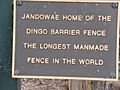
Dingo statue plaque, Jandowae, Queensland.
-
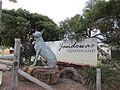
Dingo statue, Jandowae, Queensland, Australia. Jandowae is home of the Dingo Barrier fence, the longest man made fence in the world. Sculpture in steel by Andy Scott.
-
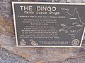
Dingo statue plaque, Jandowae, Queensland.
-
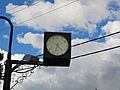
R.S.L. clock, Jandowea, Queensland, Australia. Numbers on the clock face are replaced by the words "Lest we forget".
-
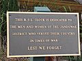
R.S.L. clock plaque, Jandowea, Queensland.
-
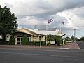
Jandowae Community and Cultural Centre, Jandowae, Queensland, Australia. September 2018


