Spicers Gap facts for kids
Quick facts for kids Spicers Gap |
|
|---|---|

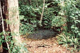
Moss's Well is a natural spring
|
|
| Elevation | 755 m (2,477 ft) |
| Location | Swanfels, Queensland, Australia |
| Range | Main Range |
| Coordinates | 28°04′13″S 152°24′52″E / 28.07028°S 152.41444°E |
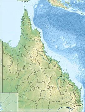
Spicers Gap is a mountain pass located about 100 kilometers west of Brisbane, Queensland, Australia. It was the first main route over the Great Dividing Range in the Brisbane area. Today, it is part of Main Range National Park. It's a popular place for people who enjoy camping and bushwalking.
To the south of the gap, you'll find Spicers Peak. West of the pass is Spicers Gap State Forest. Both the national park and the state forest are part of the incredible Gondwana Rainforests of Australia.
The highest point of Spicers Gap is protected as Spicers Gap Road Conservation Park. You can reach it by car from both the east and west. However, some parts of the road are very rough. The road through the park itself is closed to vehicles. On the steep path leading to the Gap from the east, you will pass a cemetery. You will also see Moss's Well and the spot where an old hotel used to be. Moss's Well was named after Edward Moss. He was a contractor who helped build the original road.
Contents
History of Spicers Gap
Early Routes and Discoveries
Spicers Gap is thought to have been a path for Indigenous Australians for a long time. They used it for trading between the inland areas and the coast.
In 1828, a botanist named Allan Cunningham found a different route. This route is now called Cunninghams Gap. Cunningham named Spicers Gap and Spicers Peak after Peter Beauclerk Spicer. Spicer was in charge of convicts at the time. However, Cunningham did not suggest using Spicers Gap for travel.
A stockman named Henry Alphen discovered Spicers Gap in 1847. It is about 7 kilometers south of Cunninghams Gap.
Building the Road
The road through Spicers Gap was built by convicts. This work happened during the 1850s and 1860s. This trail became a very important transport route. It connected the coast to a farming area called the Darling Downs.
Spicers Gap Road was used to carry supplies to and from the Darling Downs. It is one of the best examples of old engineering in Queensland. An inn was built in the area to serve travelers. After a railway line to the Darling Downs was built through Toowoomba, the road was used less often.
Governors Chair Lookout
You can get a great view to the north from Governors Chair Lookout. It's a short walk from the car park. Important people like Lord Kerr, Lord Scott, Sir Charles Fitzroy, and Sir George Bowen all sat on the rock in the early 1850s.
 | William Lucy |
 | Charles Hayes |
 | Cleveland Robinson |


