Wollomombi Falls facts for kids
Quick facts for kids Wollomombi Falls |
|
|---|---|

Wollomombi Falls
|
|
| Lua error in Module:Infobox_mapframe at line 185: attempt to index field 'wikibase' (a nil value). | |
| Location | New England, New South Wales, Australia |
| Coordinates | 30°31′55″S 152°02′05″E / 30.53194°S 152.03472°E |
| Type | Plunge |
| Elevation | 907 metres (2,976 ft) AHD |
| Total height | 150–230 metres (490–750 ft) |
| Number of drops | 1 |
| Longest drop | 100 metres (330 ft) |
| Watercourse | Wollomombi River |
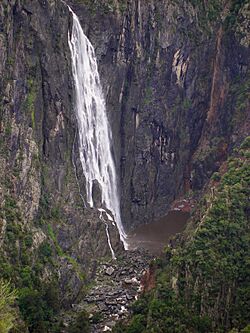
The Wollomombi Falls is a huge plunge waterfall in the New England area of New South Wales, Australia. It is found on the Wollomombi River.
Where are the Wollomombi Falls Located?
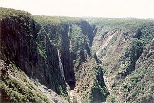
Wollomombi Falls is about 40 kilometres (25 mi) east of Armidale in the Oxley Wild Rivers National Park. You can find it just 1.45 kilometres (0.90 mi) off the Waterfall Way. The falls are at the top of the Wollomombi Gorge. This is where the Wollomombi River meets the Chandler River. Right next to Wollomombi Falls, you can also see the Chandler Falls on the Chandler River.
The falls drop from a height of 907 metres (2,976 ft) above sea level. The main drop is 100 metres (330 ft) high. The total height of the falls can be between 150–230 metres (490–750 ft). This depends on how much water is flowing in the river.
For a while, people thought Wollomombi Falls was the tallest waterfall in Australia. However, new information shows it is actually the second or third tallest. Other taller falls include the Tin Mine Falls in the Snowy Mountains and the Wallaman Falls near Ingham, Queensland.
Exploring the Falls: Walking Tracks and Camping
There are several places to camp and walking paths near Wollomombi Falls. These paths let you get close to the waterfall. The National Parks and Wildlife Service has built these areas.
- Wollomombi Gorge and Falls Picnic Area: This is a great spot for a picnic.
- Wollomombi Walking Track: This walk is about 4-kilometre-long (2.5 mi) and takes around three hours to complete. It goes upstream past a lookout platform. You will cross the Wollomombi River on a long steel bridge. The track continues to another lookout platform. From here, you can look down at the falls from the other side of the gorge. An extra part of the track leads to a platform with views into the Chandler River gorge.
- Chandler Walking Track: This path is 2.5-kilometre-long (1.6 mi) and takes about 90 minutes. It passes Checks Lookout before reaching the Chandler Lookout. Then it goes down to the bottom of the gorge. Checks Lookout offers a view back along the gorge to the falls. The track ends 400 metres (1,300 ft) below the top of the gorge.
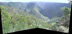
Edgars Lookout is an easy-to-reach spot. It gives you a great view of the gorge on the western side of the falls.
The area has useful facilities for visitors. These include drinking water, toilets, a shelter, and fireplaces. You can also find places for bush camping. There is an information display to help you learn more.
See also
 In Spanish: Cataratas del Wollomombi para niños
 | Delilah Pierce |
 | Gordon Parks |
 | Augusta Savage |
 | Charles Ethan Porter |


