Wollomombi River facts for kids
Quick facts for kids Wollomombi River |
|
|---|---|

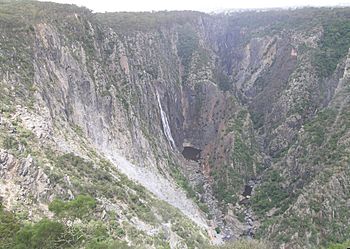
Wollomombi River (left) showing the river's confluence with the Chandler River in Oxley Wild Rivers National Park.
|
|
| Other name(s) | Woolomombi Creek, Rockvale Creek |
| Country | Australia |
| State | New South Wales |
| IBRA | New England Tablelands |
| District | Northern Tablelands |
| Local government area | Armidale Dumaresq |
| Physical characteristics | |
| Main source | Great Dividing Range southeast of Guyra 1,280 m (4,200 ft) |
| River mouth | confluence with the Chandler River ear the village of Wollomombi 677 m (2,221 ft) |
| Length | 65 km (40 mi) |
| Basin features | |
| River system | Macleay River catchment |
| Tributaries |
|
| Waterfalls | Wollomombi Falls |
The Wollomombi River is a river in New South Wales, Australia. It is part of the larger Macleay River system. The river flows all year round and is found in the Northern Tablelands area.
Contents
Journey of the Wollomombi River
The Wollomombi River starts high up on the eastern side of Chandlers Peak. This peak is part of the Great Dividing Range, a large mountain range in Australia. The river begins southeast of a town called Guyra.
Where the River Flows
From its start, the river generally flows south. Along its way, it is joined by a smaller stream, which is called a tributary. The river then tumbles over the impressive Wollomombi Falls.
Meeting Another River
After the falls, the Wollomombi River meets and joins the Chandler River. This meeting point is called a confluence. It happens near the village of Wollomombi. This area is south of the Cunnawarra National Park and inside the beautiful Oxley Wild Rivers National Park.
River's Drop and Length
The Wollomombi River drops about 606 metres (1,988 ft) from its source to where it joins the Chandler River. Its total length is about 65 kilometres (40 mi). As it flows, the river carves out amazing gorges and creates many waterfalls within the Oxley Wild Rivers National Park.
Exploring the Falls Area
Near the Wollomombi Falls lookout, there are special walking paths. These paths let you explore the edges of the deep gorges. There is also a steep path that goes down to the Chandler River itself.
Life Around the River
The areas along the upper parts of the Wollomombi River are used for farming. Farmers raise beef cattle and sheep there.
 | Calvin Brent |
 | Walter T. Bailey |
 | Martha Cassell Thompson |
 | Alberta Jeannette Cassell |

