Yarrowitch, New South Wales facts for kids
Quick facts for kids YarrowitchNew South Wales |
|
|---|---|

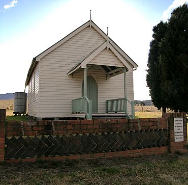
The church at Yarrowitch, NSW
|
|
| Postcode(s) | 2354 |
| Elevation | 940 m (3,084 ft) |
| Location |
|
| LGA(s) | Walcha Shire |
| County | Vernon |
| State electorate(s) | Tamworth |
| Federal Division(s) | New England |

Yarrowitch is a small, quiet place in the countryside of New South Wales, Australia. It's found in the beautiful Yarrowitch River Valley. This area is part of the Northern Tablelands, a high plateau region.
Yarrowitch is located on the Oxley Highway. It is about 48 kilometres east of Walcha. The area is part of the Walcha Shire local government area. It sits in the New England region. Yarrowitch is quite high up, about 995 metres above sea level. In 2011, about 167 people lived in the Yarrowitch area.
Contents
Exploring Yarrowitch's Past
Early Explorers and Names
The first European explorer to pass through Yarrowitch was John Oxley. He came through the area on September 17, 1818. His group camped overnight by the Yarrowitch River. They were on a tough journey to Port Macquarie. The land was very steep and covered in thick bush.
The name Yarrowitch might come from an English place called Yarrow. But there's also an Aboriginal word, 'Yarrawee'. This word is said to mean 'gum tree growing in water'.
First Settlers and Land Use
Around 1836, John Allman and N. Powell were the first Europeans to settle here. John's brother, Francis, joined them soon after. By 1839, Arthur Hodgson also joined them. The land was then split into two parts.
In 1840, Alexander Todd and Christopher Dawson Fenwicke became the first official landholders. Todd held the eastern part of Yarrowitch. It was a large area, about 32,000 acres (129 square kilometres). Fenwicke held the western part, which was about 30,400 acres (123 square kilometres).
Growing the Community
The Robertson Land Acts were introduced in 1861. These laws allowed smaller farmers to buy pieces of government land. This helped the Yarrowitch area grow even more. By 1900, Yarrowitch was a well-established farming community.
A newspaper article from 1898 described life there. It said that new buildings were going up. A new school building had been built in a better spot. Farmers were doing well growing wheat, corn, pigs, and onions. The potato crop was good, and wheat was becoming very popular. Besides these crops, people also raised cattle and sheep. Cutting down Australian Red Cedar trees was another main way to earn money.
Modern Changes and Life Today
In 1948, the government bought Yarrowitch Station. They divided the land into 17 smaller blocks. These blocks were given to soldiers returning from war and their families. This was part of a plan to help them settle down.
Most homes in the area got telephones in the 1930s. Yarrowitch village got electricity in 1962. However, some areas further out, like Kangaroo Flat, did not get power yet. In 1977, the Oxley Highway was paved all the way to Walcha and Port Macquarie. This made travel much easier. Before, the road could be very slippery in bad weather.
During the 1980s, a property called Glenferrie was divided into many small blocks. Many people who bought these blocks only visited on weekends. They were known as "weekend farmers."
Today, Yarrowitch has a church, a public school, a sports ground, and a community hall.
Amazing Natural Attractions
Werrikimbe National Park
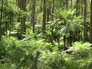
Werrikimbe National Park is a large and wild park. It is located about 26 kilometres from Yarrowitch. Most of Werrikimbe Park is a World Heritage site. This means it is recognized as a place of great importance around the world.
The park is home to a very rare animal called the Hastings River Mouse. This mouse is considered to be in danger of disappearing forever. Protecting places like Werrikimbe helps keep these special animals safe.
 | Claudette Colvin |
 | Myrlie Evers-Williams |
 | Alberta Odell Jones |


